- Page 1:
SWEIS Yearbook - 2002LA-UR-03-5862
- Page 5:
CONTENTSList of Tables . . . . . .
- Page 11 and 12:
2.13-1. Radiochemistry Buildings wi
- Page 13 and 14:
F-1. RTBF Line Item Projects . . .
- Page 15 and 16:
AcronymsAFCIALARAAOCBABSLCASACDCCDI
- Page 17 and 18:
PrefaceIn the Record of Decision fo
- Page 19 and 20:
Executive SummaryIn 1999, the US De
- Page 21 and 22:
Also, following the events of Septe
- Page 23 and 24:
ReferencesDepartment of Energy, 199
- Page 26 and 27:
AREA OF CONTRIBUTION (continued)Los
- Page 28 and 29:
• Summary and conclusion (Chapter
- Page 30 and 31:
Aerial view-North from Pajarito Roa
- Page 32 and 33:
Table 2.0-2. Radiological Exposure
- Page 34 and 35:
2-4Table 2.0-4. Low-Level Waste Gen
- Page 36 and 37:
2-6Table 2.0-6. TRU Waste Generatio
- Page 38 and 39:
2-8Table 2.0-8. Overall Solid Radio
- Page 40 and 41:
In addition, the Key Facilities (as
- Page 42 and 43:
2-12SWEIS Yearbook—2002Table 2.0-
- Page 44 and 45:
2-14SWEIS Yearbook—2002Table 2.0-
- Page 46 and 47:
2-16SWEIS Yearbook—2002Table 2.0-
- Page 48 and 49:
Table 2.0-12. Projected Constructio
- Page 50 and 51:
2-20SWEIS Yearbook—2002Table 2.0-
- Page 52 and 53:
2-22SWEIS Yearbook—2002Table 2.0-
- Page 54 and 55:
2-24SWEIS Yearbook—2002Table 2.0-
- Page 56 and 57:
2-26SWEIS Yearbook—2002Table 2.0-
- Page 58 and 59:
2-28SWEIS Yearbook—2002Table 2.0-
- Page 60 and 61:
This chapter also discusses Non-Key
- Page 62 and 63:
SANTA FENATIONALSANTA FENATIONAL FO
- Page 64 and 65:
2.1 Plutonium Complex (TA-55)The Pl
- Page 66 and 67:
2-36SWEIS Yearbook—2002Table 2.1.
- Page 68 and 69:
2-38SWEIS Yearbook—2002Table 2.1.
- Page 70 and 71:
2-40SWEIS Yearbook—2002Table 2.1.
- Page 72 and 73:
2-42Table 2.1.2-1. Plutonium Comple
- Page 74 and 75:
Glovebox linesWaste transfer2.1.4 C
- Page 76 and 77:
TA-16 during 1999, 2000, and 2001.
- Page 78 and 79:
2-48SWEIS Yearbook—2002Table 2.2.
- Page 80 and 81:
2.2.3 Operations Data for the Triti
- Page 82 and 83:
Tree-thinning operations on Two-Mil
- Page 84 and 85:
completed; work on the wing electri
- Page 86 and 87:
2-56Table 2.3.1-1. CMR Building Con
- Page 88 and 89:
2-58SWEIS Yearbook—2002Table 2.3.
- Page 90 and 91:
2-60SWEIS Yearbook—2002Table 2.3.
- Page 92 and 93:
Table 2.3.2-1. CMR Building (TA-03)
- Page 94 and 95:
Table 2.3.3-1. CMR Building (TA-03)
- Page 96 and 97:
2.4.1 Construction and Modification
- Page 98 and 99:
2-68SWEIS Yearbook—2002Table 2.4.
- Page 100 and 101:
2-70Table 2.4.2-1. Pajarito Site (T
- Page 102 and 103:
“Hummer”2.4.4 Cerro Grande Fire
- Page 104 and 105:
2.5.1 Construction and Modification
- Page 106 and 107:
2-76SWEIS Yearbook—2002Table 2.5.
- Page 108 and 109:
Table 2.5.3-1. Sigma Complex (TA-03
- Page 110 and 111:
2-80Table 2.6.2-1. MSL (TA-03)/Comp
- Page 112 and 113:
2-82SWEIS Yearbook—2002Table 2.6.
- Page 114 and 115:
2.6.4 Cerro Grande Fire Effects at
- Page 116 and 117:
2-86Table 2.7.2-1. TFF (TA-35)/Comp
- Page 118 and 119:
Inspection of target component2.8 M
- Page 120 and 121:
2.8.2 Operations at the Machine Sho
- Page 122 and 123:
Table 2.8.3-1. Machine Shops (TA-03
- Page 124 and 125:
Operations at this Key Facility are
- Page 126 and 127:
2-96SWEIS Yearbook—2002Table 2.9.
- Page 128 and 129:
2.9.2 Operations at High Explosives
- Page 130 and 131:
2-100SWEIS Yearbook—2002Table 2.9
- Page 132 and 133:
Table 2.9.3-1. High Explosives Proc
- Page 134 and 135:
2-104SWEIS Yearbook—2002Table 2.1
- Page 136 and 137:
2.10.2 Operations at High Explosive
- Page 138 and 139:
2-108Table 2.10.2-1. High Explosive
- Page 140 and 141:
Table 2.10.3-1. High Explosives Tes
- Page 142 and 143:
DX Division Strategic Plan for the
- Page 144 and 145:
2-114SWEIS Yearbook—2002Table 2.1
- Page 146 and 147:
2-116Table 2.11.1-1. Los Alamos Neu
- Page 148 and 149:
Table 2.11.2-1. Los Alamos Neutron
- Page 150 and 151:
2-120SWEIS Yearbook—2002Table 2.1
- Page 152 and 153:
2-122Table 2.11.2-1. Los Alamos Neu
- Page 154 and 155:
2-124SWEIS Yearbook—2002Table 2.1
- Page 156 and 157:
2.12 Bioscience Facilities (TA-43,
- Page 158 and 159:
Because of the building’s small s
- Page 160 and 161:
is expected to continue through 200
- Page 162 and 163:
2-132SWEIS Yearbook—2002Table 2.1
- Page 164 and 165:
2-134Table 2.12.3-1. Bioscience Fac
- Page 166 and 167:
Table 2.13-1. Radiochemistry Buildi
- Page 168 and 169:
2-138SWEIS Yearbook—2002Table 2.1
- Page 170 and 171:
Table 2.13.2-1. Radiochemistry Faci
- Page 172 and 173:
Table 2.13.3-1. Radiochemistry Faci
- Page 174 and 175:
Table 2.14-1. Radioactive Liquid Wa
- Page 176 and 177:
2.14.2 Operations at the Radioactiv
- Page 178 and 179:
Table 2.14.2-1. Radioactive Liquid
- Page 180 and 181:
Table 2.14.3-1. Radioactive Liquid
- Page 182 and 183:
Table 2.15-1. Solid Radioactive and
- Page 184 and 185:
volume is an increase from the last
- Page 186 and 187:
2-156SWEIS Yearbook—2002Table 2.1
- Page 188 and 189:
2-158SWEIS Yearbook—2002Table 2.1
- Page 190 and 191:
2-160Table 2.15.2-1. Solid Radioact
- Page 192 and 193:
2.16 Non-Key FacilitiesThe balance,
- Page 194 and 195:
2-164SWEIS Yearbook—2002Table 2.1
- Page 196 and 197: 2-166Table 2.16.1-1. Non-Key Facili
- Page 198 and 199: consumption would represent approxi
- Page 200 and 201: Exterior and interior views of the
- Page 202 and 203: Decision Applications Division Offi
- Page 204 and 205: k) Materials Science and Technology
- Page 206 and 207: n) NPDES Outfall ProjectDuring 1997
- Page 208 and 209: 2-178SWEIS Yearbook—2002Table 2.1
- Page 210 and 211: 2.17 Environmental Restoration Proj
- Page 212 and 213: The sludge and water in the lagoons
- Page 214 and 215: Table 2.17.3-1. Evaluated and Stabi
- Page 216 and 217: 2.18 ReferencesDepartment of Energy
- Page 218 and 219: Department of Energy, 1999d. “Cat
- Page 220 and 221: Katzman, 2000. Personal communicati
- Page 222 and 223: Los Alamos National Laboratory, 200
- Page 224 and 225: Table 3.1.1-1 summarizes the radioa
- Page 226 and 227: for reporting under Section 313 of
- Page 228 and 229: NPDES permitted outfalls, including
- Page 230 and 231: Table 3.2-4. Discharges from NPDES
- Page 232 and 233: ensures that LANL meets all require
- Page 234 and 235: 3.3.3 Low-Level Radioactive WastesT
- Page 236 and 237: Table 3.3.5-1. Transuranic Waste Ge
- Page 238 and 239: Power Plant ComplexIn CY 2002, an e
- Page 240 and 241: 3.4.3 WaterBefore September 8, 1998
- Page 242 and 243: Table 3.5.2-1. Radiological Exposur
- Page 244 and 245: These employees have had a positive
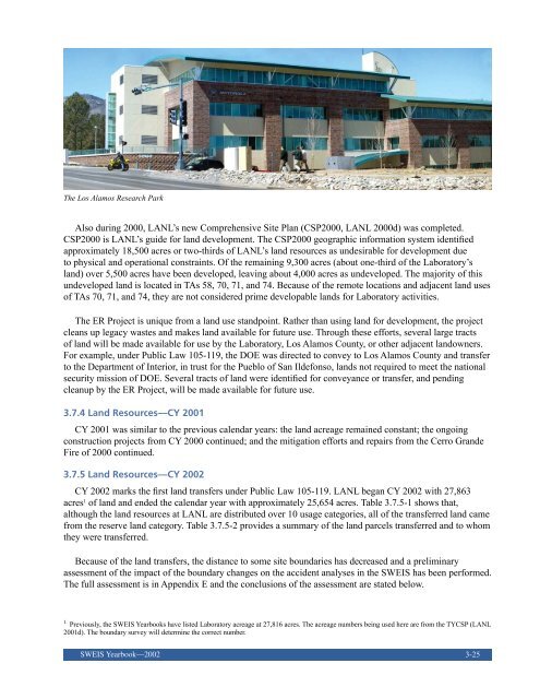
- Page 248 and 249: Table 3.7.5-1. Site-wide Land UseAC
- Page 250 and 251: Table 3.8-1. Groundwater Characteri
- Page 252 and 253: captured in the Laboratory’s annu
- Page 254 and 255: 828 ft. One sample of water from th
- Page 256 and 257: Table3.9-2. HistoricPeriodCulturalR
- Page 258 and 259: Traditional Cultural Properties Com
- Page 260 and 261: 2002 Land TransferredNine cultural
- Page 262 and 263: During 2002, LANL completed three b
- Page 264 and 265: Lansford, R., L. Adcock, S. Ben-Dav
- Page 266 and 267: Wetland in Mortandad Canyon3-44SWEI
- Page 268 and 269: years for which data were reported;
- Page 270 and 271: Figure 4-4. Carbon monoxide emissio
- Page 272 and 273: The SWEIS assumed that reducing out
- Page 274 and 275: Sanitary WasteLANL sanitary waste g
- Page 276 and 277: Low-Level WasteLANL generation of L
- Page 278 and 279: 4.4 Utility ConsumptionConsumption
- Page 280 and 281: TRI(UC Workers Only)TRI(All Workers
- Page 282 and 283: Though construction and modificatio
- Page 284 and 285: LANL has also increased the invento
- Page 286 and 287: 4.13 ReferencesClean Air Act. 42 US
- Page 288 and 289: The PastV-Site building related to
- Page 290 and 291: 5.1.2 AssumptionsThe Laboratory use
- Page 292 and 293: Figure 5-1. Existing land use at LA
- Page 294 and 295: Table 5.2.3.1-1. Site-Wide Land Use
- Page 296 and 297:
• Manhattan Monument tract, a fra
- Page 298 and 299:
Table 5.2.4-2. Selected Proposed Co
- Page 300 and 301:
infrastructure required to conduct
- Page 302 and 303:
5-14SWEIS Yearbook—2002Table 5.3.
- Page 304 and 305:
5.4 The Plan5.4.1 Planning ProcessT
- Page 306 and 307:
Table 5.4.3-1. Electrical Power Con
- Page 308 and 309:
easily provide forecasted water dem
- Page 310 and 311:
• Fire Hazard Mitigation: Facilit
- Page 312 and 313:
Table 5.5.1-1. Funding SourcesFUNDI
- Page 314 and 315:
Emergency Operations Center (above
- Page 316 and 317:
5.6 ReferencesAmerican Standard of
- Page 318 and 319:
5-30SWEIS Yearbook—2002
- Page 320 and 321:
• Construction of the DecisionApp
- Page 322 and 323:
projected by the ROD. Similarly, a
- Page 324 and 325:
6.2 ConclusionsIn conclusion, LANL
- Page 326 and 327:
6-8SWEIS Yearbook—2002
- Page 328 and 329:
A-2Table A-1. Chemistry and Metallu
- Page 330 and 331:
A-4Table A-2. Bioscience Air Emissi
- Page 332 and 333:
A-6SWEIS Yearbook—2002Table A-3.
- Page 334 and 335:
A-8SWEIS Yearbook—2002Table A-5.
- Page 336 and 337:
A-10Table A-6. Machine Shops Air Em
- Page 338 and 339:
A-12SWEIS Yearbook—2002Table A-7.
- Page 340 and 341:
A-14SWEIS Yearbook—2002Table A-9.
- Page 342 and 343:
A-16SWEIS Yearbook—2002Table A-10
- Page 344 and 345:
A-18SWEIS Yearbook—2002Table A-10
- Page 346 and 347:
A-20Table A-10. Radiochemistry Site
- Page 348 and 349:
A-22Table A-11. Sigma Complex Air E
- Page 350 and 351:
A-24SWEIS Yearbook—2002Table A-12
- Page 352 and 353:
A-26Table A-13. Tritium Operations
- Page 354 and 355:
A-28SWEIS Yearbook—2002Table A-14
- Page 356 and 357:
Table B-1. Comparison of Nuclear Fa
- Page 358 and 359:
B-4Table B-1. Comparison of Nuclear
- Page 360 and 361:
Table B-1. Comparison of Nuclear Fa
- Page 362 and 363:
B-8SWEIS Yearbook—2002Table B-1.
- Page 364 and 365:
B-10SWEIS Yearbook—2002Table B-1.
- Page 366 and 367:
Table B-1. Comparison of Nuclear Fa
- Page 368 and 369:
Table B-1. Comparison of Nuclear Fa
- Page 370 and 371:
Table C-1. Radiological Facility Li
- Page 372 and 373:
Appendix D. NPDES Outfall Status Su
- Page 374 and 375:
Appendix D. NPDES Outfall Status Su
- Page 376 and 377:
D-6SWEIS Yearbook—2002
- Page 378 and 379:
Site Boundary ChangesOn December 11
- Page 380 and 381:
Figure E-2a. TA-55 old evaluationbo
- Page 382 and 383:
Table E-1. Land Parcels Transferred
- Page 384 and 385:
Figure E-3. Location of transfer pa
- Page 386 and 387:
References and Key Information Sour
- Page 388 and 389:
F-2SWEIS Yearbook—2002Table F-1.
- Page 390 and 391:
F-4SWEIS Yearbook—2002Table F-2.
- Page 392 and 393:
F-6SWEIS Yearbook—2002Table F-2.
- Page 394 and 395:
F-8SWEIS Yearbook—2002Table F-3.
- Page 396 and 397:
F-10SWEIS Yearbook—2002Table F-3.
- Page 398 and 399:
F-12SWEIS Yearbook—2002Table F-3.
- Page 400 and 401:
F-14SWEIS Yearbook—2002Table F-4.
- Page 402 and 403:
F-16SWEIS Yearbook—2002Table F-5.
- Page 404 and 405:
F-18SWEIS Yearbook—2002Table F-5.
- Page 406 and 407:
F-20Table F-5. Non-RTBF Non-Facilit
- Page 408 and 409:
F-22Table F-6. Non-RTBF Non-Facilit
- Page 410 and 411:
F-24SWEIS Yearbook—2002Table F-8.
- Page 412:
To obtain a copy of the SWEIS Yearb