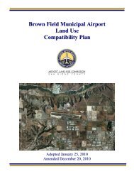
MCAS Miramar Airport Land Use Compatibility Plan - San Diego ...
MCAS Miramar Airport Land Use Compatibility Plan - San Diego ...
MCAS Miramar Airport Land Use Compatibility Plan - San Diego ...

Create successful ePaper yourself
Turn your PDF publications into a flip-book with our unique Google optimized e-Paper software.
AIRPORT LAND USE COMMISSION POLICIES CHAPTER 22.2.32 Redevelopment: Development of a new use (not necessarily a new type of use) to replace anexisting use at a density or intensity that may vary from the existing use. Redevelopment projectsare subject to the provisions of this <strong>Compatibility</strong> <strong>Plan</strong> to the same extent as other forms ofproposed development. (Also see Policy 2.6.2(c).)2.2.33 Restrictive <strong>Use</strong> Easement: Transfers certain property rights from the owner of property to theUnited States Department of Navy (DON). These easements are maintained by the DON as atool to assist in ensuring compatible land use planning in surrounding communities adjacent to<strong>MCAS</strong> <strong>Miramar</strong>.2.2.34 SDCRAA: <strong>San</strong> <strong>Diego</strong> County Regional <strong>Airport</strong> Authority, acting in its capacity as the ALUC for theCounty of <strong>San</strong> <strong>Diego</strong>.2.2.35 Sensitive <strong>Land</strong> <strong>Use</strong>s: <strong>Land</strong> uses for which the associated primary activities, whether indoor oroutdoor, are susceptible to disruption by aircraft operations and require special protection fromhazards, such as potential aircraft accidents, because of, for example, the low effective mobilityof occupancies or the presence of hazardous materials. The most common types of sensitive landuses include, but are not limited to: residential, hospitals, nursing facilities, intermediate carefacilities, educational facilities, outdoor assembly uses, libraries, museums, places of worship,and child-care facilities.2.2.36 Transition Zone (TZ): The Transition Zone is the safety zone located on the perimeter of APZ II.The boundaries of the Transition Zone were created for this <strong>Compatibility</strong> <strong>Plan</strong> using low-altitudefixed-wing aircraft flight track location data presented in the AICUZ. Additional data from themilitary was used to identify locations where these aircraft fly at an altitude of less than 2,000feet above mean sea level (MSL).2.2.37 U.S. Standard for Terminal Instrument Procedures (TERPS): Standardized criteria adopted by theFederal Aviation Administration, U.S. military branches, and the U.S. Coast Guard for use indesigning the airport area and en route instrument flight procedures. The criteria are predicatedon normal aircraft operations for considering obstacle clearance requirements.2.3 EFFECTIVE DATE2.3.1 <strong>Plan</strong> Adoption: The policies in this <strong>Compatibility</strong> <strong>Plan</strong> shall become effective as of the date thatthe ALUC adopts this <strong>Compatibility</strong> <strong>Plan</strong>.(a) The <strong>MCAS</strong> <strong>Miramar</strong> ALUCP adopted by the ALUC in 2004 shall remain in effect untilALUC adoption of this <strong>Compatibility</strong> <strong>Plan</strong>, and shall again become effective if theentirety of this <strong>Compatibility</strong> <strong>Plan</strong> should be invalidated by court action.(b) If any portion of this <strong>Compatibility</strong> <strong>Plan</strong> should be invalidated by court action, it shallnot invalidate the portions of this <strong>Compatibility</strong> <strong>Plan</strong> that are not the subject of thecourt action.(c) Any action to invalidate all or portions of a compatibility plan adopted by the ALUC forany other airport within its jurisdiction shall not invalidate this <strong>Compatibility</strong> <strong>Plan</strong>.2.3.2 Applicability to Projects Not Yet Completed: The compatibility policies, if any, that will be used toperform a consistency review for a proposed project, and any subsequent implementing action(s)associated with that project, shall be determined according to the following, as provided in<strong>MCAS</strong> <strong>Miramar</strong> <strong>Airport</strong> <strong>Land</strong> <strong>Use</strong> <strong>Compatibility</strong> <strong>Plan</strong> (Adopted October 2008 Amended December 2010) 2–5