B. Collect a minimum <strong>of</strong> one soil sample topographically downgradient <strong>of</strong>the point or area <strong>of</strong> discharge; andC. Collect a minimum <strong>of</strong> one soil sample at a depression, if present.5.3.3 How to Collect SamplesThe following sections review the methodologies to be employed in collectingenvironmental samples to be used in the preparation <strong>of</strong> EEs. Also see Section5.5(a)iii and (a)iv for additional parameters required to be reported.5.3.3.1 Soils and SedimentsWhen COPECs are potentially present because <strong>of</strong> a surface discharge,samples should be collected from the zero to six inch interval, except forvolatile organic compounds (VOC), which should be collected from the six totwelve inch interval. When COPECs are potentially present because <strong>of</strong> asubsurface discharge or groundwater migration pathway or the accretion <strong>of</strong>cleaner sediments over contaminated sediments may have occurred, samplesshould be collected from the point <strong>of</strong> discharge in soils or sediment and fromboth the zero to six inch and six to twelve inch interval in sediments,respectively. If historical evidence indicates the potential for contamination tobe present at intervals greater than six inches, sampling at depth also shouldbe considered to evaluate potential future risks from the sediments,particularly if future dredging or scouring is likely to occur. All soil andsediment must be collected as discrete rather than composite samples toascertain a more representative contaminant pr<strong>of</strong>ile (N.J.A.C. 7:26E-3.4(a)2).If contaminants are found above the ESC, then delineation must be performedin accordance with N.J.A.C. 7:26E-4.8(c)1.5.3.3.2 Surface WaterSurface water samples should be collected in the following manner:(1) When COPECs are potentially present because <strong>of</strong> a seep or surfacedischarge, samples should consist <strong>of</strong> a seep/discharge sample and agrab surface water sample adjacent to the point <strong>of</strong> discharge;(2) When COPECs are potentially present because <strong>of</strong> sedimentcontamination or groundwater migration pathway, samples should becollected from the zero to six inch interval directly above thesediments; and(3) For general water contamination with no obvious discharge source,samples should be collected from the mid-column <strong>of</strong> water. Forcertain metals, the ESC are based on either total or dissolvedconcentration. For EE purposes, both dissolved and totalconcentrations provide useful information regardless <strong>of</strong> what the ESCis based on. Therefore, both filtered and non-filtered samples shouldbe collected for metals analysis.<strong>Ecological</strong> <strong>Evaluation</strong> <strong>Technical</strong> <strong>Guidance</strong> Document 25Version 1.2 8/29/12
5.3.4 Background ConsiderationsIt is important to establish background contaminant levels in sediment, surfacewater, and soil on or near the site, but not influenced by the site to:(1) refine the COPEC list;(2) help determine if the contaminants are site-related;(3) aid in the assessment <strong>of</strong> the site’s contaminant levels relative to theregional contaminant levels; and(4) develop RMD goals for ESNRs.Many <strong>of</strong> the state’s soils, water bodies, and wetlands, especially in urban andindustrial settings, have become contaminated by historic point and non-pointdischarges (diffuse anthropogenic pollution), making it difficult to distinguishbetween contaminants from the site and <strong>of</strong>f-site sources. Additionally, in tidalwater bodies, upgradient and downgradient sediments and surface water can becontaminated by the site because <strong>of</strong> tidal influences, which can add to thecomplexity <strong>of</strong> determining background contaminant concentrations. However, itis paramount that the investigator attempt to distinguish between site-related anddiffuse anthropogenic contamination or contamination from <strong>of</strong>fsite sources. Ifpotential sources <strong>of</strong> contamination are present upgradient <strong>of</strong> the site, and it isbelieved that these sources have contributed to the contamination detected on-site,these upgradient areas should be sampled, and pr<strong>of</strong>essional judgment shoulddictate how these data are to be interpreted and used. The investigator maychoose to supplement data collected from background locations with data fromrelevant and appropriate regional databases. In circumstances where backgrounddata cannot be collected, these databases may serve as the source <strong>of</strong> backgrounddata.For the determination <strong>of</strong> background contaminant levels in sediment and surfacewater, samples should be collected from a minimum <strong>of</strong> three to five sedimentlocations (the larger number <strong>of</strong> samples is recommended because <strong>of</strong> sedimentheterogeneity) from the zero to six inch interval, and other intervals as appropriateto correspond to site-related samples. For tidal water bodies, upstream areasinfluenced by tides should be sampled at locations upstream <strong>of</strong> any mixing zoneto assess background contaminant levels.For the determination <strong>of</strong> background contaminant levels in soils, the investigatorshould collect a minimum <strong>of</strong> three to five soil samples from the zero to six inchdepth interval and other six inch intervals as appropriate.All background area samples should be collected from areas outside the site’spotential influence. The samples should not be collected from locations directlyinfluenced by or in proximity to other obvious sources <strong>of</strong> contamination (e.g.,other contaminated sites, sewer and storm-water outfalls, tributaries, and otherpoint and nonpoint source discharges). Background area locations should be <strong>of</strong>similar physical, chemical, and biological structure (e.g., similar TOC, grain size,etc.), and at a minimum should receive the same chemical analyses as site-relatedsamples. For a relatively small background area sample size, the mean and range<strong>of</strong> background contaminant concentrations should be used for comparison with<strong>Ecological</strong> <strong>Evaluation</strong> <strong>Technical</strong> <strong>Guidance</strong> Document 26Version 1.2 8/29/12
- Page 1 and 2: Ecological EvaluationTechnical Guid
- Page 3 and 4: 6.2.1.3 Biological Sampling of Fish
- Page 5 and 6: Acronyms and AbbreviationsADDAETAFA
- Page 7 and 8: Executive SummaryThis document prov
- Page 9 and 10: environmentally sensitive areas pur
- Page 11 and 12: Figure 3-1: Flow diagram to describ
- Page 13 and 14: assessment may also include evaluat
- Page 15 and 16: “Hazard quotient” or “HQ” m
- Page 17 and 18: “Site investigation” means the
- Page 19 and 20: parameters as specified in ERAGS (i
- Page 21 and 22: document otherwise). The investigat
- Page 23 and 24: 5.3.2.1 Potential Contaminant Migra
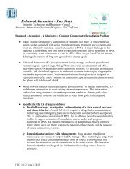
- Page 25: 71 0Sampling pointsSampling transec
- Page 29 and 30: III. GroundwaterAnalytical data fro
- Page 31 and 32: 5.5 Ecological Evaluation ReportThe
- Page 33 and 34: Step 1 - Preliminary Screening Leve
- Page 35 and 36: specific measurements of receptor h
- Page 37 and 38: Figure 6-2: Ecological Conceptual S
- Page 39 and 40: ingested, air inhaled, or material
- Page 41 and 42: Fugacity, which is described as the
- Page 43 and 44: environment. As noted in ERAGS, the
- Page 45 and 46: Sample SelectionAfter completing th
- Page 47 and 48: While there are many laboratories t
- Page 49 and 50: ioavailability, and by doing so, of
- Page 51 and 52: For the purposes of surface water,
- Page 53 and 54: higher trophic level receptors. Lip
- Page 55 and 56: Details regarding surface water tox
- Page 57 and 58: e present at intervals greater than
- Page 59 and 60: elatively sedentary organisms that
- Page 61 and 62: COPECs. The following references ar
- Page 63 and 64: tests (USEPA, 2002e). After collect
- Page 65 and 66: multiple reference area soils repre
- Page 67 and 68: In ERAs, tissue residue analyses ar
- Page 69 and 70: Objectives of the ERA: including a
- Page 71 and 72: evaluation might necessitate the co
- Page 73 and 74: N.J.A.C. 7:26E-4.8(c)1. The ERA may
- Page 75 and 76: sediment (i.e., that fraction that
- Page 77 and 78:
Twelve dioxin-like PCB congeners ha
- Page 79 and 80:
indicates burial of potential dioxi
- Page 81 and 82:
of evidence for evaluating risk unt
- Page 83 and 84:
7.2.1 Apparent Effects Threshold Ap
- Page 85 and 86:
when site conditions are most simil
- Page 87 and 88:
destroying 10 acres of the mature f
- Page 89 and 90:
ASTM (American Society for Testing
- Page 91 and 92:
Establishing Sediment Quality Crite
- Page 93 and 94:
N.J.A.C. (New Jersey Administrative
- Page 95 and 96:
USEPA. 1989c. Risk Assessment Guida
- Page 97 and 98:
http://www.epa.gov/owow/oceans/regu
- Page 99 and 100:
USEPA 2006a. Data Quality Assessmen
- Page 101 and 102:
Appendix A - Habitat Survey FormsEc
- Page 103 and 104:
Ecological Evaluation Technical Gui
- Page 105 and 106:
Appendix B - Sampling Procedures fo
- Page 107 and 108:
Appendix C - Surface Water Toxicity
- Page 109 and 110:
Short-term chronic studies, endpoin
- Page 111 and 112:
Appendix D - Sediment Toxicity Test
- Page 113 and 114:
Toxicity Test DesignSediment toxici
- Page 115 and 116:
Appendix E - Sediment Pore Water an
- Page 117 and 118:
The seven-day daphnid survival and
- Page 119 and 120:
esults are then evaluated using USE
- Page 121 and 122:
Surber or Square-foot BottomThis sa
- Page 123 and 124:
Appendix H - Soil Toxicity TestingS
- Page 125 and 126:
another sample may still have a sub
- Page 127 and 128:
conservative approach from an ecolo
- Page 129:
Data PresentationTabular presentati