PREFACE
Southeastern New Mexico Regional Research Design and ...
Southeastern New Mexico Regional Research Design and ...
- No tags were found...
Create successful ePaper yourself
Turn your PDF publications into a flip-book with our unique Google optimized e-Paper software.
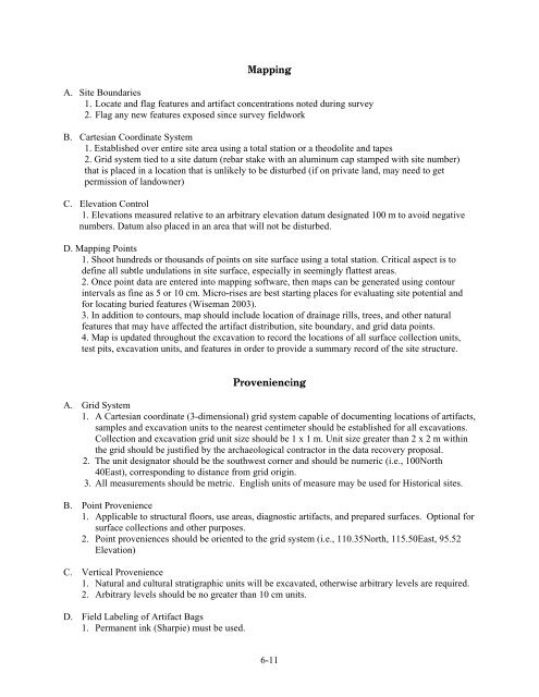
MappingA. Site Boundaries1. Locate and flag features and artifact concentrations noted during survey2. Flag any new features exposed since survey fieldworkB. Cartesian Coordinate System1. Established over entire site area using a total station or a theodolite and tapes2. Grid system tied to a site datum (rebar stake with an aluminum cap stamped with site number)that is placed in a location that is unlikely to be disturbed (if on private land, may need to getpermission of landowner)C. Elevation Control1. Elevations measured relative to an arbitrary elevation datum designated 100 m to avoid negativenumbers. Datum also placed in an area that will not be disturbed.D. Mapping Points1. Shoot hundreds or thousands of points on site surface using a total station. Critical aspect is todefine all subtle undulations in site surface, especially in seemingly flattest areas.2. Once point data are entered into mapping software, then maps can be generated using contourintervals as fine as 5 or 10 cm. Micro-rises are best starting places for evaluating site potential andfor locating buried features (Wiseman 2003).3. In addition to contours, map should include location of drainage rills, trees, and other naturalfeatures that may have affected the artifact distribution, site boundary, and grid data points.4. Map is updated throughout the excavation to record the locations of all surface collection units,test pits, excavation units, and features in order to provide a summary record of the site structure.ProveniencingA. Grid System1. A Cartesian coordinate (3-dimensional) grid system capable of documenting locations of artifacts,samples and excavation units to the nearest centimeter should be established for all excavations.Collection and excavation grid unit size should be 1 x 1 m. Unit size greater than 2 x 2 m withinthe grid should be justified by the archaeological contractor in the data recovery proposal.2. The unit designator should be the southwest corner and should be numeric (i.e., 100North40East), corresponding to distance from grid origin.3. All measurements should be metric. English units of measure may be used for Historical sites.B. Point Provenience1. Applicable to structural floors, use areas, diagnostic artifacts, and prepared surfaces. Optional forsurface collections and other purposes.2. Point proveniences should be oriented to the grid system (i.e., 110.35North, 115.50East, 95.52Elevation)C. Vertical Provenience1. Natural and cultural stratigraphic units will be excavated, otherwise arbitrary levels are required.2. Arbitrary levels should be no greater than 10 cm units.D. Field Labeling of Artifact Bags1. Permanent ink (Sharpie) must be used.6-11


