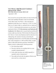
PREFACE
Southeastern New Mexico Regional Research Design and ...
Southeastern New Mexico Regional Research Design and ...
- No tags were found...

You also want an ePaper? Increase the reach of your titles
YUMPU automatically turns print PDFs into web optimized ePapers that Google loves.
In mapping the physiographic units, the major boundaries illustrated by Hawley (1993:262, Figure 1)were transferred to the provisional southeastern quadrant of the Surficial Geologic Map of New Mexico(NMBGMR, 2005) by keying on the upper Cenozoic deposits common to both maps. The boundaries ofthe Pecos River Valley subsection were then drawn to encompass the late Pleistocene and Quaternaryriver alluvium (AR, ARy, ARo2). Next, the western boundary of the Canadian River Drainage wasmapped based on the topography and drainages shown on the Santa Rosa and Tucumcari USGS1:100,000 scale metric topographic maps. Finally, on the advice of the BLM’s coordinating committee,the western boundary of the Portales Valley was redrawn to conform more closely to local usage.GEOARCHAEOLOGIC MAP OF SOUTHEASTERN NEW MEXICOStephen A. HallThe geoarchaeologic map is a new category of maps based on surface deposits and landforms that areassociated with archaeological sites. Neither landforms nor archaeological sites are randomly distributedacross the Earth’s surface, and the relationship between the two may form patterns that can be recognizedand charted on maps. The resulting maps can be used to predict whether sites of different ages will be atthe ground surface or deeply buried. Consequently, the map serves as a guide in cultural resourceplanning and management.Regional Geology and GeomorphologyThe eight physiographic units defined previously are each characterized by unique bedrock andtopographic expression and geologic history. These units also incorporate differences in surfacehydrology, vegetation, fauna, climate, and lithic resources. Because of the differences in the physical andbiotic landscape that are related to geologic history, the occurrence, preservation, and burial ofarchaeological sites may have geographic patterns that in turn reflect that geologic history. In thefollowing discussions of these patterns, symbols in parentheses below are map units from the GeologicMap of New Mexico (NMBGMR 2003). Selected references that pertain to the geoarchaeology of eachphysiographic region are listed in Table 2.1.Sacramento SectionThe bedrock geology of the Sacramento Section is dominated by limestone of the San Andreas formation(Psa, Permian) with some outcrops of older Yeso formation (Py, Permian) along stream valleys where theSan Andreas limestone is down cut. Undifferentiated Pennsylvanian rocks form the bulk of theSacramento Mountains, and Tertiary igneous rocks form the Sierra Blanca and Capitan mountains. Recentalluvial deposits along the numerous streams in the area are too narrow to be shown on the 1:500,000scale geologic and surficial geology maps of the state.Large area of the Sacramento Section are predominantly denuded limestone bedrock with only a thin(