

Nebraska Soils Field Trip - Virginia Tech
Nebraska Soils Field Trip - Virginia Tech
Nebraska Soils Field Trip - Virginia Tech

You also want an ePaper? Increase the reach of your titles
YUMPU automatically turns print PDFs into web optimized ePapers that Google loves.
4th IUSS Soil Classification Conference <strong>Field</strong> Tour Guidebook<br />
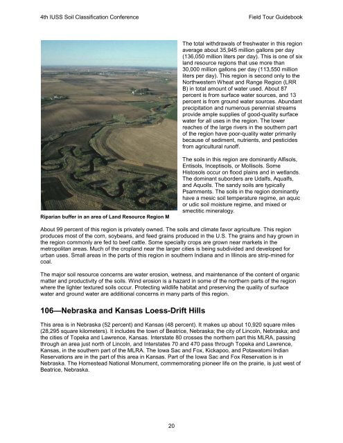
Riparian buffer in an area of Land Resource Region M<br />
The total withdrawals of freshwater in this region<br />
average about 35,945 million gallons per day<br />
(136,050 million liters per day). This is one of six<br />
land resource regions that use more than<br />
30,000 million gallons per day (113,550 million<br />
liters per day). This region is second only to the<br />
Northwestern Wheat and Range Region (LRR<br />
B) in total amount of water used. About 87<br />
percent is from surface water sources, and 13<br />
percent is from ground water sources. Abundant<br />
precipitation and numerous perennial streams<br />
provide ample supplies of good-quality surface<br />
water for all uses in the region. The lower<br />
reaches of the large rivers in the southern part<br />
of the region have poor-quality water primarily<br />
because of sediment, nutrients, and pesticides<br />
from agricultural runoff.<br />
The soils in this region are dominantly Alfisols,<br />
Entisols, Inceptisols, or Mollisols. Some<br />
Histosols occur on flood plains and in wetlands.<br />
The dominant suborders are Udalfs, Aqualfs,<br />
and Aquolls. The sandy soils are typically<br />
Psamments. The soils in the region dominantly<br />
have a mesic soil temperature regime, an aquic<br />
or udic soil moisture regime, and mixed or<br />
smectitic mineralogy.<br />
About 99 percent of this region is privately owned. The soils and climate favor agriculture. This region<br />
produces most of the corn, soybeans, and feed grains produced in the U.S. The grains and hay grown in<br />
the region commonly are fed to beef cattle. Some specialty crops are grown near markets in the<br />
metropolitan areas. Much of the cropland near the larger cities is being subdivided and developed for<br />
urban uses. Small areas in the parts of this region in southern Indiana and in Illinois are strip-mined for<br />
coal.<br />
The major soil resource concerns are water erosion, wetness, and maintenance of the content of organic<br />
matter and productivity of the soils. Wind erosion is a hazard in some of the northern parts of the region<br />
where the lighter textured soils occur. Protecting wildlife habitat and preserving the quality of surface<br />
water and ground water are additional concerns in many parts of this region.<br />
106—<strong>Nebraska</strong> and Kansas Loess-Drift Hills<br />
This area is in <strong>Nebraska</strong> (52 percent) and Kansas (48 percent). It makes up about 10,920 square miles<br />
(28,295 square kilometers). It includes the town of Beatrice, <strong>Nebraska</strong>; the city of Lincoln, <strong>Nebraska</strong>; and<br />
the cities of Topeka and Lawrence, Kansas. Interstate 80 crosses the northern part this MLRA, passing<br />
through an area just north of Lincoln, and Interstates 70 and 470 pass through Topeka and Lawrence,<br />
Kansas, in the southern part of the MLRA. The Iowa Sac and Fox, Kickapoo, and Potawatomi Indian<br />
Reservations are in the part of this area in Kansas. Part of the Iowa Sac and Fox Reservation is in<br />
<strong>Nebraska</strong>. The Homestead National Monument, commemorating pioneer life on the prairie, is just west of<br />
Beatrice, <strong>Nebraska</strong>.<br />
20


