

Nebraska Soils Field Trip - Virginia Tech
Nebraska Soils Field Trip - Virginia Tech
Nebraska Soils Field Trip - Virginia Tech

You also want an ePaper? Increase the reach of your titles
YUMPU automatically turns print PDFs into web optimized ePapers that Google loves.
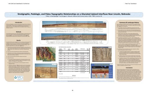
4th IUSS Soil Classification Conference <strong>Field</strong> Tour Guidebook<br />
Stratigraphic, Pedologic, and Paleo-Topographic Relationships on a Glaciated Upland Interfluve Near Lincoln, <strong>Nebraska</strong><br />
Philip JJ. Schoeneberger* Schoeneberger and Douglas AA. Wysocki Wysocki, National Soil Survey Center Center, USDA - NRCS NRCS, Lincoln Lincoln, NE<br />
Introduction<br />
<strong>Soils</strong> are a synthograph, a record of earth system processes that can lead to an<br />
understanding of landscape history, soil geography, and the dynamic processes<br />
that formed them. These insights substantively explain what otherwise<br />
appears to be random soil variability, and can be applied to better manage soil<br />
Methods<br />
Fi Figure 22.<br />
Summary & Landscape History<br />
Site morphology and sediment body composition and configuration detail a<br />
dynamic, varied landscape history. The sequence of layers (from the surface<br />
down; Figure 5) are interpreted as:<br />
and water resources. 0) Anthropogenic land surface modification by removal of most of the<br />
modern mollic surface and exposure of headwalls (borrow-pit activities).<br />
Primary field observations were made along headwalls of an extensive borrowpit<br />
site cut through an interfluve of dissected till plains adjacent to Lincoln,<br />
<strong>Nebraska</strong> (Figure 1). Cross-sectional documentation is shown (Figure 2).<br />
Standard laboratory analyses were conducted on soil horizons (Burt, 2004).<br />
Results<br />
An upland interfluve was investigated in a loess-mantled, pre-Illinoian glaciated<br />
landscape near Lincoln, NE. The site retains a record of the stratigraphic,<br />
pedologic and paleo-topographic paleo topographic relationships of multiple depositional and soil<br />
development episodes over the last several hundred thousand years. The<br />
sequence of layers (from the surface down; Figure 3) are:<br />
1) Greyish-brown loess [locally colluviated, homogeneous eolian-derived silt<br />
with scattered till-derived gravels, and an oxidized upper portion (including<br />
a black, modern mollic surface) and an intermittent, deoxidized lower<br />
portion].<br />
2) Brown loess (locally colluviated with scattered, till-derived gravels).<br />
3) Pedisediment unit including a reddish-brown paleosol (reworked, loessderived<br />
slope alluvium, including scattered gravels and channel-fills, rather<br />
than primary air-fall loess deposits).<br />
4) Stone line (erosional lag concentration of gravels and stones)<br />
5) Glacial till (3 zones):<br />
a) A truncated, red paleosol developed in the uppermost portion of the<br />
leached, oxidized till. (weathered, reddish, strong pedogenic structure,<br />
leached, in an oxidized, till – derived matrix).<br />
b) Oxidized, leached till (weathered, weak pedo-geogenic structure,<br />
oxidized till matrix).<br />
c) Unoxidized, unleached till (Figure 4) (weathered, with strong geogenic<br />
structure, grey till matrix. The upper 5-10m of the till is dominated by<br />
prominent, deep polygonal fractures. The fractures are lined with a<br />
thin, black Mn / Fe-Mn film along the primary fracture face which is<br />
surrounded by white secondary CaCO3 , which is bounded by a thick<br />
yellow halo (hypocoats) of Fe and Mn oxides. These polygonal seams<br />
are nearly vertical at depth (>5-10m). Near the upper limit of the till<br />
the seams are vertical in proximity to the interfluve axis, but bend<br />
obliquely in a down-slope direction on sideslopes.<br />
Pit 6 Profile Description and Lab Data 1<br />
Figure 1. Figure 4.<br />
Relative Horiz. Soil Co. Matrix Soil Structure Efferv.<br />
Depth (cm) (top 40 cm<br />
Texture Frags Frags. % Color (m) Class<br />
removed) -- -- -- -- -- --<br />
0-10 A sicl 1 10YR 3/1 3,f -m, abk NE<br />
10-40 Bt1 sicl 0 10YR 4/3<br />
& 5/3<br />
2, m-c, sbk NE<br />
DEM of NW 27th & 5/3<br />
40-70 Bt2 sicl 1 10YR 4/3 2, m, pr parts<br />
to 2, m, sbk<br />
NE<br />
70-100 Bt3 sicl 2 7.5YR 4/3 1, co, pr parts<br />
to 1, m,sbk<br />
NE<br />
DEM of NW 27 St. Area 100-130 100 130 Bt4 sicl 2 5YR 3/3 11, mm-cc, pr prparts parts NE<br />
& 4/3 to 2, m, sbk<br />
130-145 2Bt1 extr. gr. l 85 7.5YR 4/6 1, m NE<br />
Figure 3. Pit 6. 145-160 2Bt2 cl 7 7.5YR 4/6 2, m, sbk NE<br />
Figure 5.<br />
160-210 3Bt cl 2 7.5YR 4/4 3 co-v.co pr parts<br />
to o 3, f-m, , sbk sb<br />
NE<br />
210-230 3BC c 2 2.5Y 5/2 3 co-v.co pr parts<br />
to 3, f-m, sbk<br />
NE<br />
230-260 3C c 2 2.5Y 5/2 3 co-v.co pr parts<br />
to 3, f-m, abk<br />
SL<br />
260+<br />
1 Burt, 2004.<br />
-- c 2 2.5Y 5/2 3 co-v.co pr p parts p<br />
to 3, f-m, abk<br />
SL<br />
References<br />
Burt, R. 2004. Soil Survey Laboratory Methods Manual, ver. 4.0. USDA- NRCS, SSIR 42.<br />
Mason, J.A., Joeckle, R.M., Bettis, E.A. III. 2007. Middle to late Pleistocence loess record in eastern <strong>Nebraska</strong>, USA, and implications for the unique nature of<br />
Oxygen isotope Stage 2. Quaternary Science Reviews: 26 pp. 773-792.<br />
USDA is an equal opportunity provider and employer<br />
28<br />
1) Peoria-aged* loess (>11 to 20 to 50 to 640 ka (Lava Creek –B tephra) to


