

Nebraska Soils Field Trip - Virginia Tech
Nebraska Soils Field Trip - Virginia Tech
Nebraska Soils Field Trip - Virginia Tech

You also want an ePaper? Increase the reach of your titles
YUMPU automatically turns print PDFs into web optimized ePapers that Google loves.
4th IUSS Soil Classification Conference <strong>Field</strong> Tour Guidebook<br />
Overview of the Loess Hills<br />
By Richard Lensch<br />
Soil Scientist (Retired)<br />
Iowa Loess Hills<br />
The loess hills of western Iowa are divided into two Major Land Resource areas-MLRA<br />
107A and MLRA 107B. MLRA107A is located on the Northern Iowa drift plane and MLRA107B is<br />
located on the Southern Iowa drift plane.<br />
The Northern Iowa drift plane, which occupies Northwestern Iowa, was covered by the<br />
Tazewell ice sheet approximately 40,000 BP. Little modification of the landscape occurred<br />
between the recession of the early Wisconsin ice sheet and the beginning of Wisconsin loess<br />
deposition about 31,000 years BP. It is characterized by broad loess covered flats with glacial till<br />
at depths of 1 and 8 meters.<br />
In stark contrast to the Northern Iowa drift plane, the Southern Iowa drift plane is a much<br />
more mature landscape that is heavily dissected by geologic erosion. Erosion began on the<br />
Southern Iowa drift plane in Pre-Illinoian time, and is characterized by hills with narrower<br />
interfluves and steeper side slopes than the Northern Iowa drift plane. Loess thickness ranges<br />
from more than 22 meters to 2 meters on the Southern Iowa drift plane.<br />
Loess deposition started approximately 159,000 yeas BP on the Southern Iowa drift<br />
plane. The Loess Hills are comprised of three major layers. From oldest to youngest, the layers<br />
are known as the Loveland Loess, (120,000 to 159,000 years old), the Pisgah Loess (25,000 to<br />
31,000 years old), and the Peoria Loess (12,500-25,000 years old). (1)<br />
Thickness of the loess, in MLRA 107B, ranges in from more than 22 meters at the bluffs<br />
to about 5 meters at the eastern boundary. As the loess thickness thins with the distance from<br />
the source area, sand content and coarse silt to fine silt ratios decrease, and clay content<br />
increases, within the solum. Soil solums show increased weathering and maturity as the distance<br />
increases from the source area.<br />
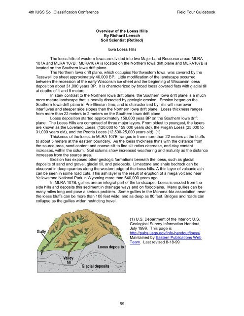
Erosion has exposed other geologic formations beneath the loess, such as glacial<br />
deposits of sand and gravel, glacial till, and paleosols. Limestone and shale bedrock can be<br />
observed in deep quarries along the western edge of the loess hills. A thin layer of volcanic ash<br />
can be seen in some road cuts. This ash layer is the result of eruption of a mega volcano near<br />
Yellowstone National Park in Wyoming more than 640,000 years ago.<br />
In MLRA 107B, gullies are an integral part of the landscape. Loess is eroded from the<br />
side hills and deposits this sediment in drainage ways and on floodplains. Many gullies can be<br />
many miles long and pose a serious problem. Some gullies in the Monona-Ida association, near<br />
the loess bluffs can be more than 100 feet wide, and as deep as 80 feet. Bridges and roads can<br />
collapse as the gullies widen restricting travel.<br />
59<br />
(1) U.S. Department of the Interior; U.S.<br />
Geological Survey Information Handout,<br />
July 1999. This page is<br />
http://pubs.usgs.gov/info-handout/loess/.<br />
Maintained by Eastern Publications Web<br />
Team. Last revised 8-18-99


