Nebraska Soils Field Trip - Virginia Tech
Nebraska Soils Field Trip - Virginia Tech
Nebraska Soils Field Trip - Virginia Tech
You also want an ePaper? Increase the reach of your titles
YUMPU automatically turns print PDFs into web optimized ePapers that Google loves.
4th IUSS Soil Classification Conference <strong>Field</strong> Tour Guidebook<br />
Water<br />
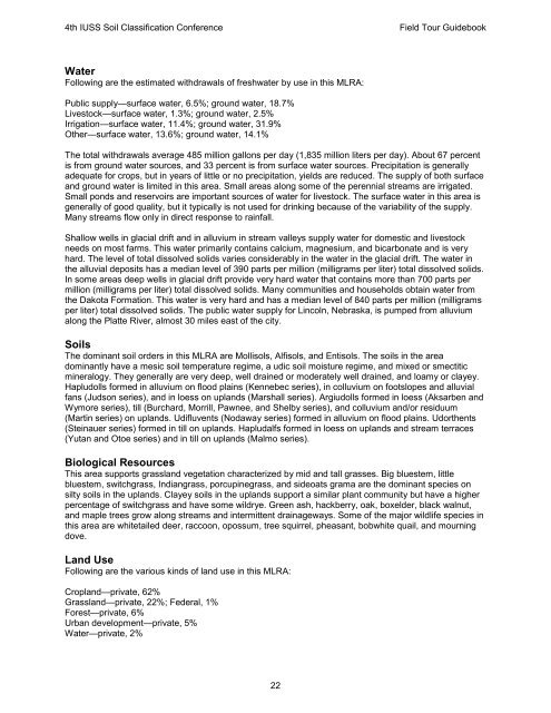
Following are the estimated withdrawals of freshwater by use in this MLRA:<br />
Public supply—surface water, 6.5%; ground water, 18.7%<br />
Livestock—surface water, 1.3%; ground water, 2.5%<br />
Irrigation—surface water, 11.4%; ground water, 31.9%<br />
Other—surface water, 13.6%; ground water, 14.1%<br />
The total withdrawals average 485 million gallons per day (1,835 million liters per day). About 67 percent<br />
is from ground water sources, and 33 percent is from surface water sources. Precipitation is generally<br />
adequate for crops, but in years of little or no precipitation, yields are reduced. The supply of both surface<br />
and ground water is limited in this area. Small areas along some of the perennial streams are irrigated.<br />
Small ponds and reservoirs are important sources of water for livestock. The surface water in this area is<br />
generally of good quality, but it typically is not used for drinking because of the variability of the supply.<br />
Many streams flow only in direct response to rainfall.<br />
Shallow wells in glacial drift and in alluvium in stream valleys supply water for domestic and livestock<br />
needs on most farms. This water primarily contains calcium, magnesium, and bicarbonate and is very<br />
hard. The level of total dissolved solids varies considerably in the water in the glacial drift. The water in<br />
the alluvial deposits has a median level of 390 parts per million (milligrams per liter) total dissolved solids.<br />
In some areas deep wells in glacial drift provide very hard water that contains more than 700 parts per<br />
million (milligrams per liter) total dissolved solids. Many communities and households obtain water from<br />
the Dakota Formation. This water is very hard and has a median level of 840 parts per million (milligrams<br />
per liter) total dissolved solids. The public water supply for Lincoln, <strong>Nebraska</strong>, is pumped from alluvium<br />
along the Platte River, almost 30 miles east of the city.<br />
<strong>Soils</strong><br />
The dominant soil orders in this MLRA are Mollisols, Alfisols, and Entisols. The soils in the area<br />
dominantly have a mesic soil temperature regime, a udic soil moisture regime, and mixed or smectitic<br />
mineralogy. They generally are very deep, well drained or moderately well drained, and loamy or clayey.<br />
Hapludolls formed in alluvium on flood plains (Kennebec series), in colluvium on footslopes and alluvial<br />
fans (Judson series), and in loess on uplands (Marshall series). Argiudolls formed in loess (Aksarben and<br />
Wymore series), till (Burchard, Morrill, Pawnee, and Shelby series), and colluvium and/or residuum<br />
(Martin series) on uplands. Udifluvents (Nodaway series) formed in alluvium on flood plains. Udorthents<br />
(Steinauer series) formed in till on uplands. Hapludalfs formed in loess on uplands and stream terraces<br />
(Yutan and Otoe series) and in till on uplands (Malmo series).<br />
Biological Resources<br />
This area supports grassland vegetation characterized by mid and tall grasses. Big bluestem, little<br />
bluestem, switchgrass, Indiangrass, porcupinegrass, and sideoats grama are the dominant species on<br />
silty soils in the uplands. Clayey soils in the uplands support a similar plant community but have a higher<br />
percentage of switchgrass and have some wildrye. Green ash, hackberry, oak, boxelder, black walnut,<br />
and maple trees grow along streams and intermittent drainageways. Some of the major wildlife species in<br />
this area are whitetailed deer, raccoon, opossum, tree squirrel, pheasant, bobwhite quail, and mourning<br />
dove.<br />
Land Use<br />
Following are the various kinds of land use in this MLRA:<br />
Cropland—private, 62%<br />
Grassland—private, 22%; Federal, 1%<br />
Forest—private, 6%<br />
Urban development—private, 5%<br />
Water—private, 2%<br />
22


