

Ground-water development in East St. Louis area, Illinois. Urbana, IL ...
Ground-water development in East St. Louis area, Illinois. Urbana, IL ...
Ground-water development in East St. Louis area, Illinois. Urbana, IL ...

You also want an ePaper? Increase the reach of your titles
YUMPU automatically turns print PDFs into web optimized ePapers that Google loves.
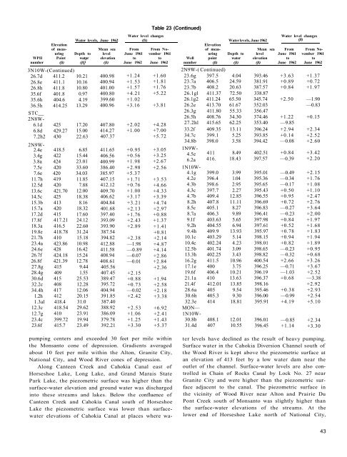
Table 23 (Cont<strong>in</strong>ued)<br />
Water level changes<br />
Water level changes<br />
Water levels, June 1962 (ft) Water levels, June 1962 (ft)<br />
Elevation<br />
Elevation<br />
of meas- Mean sea From From No- of meas- Mean sea From From Nour<strong>in</strong>g<br />
Depth to level June 1961 vember 1961 ur<strong>in</strong>g Depth to level June 1961 vember 1961<br />
WPII Po<strong>in</strong>t watpr elevation to to Well po<strong>in</strong>t <strong>water</strong> elevation to to<br />
number (ft) (fQ (ft) June 1962 June 1962 number (ft) (ft) (ft) June 1962 June 1962<br />
3N10W-(Cont<strong>in</strong>ued)<br />
2N9W-( Cont<strong>in</strong>ued)<br />
26.7d 411.2 10.21 400.98 +1.24 +1.60 23.6g 397.5 4.04 393.46 +3.63 +1.37<br />
26.8e 411.1 10.16 400.94 +1.53 +1.81 23.7a 406.5 24.59 381.91 +0.89 +0.72<br />
26.8h 411.8 10.80 401.00 +1.57 +1.76 23.7b 408.2 20.63 387.57 +0.84 +1.97<br />
35.6f 401.8 0.97 400.80 +4.21 +5.22 26.1gl 411.37 72.50 338.87<br />
35.6h 404.6 4.19 399.60 +1.02 26.1g2 411.24 65.50 345.74 +2.50 —1.90<br />
36.5h 414.25 13.29 400.96 +3.16 +3.81 26.2e 413.70 61.67 352.03 —0.83<br />
STC<br />
26.3g 411.80 55.33 356.47<br />
2N8W-<br />
26.5h 408.76 34.30 374.46 +1.22 +0.15<br />
6.1d 425 17.20 407.80 +2.02 +4.28 27.2hl 415.65 62.25 353.40 —9.85<br />
6.8d 429.27 15.00 414.27 +1.00 +7.00 33.2f 409.35 13.11 396.24 +2.94 +2.34<br />
7.2h2 430 22.63 407.37 +5.72 34.7c 399.1 5.25 393.85 +0.14 +2.52<br />
34.8b 398.0 3.58 394.42 —0.08 +2.60<br />
2N9W-<br />
2.4e<br />
3.4g<br />
3.8a<br />
418.5<br />
422<br />
424<br />
6.85<br />
15.44<br />
23.01<br />
411.65<br />
406.56<br />
400.99<br />
+0.95<br />
+0.56<br />
+1.98<br />
+3.05<br />
+3.25<br />
+2.67<br />
1N9W-<br />
4.5e<br />
6.2a<br />
411<br />
416.<br />
8.49<br />
18.43<br />
402.51<br />
397.57<br />
+0.84<br />
—0.39<br />
+3.42<br />
+2.20<br />
7.5e 420 33.60 386.40 +2.98 +2.56 1N10W-<br />
7.6e 420 34.03 385.97 +5.37 4.1g 399.0 3.99 395.01 —0.49 +2.15<br />
11.7h 419 11.85 407.15 +1.71 +3.53 4.2e 396.4 1.04 395.36 —0.34 +1.76<br />
12.5d 420 7.88 412.12 +0.76 +4.66 4.3b 398.6 2.95 395.65 —0.17 +1.08<br />
13.6c 421.70 12.00 409.70 +1.00 +4.33 4.3c 397.7 2.27 395.43 +0.50 +1.10<br />
14.5c 425 18.38 406.62 +3.17 +3.39 4.7b 409.4 12.85 396.55 +0.95 +2.47<br />
15.3b 413 8.16 404.84 +3.21 +4.74 8.2h 407.8 11.11 396.69 +0.72 +2.76<br />
15.7a 420 18.32 401.68 +2.13 +2.97 8.5c 405.1 8.27 396.83 —0.27 +3.64<br />
17.2d 415 17.60 397.40 +1.76 +0.88 8.7a 406.3 9.89 396.41 —0.23 +2.00<br />
17.8f 417.21 24.12 393.09 +2.43 +1.37 9.1f 403.63 5.65 397.98 +0.84 +1.97<br />
18.3a 416.5 22.60 393.90 +2.89 +1.41 9.2h 404.55 6.94 397.61 +0.52 +1.68<br />
19.8e 418.78 31.24 387.54 +0.81 9.4h 409.9 13.93 395.97 +0.78 +1.83<br />
21.7h 410 15.18 394.82 +2.38 +2.14 10.1c 403.29 5.14 398.15 +0.94 +1.94<br />
23.4a 423.86 10.98 412.88 —1.98 +4.87 10.4c 402.24 4.23 398.01 +0.82 +1.89<br />
24.6e 428 16.42 411.58 —0.89 +4.14 12.5b 401.74 3.09 398.65 —0.23 +0.95<br />
26.7f 424.18 15.24 408.94 —0.07 +2.86 13.3h 402.25 3.43 398.82 —0.32 +0.68<br />
26.8f 421.39 12.78 408.61 —0.01 +2.84 16.2g 411.5 10.96 400.54 +2.66 +3.26<br />
27.8g 415 9.44 405.56 +2.36 17.1e 400 3.75 396.25 —0.71 +3.67<br />
28.4g 409 1.55 407.45 +2.15 19.6f 406.4 10.21 396.19 —1.03 +2.52<br />
30.6d 415 25.53 389.47 +0.88 +1.94 21.1a 410 13.63 396.37 +0.68 —3.38<br />
32.2c 408 12.28 395.72 +0.73 +2.58 21.4f 412.01 13.85 398.16 +2.92<br />
34.4h 417 12.06 404.94 —0.02 +2.18 28.6a 405 9.54 395.46 +0.38 +2.93<br />
1.2h 412 20.15 391.85 +2.42 +3.38 30.6h 405.3 9.30 396.00 —0.99 +2.54<br />
1.3al 418.4 31.0 387.40 32.3e 414 18.81 395.91 +4.19 +5.10<br />
12.3c 418.54 29.62 388.92 +2.53 +6.92 MON—<br />
12.7g 410 23.91 386.09 +1.06 +2.41 1N10W-<br />
23.4c 399.72 19.94 379.78 +1.25 +1.43 30.8b 408.1 12.01 396.01 —0.85 +2.34<br />
23.6f 415.7 23.49 392.21 +3.30 +5.37 31.4d 407 10.55 396.45 +1.14 +3.30<br />
pump<strong>in</strong>g centers and exceeded 30 feet per mile with<strong>in</strong><br />
the Monsanto cone of depression. Gradients averaged<br />
about 10 feet per mile with<strong>in</strong> the Alton, Granite City,<br />
National City, and Wood River cones of depression.<br />
Along Canteen Creek and Cahokia Canal east of<br />
Horseshoe Lake, Long Lake, and Grand Marais <strong>St</strong>ate<br />
Park Lake, the piezometric surface was higher than the<br />
surface-<strong>water</strong> elevation and ground <strong>water</strong> was discharged<br />
<strong>in</strong>to these streams and lakes. Below the confluence of<br />
Canteen Creek and Cahokia Canal south of Horseshoe<br />
Lake the piezometric surface was lower than surface<strong>water</strong><br />
elevations of Cahokia Canal at places where <strong>water</strong><br />
levels have decl<strong>in</strong>ed as the result of heavy pump<strong>in</strong>g.<br />
Surface <strong>water</strong> <strong>in</strong> the Cahokia Diversion Channel south of<br />
the Wood River is kept above the piezometric surface at<br />
an elevation of 413 feet by a low <strong>water</strong> dam near the<br />
outlet of the channel. Surface-<strong>water</strong> levels are also controlled<br />
<strong>in</strong> Cha<strong>in</strong> of Rocks Canal by Lock No. 27 near<br />
Granite City and were higher than the piezometric surface<br />
adjacent to the canal. The piezometric surface <strong>in</strong><br />
the vic<strong>in</strong>ity of Wood River near Alton and Prairie Du<br />
Pont Creek south of Monsanto was slightly higher than<br />
the surface-<strong>water</strong> elevations of the streams. At the<br />
lower end of Horseshoe Lake north of National City,<br />
43


