

Download PDF (2.5MB) - Anchor Environmental
Download PDF (2.5MB) - Anchor Environmental
Download PDF (2.5MB) - Anchor Environmental

You also want an ePaper? Increase the reach of your titles
YUMPU automatically turns print PDFs into web optimized ePapers that Google loves.
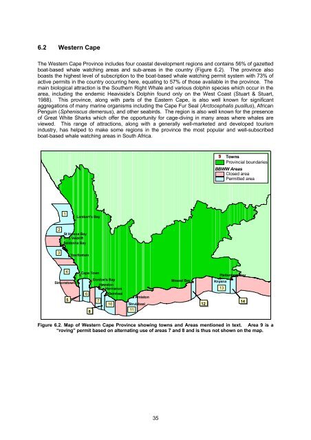
6.2 Western Cape<br />
The Western Cape Province includes four coastal development regions and contains 56% of gazetted<br />
boat-based whale watching areas and sub-areas in the country (Figure 6.2). The province also<br />
boasts the highest level of subscription to the boat-based whale watching permit system with 73% of<br />
active permits in the country occurring here, equating to 57% of those available in the province. The<br />
main biological attraction is the Southern Right Whale and various dolphin species which occur in the<br />
area, including the endemic Heaviside’s Dolphin found only on the West Coast (Stuart & Stuart,<br />
1988). This province, along with parts of the Eastern Cape, is also well known for significant<br />
aggregations of many marine organisms including the Cape Fur Seal (Arctocephalis pusillus), African<br />
Penguin (Spheniscus demersus), and other seabirds. The region is also well known for the presence<br />
of Great White Sharks which offer the opportunity for cage-diving in many areas where whales are<br />
viewed. This range of attractions, along with a generally well-marketed and developed tourism<br />
industry, has helped to make some regions in the province the most popular and well-subscribed<br />
boat-based whale watching areas in South Africa.<br />
#S<br />
Towns<br />
Provincial boundaries<br />
BBWW Areas<br />
Closed area<br />
Permitted area<br />
1<br />
#S Lambert's Bay<br />
2<br />
St Helena Bay<br />
#S #S Veldrift<br />
Saldanha Bay<br />
#S<br />
3<br />
#S Yzerfontein<br />
4 Cape Town<br />
#S<br />
#S<br />
#S<br />
Gordon's Bay<br />
Simonstown<br />
Hawston<br />
#S #S Hermanus<br />
6 #S Kleinbaai<br />
5<br />
7<br />
10<br />
8<br />
#S Arniston<br />
#S<br />
Struisbaai<br />
11<br />
Mossel Bay #S<br />
12<br />
Plettenberg Bay<br />
#S #S<br />
Knysna<br />
13<br />
14<br />
Figure 6.2. Map of Western Cape Province showing towns and Areas mentioned in text. Area 9 is a<br />
“roving” permit based on alternating use of areas 7 and 8 and is thus not shown on the map.<br />
35


