the PDF version! - Danube Limes
the PDF version! - Danube Limes
the PDF version! - Danube Limes

Create successful ePaper yourself
Turn your PDF publications into a flip-book with our unique Google optimized e-Paper software.
Frontiers of <strong>the</strong> Roman Empire – Ripa Pannonica in Hungary (RPH) Nomination statement<br />
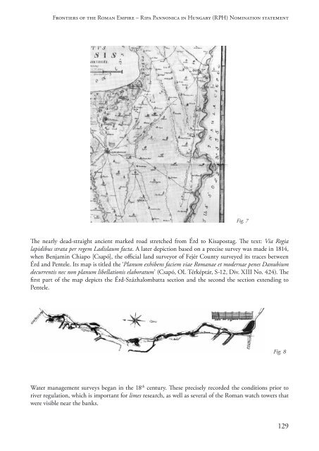
Fig. 7<br />
The nearly dead-straight ancient marked road stretched from Érd to Kisapostag. The text: Via Regia<br />
lapidibus strata per regem Ladislaum facta. A later depiction based on a precise survey was made in 1814,<br />
when Benjamin Chiapo [Csapó], <strong>the</strong> official land surveyor of Fejér County surveyed its traces between<br />
Érd and Pentele. Its map is titled <strong>the</strong> ‘Planum exhibens faciem viae Romanae et modernae penes Danubium<br />
decurrentis nec non planum libellationis elaboratum’ (Csapó, OL Térképtár, S-12, Div. XIII No. 424). The<br />
first part of <strong>the</strong> map depicts <strong>the</strong> Érd-Százhalombatta section and <strong>the</strong> second <strong>the</strong> section extending to<br />
Pentele.<br />
Fig. 8<br />
Water management surveys began in <strong>the</strong> 18 th century. These precisely recorded <strong>the</strong> conditions prior to<br />
river regulation, which is important for limes research, as well as several of <strong>the</strong> Roman watch towers that<br />
were visible near <strong>the</strong> banks.<br />
129