Land Use 2025 - RhodeMap RI
Land Use 2025 - RhodeMap RI
Land Use 2025 - RhodeMap RI
- No tags were found...
You also want an ePaper? Increase the reach of your titles
YUMPU automatically turns print PDFs into web optimized ePapers that Google loves.
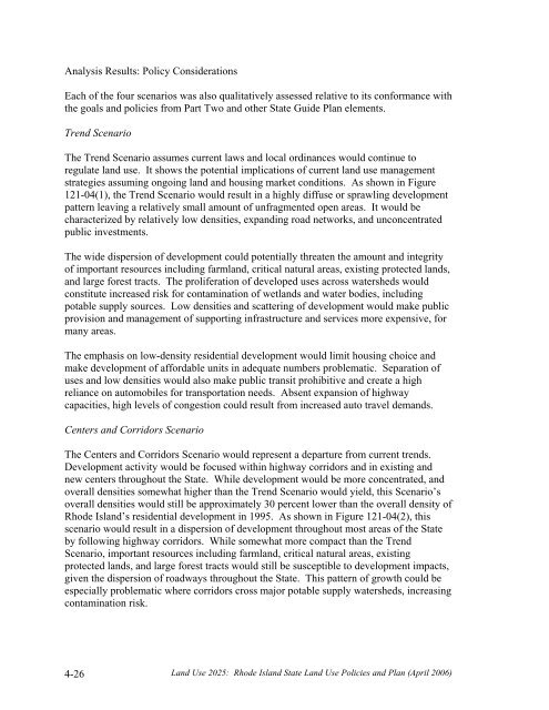
Analysis Results: Policy ConsiderationsEach of the four scenarios was also qualitatively assessed relative to its conformance withthe goals and policies from Part Two and other State Guide Plan elements.Trend ScenarioThe Trend Scenario assumes current laws and local ordinances would continue toregulate land use. It shows the potential implications of current land use managementstrategies assuming ongoing land and housing market conditions. As shown in Figure121-04(1), the Trend Scenario would result in a highly diffuse or sprawling developmentpattern leaving a relatively small amount of unfragmented open areas. It would becharacterized by relatively low densities, expanding road networks, and unconcentratedpublic investments.The wide dispersion of development could potentially threaten the amount and integrityof important resources including farmland, critical natural areas, existing protected lands,and large forest tracts. The proliferation of developed uses across watersheds wouldconstitute increased risk for contamination of wetlands and water bodies, includingpotable supply sources. Low densities and scattering of development would make publicprovision and management of supporting infrastructure and services more expensive, formany areas.The emphasis on low-density residential development would limit housing choice andmake development of affordable units in adequate numbers problematic. Separation ofuses and low densities would also make public transit prohibitive and create a highreliance on automobiles for transportation needs. Absent expansion of highwaycapacities, high levels of congestion could result from increased auto travel demands.Centers and Corridors ScenarioThe Centers and Corridors Scenario would represent a departure from current trends.Development activity would be focused within highway corridors and in existing andnew centers throughout the State. While development would be more concentrated, andoverall densities somewhat higher than the Trend Scenario would yield, this Scenario’soverall densities would still be approximately 30 percent lower than the overall density ofRhode Island’s residential development in 1995. As shown in Figure 121-04(2), thisscenario would result in a dispersion of development throughout most areas of the Stateby following highway corridors. While somewhat more compact than the TrendScenario, important resources including farmland, critical natural areas, existingprotected lands, and large forest tracts would still be susceptible to development impacts,given the dispersion of roadways throughout the State. This pattern of growth could beespecially problematic where corridors cross major potable supply watersheds, increasingcontamination risk.4-26<strong>Land</strong> <strong>Use</strong> <strong>2025</strong>: Rhode Island State <strong>Land</strong> <strong>Use</strong> Policies and Plan (April 2006)


