

Land Use 2025 - RhodeMap RI
Land Use 2025 - RhodeMap RI
Land Use 2025 - RhodeMap RI
- No tags were found...

You also want an ePaper? Increase the reach of your titles
YUMPU automatically turns print PDFs into web optimized ePapers that Google loves.
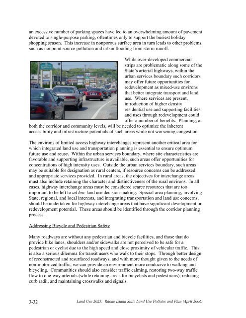
an excessive number of parking spaces have led to an overwhelming amount of pavementdevoted to single-purpose parking, oftentimes only to support the busiest holidayshopping season. This increase in nonporous surface area in turn leads to other problems,such as nonpoint source pollution and urban flooding from storm runoff.While over-developed commercialstrips are problematic along some of theState’s arterial highways, within theurban services boundary such corridorsmay offer future opportunities forredevelopment as mixed-use environsthat better integrate transport and landuse. Where services are present,introduction of higher densityresidential use and supporting facilitiesand uses through redevelopment couldoffer a number of benefits. Planning, atboth the corridor and community levels, will be needed to optimize the inherentaccessibility and infrastructure potentials of such areas while not worsening congestion.The environs of limited access highway interchanges represent another critical area forwhich integrated land use and transportation planning is essential to ensure optimumfuture use and reuse. Within the urban services boundary, where site characteristics arefavorable and supporting infrastructure is available, such areas offer opportunities forconcentrations of high intensity uses. Outside the urban services boundary, such areasmay be suitable for designation as rural centers, if resource concerns can be addressedand appropriate services provided. In rural areas, the objectives for interchange areasmust also include retaining the character and distinctiveness of the rural environs. In allcases, highway interchange areas must be considered scarce resources that are tooimportant to be left to ad hoc land use decision-making. Special area planning, involvingState, regional, and local interests, and integrating transportation and land use concerns,should be undertaken for highway interchange areas that have significant development orredevelopment potential. These areas should be identified through the corridor planningprocess.Addressing Bicycle and Pedestrian SafetyMany roadways are without any pedestrian and bicycle facilities, and those that doprovide bike lanes, shoulders and/or sidewalks are not perceived to be safe for apedestrian or cyclist due to the high speed and close proximity of vehicular traffic. Thisis also a serious dilemma for transit users who walk to their stops. Through better designof reconstructed and resurfaced roadways, and with more thought given to the needs ofnon-motorized traffic, we can provide an environment more conducive to walking andbicycling. Communities should also consider traffic calming, restoring two-way trafficflow to one-way arterials (while retaining areas for bicyclists and pedestrians), reducingcurb radii, and maintaining crosswalks and signals.3-32<strong>Land</strong> <strong>Use</strong> <strong>2025</strong>: Rhode Island State <strong>Land</strong> <strong>Use</strong> Policies and Plan (April 2006)


