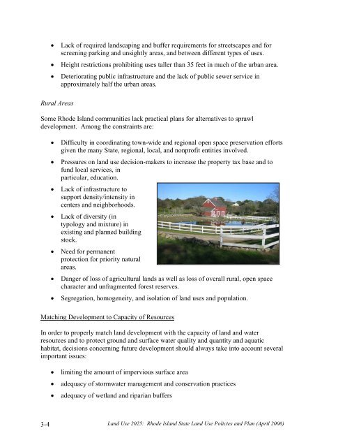
• Lack of required landscaping and buffer requirements for streetscapes and forscreening parking and unsightly areas, and between different types of uses.• Height restrictions prohibiting uses taller than 35 feet in much of the urban area.• Deteriorating public infrastructure and the lack of public sewer service inapproximately half the urban areas.Rural AreasSome Rhode Island communities lack practical plans for alternatives to sprawldevelopment. Among the constraints are:• Difficulty in coordinating town-wide and regional open space preservation effortsgiven the many State, regional, local, and nonprofit entities involved.• Pressures on land use decision-makers to increase the property tax base and tofund local services, inparticular, education.• Lack of infrastructure tosupport density/intensity incenters and neighborhoods.• Lack of diversity (intypology and mixture) inexisting and planned buildingstock.• Need for permanentprotection for priority naturalareas.• Danger of loss of agricultural lands as well as loss of overall rural, open spacecharacter and unfragmented forest reserves.• Segregation, homogeneity, and isolation of land uses and population.Matching Development to Capacity of ResourcesIn order to properly match land development with the capacity of land and waterresources and to protect ground and surface water quality and quantity and aquatichabitat, decisions concerning future development should always take into account severalimportant issues:• limiting the amount of impervious surface area• adequacy of stormwater management and conservation practices• adequacy of wetland and riparian buffers3-4 <strong>Land</strong> <strong>Use</strong> <strong>2025</strong>: Rhode Island State <strong>Land</strong> <strong>Use</strong> Policies and Plan (April 2006)
• wastewater system design and capacity• water system design and capacity• adequacy of water supply sourcesThese issues are equally important for development within the urban services boundaryand outside the urban services boundary. For communities within the urban servicesboundary, addressing these issues will promote groundwater recharge and water qualityimprovement. For communities outside the urban services boundary, consideration ofthese issues should guide towns in their evaluation of land and water capacity as theydetermine appropriate levels and intensity of development for different areas.The consideration of these factors, combined with good site characteristics and acommunity’s desire to promote village development, provides the potential for a mix ofuses and housing densities that could be considerably greater than what typical rural, lowdensity zoning would otherwise achieve. If coupled with open space preservation, wecan attain a model for rural development that fulfills the vision of compact centerssurrounded by agriculture, open space, and very low density development.The Future <strong>Land</strong> <strong>Use</strong> <strong>2025</strong> map (Figure 121-02(1)), recommends limited development inlarge areas of the State lacking infrastructure, or having resource constraints; and aconcentration of development and higher densities in areas having adequate facilities andservices. To achieve this vision while safeguarding the legitimate property interests ofprivate landowners, it may be timely for Rhode Island communities to explore andembrace several authorized land development techniques that have not traditionally beenextensively relied upon in Rhode Island.Transfer of development rights (TDR) programs for example, offer a means forcommunities to concentrate development in the best suited areas that they have plannedfor growth and higher densities, while limiting development of sensitive areas. TDRprograms, as the name implies, provide a legal means for making the right to develop at acertain density that is embodied in enacted zoning, portable, allowing it to be transferredgeographically, thereby directing growth and development to areas suitable anddesignated for higher densities (receiving zones), and away from areas wheredevelopment is not desired (sending zones). Properly crafted, such systems can offer amarket-based solution that allows landowners’ economic expectations to be realizedwhile protecting important resource areas, and allowing a concentration of density inareas where that is both desirable and productive (e.g., to support walkable villagecenters).There are, of course, obstacles to be surmounted if TDR and similar programs are tobecome more widespread and accepted. The programs are complicated and require adegree of sophistication in administration. State technical assistance will likely berequired. Regional programs that would look beyond a single community (which mightbe desirable in some parts of the State) may require additional enabling legislation, andmight also require a complementary means for addressing related issues such as<strong>Land</strong> <strong>Use</strong> <strong>2025</strong>: Rhode Island State <strong>Land</strong> <strong>Use</strong> Policies and Plan (April 2006) 3-5
- Page 2:
The Statewide Planning Program, Rho
- Page 5:
Advisors to the Technical Committee
- Page 8 and 9:
objectives is the only way we can p
- Page 10: In addition, there are four technic
- Page 13 and 14: Institutional .....................
- Page 15: LIST OF TABLESTable 121-03(1) Perce
- Page 19 and 20: PART ONE: WHERE ARE WE AND WHERE AR
- Page 21 and 22: distinction between historic urban
- Page 23 and 24: constructed on larger lots than in
- Page 25 and 26: major pubic investments, such as re
- Page 27 and 28: and also included a continuation of
- Page 30 and 31: Geographically, the Current Trend S
- Page 33: PART TWOWHERE DO WE WANT TO BE IN 2
- Page 36 and 37: Gauging Public Perceptions of Land
- Page 38 and 39: etween the historic urban centers a
- Page 40 and 41: to provide guidance for the (vast m
- Page 42 and 43: LUO 4C: Utilize infrastructure to a
- Page 44 and 45: LUP 12: Encourage development patte
- Page 46 and 47: commercial, and institutional devel
- Page 48 and 49: comprehensive plans and supporting
- Page 50 and 51: Urban Services BoundaryAs noted pre
- Page 52 and 53: Conservation/open space-style devel
- Page 54 and 55: Narragansett Indian Tribal LandsThi
- Page 57 and 58: PART THREE: WHAT ISSUES DO WE NEED
- Page 59: need of replacement), expanded faci
- Page 63 and 64: • Less than five percent of Rhode
- Page 65 and 66: To help address its housing needs,
- Page 67 and 68: - needs to be upgraded, the advanta
- Page 69 and 70: How This Land Use Plan Supports Sta
- Page 71 and 72: industry has resulted. Since the 19
- Page 73 and 74: municipal plans as future commercia
- Page 75 and 76: The Future Land Use 2025 map identi
- Page 77 and 78: modifications, the capacity of floo
- Page 79 and 80: Restoration and maintenance of the
- Page 81 and 82: The best locations for redevelopmen
- Page 83 and 84: 3-6 Open Space and RecreationThe te
- Page 85 and 86: • How much land overall should be
- Page 87 and 88: Providence to Warwick and Wickford,
- Page 89 and 90: Another disincentive to walking and
- Page 91: Designers and the community at larg
- Page 95 and 96: PART FOUR: HOW DO WE GET THERE?4-1
- Page 97 and 98: density or medium-high density deve
- Page 99 and 100: Table 121-04(2)COMPOSITE OF FUTURE
- Page 101 and 102: This section describes the process
- Page 103 and 104: wetlands comprised about 18 percent
- Page 105 and 106: Table 121-04(5) defines the five la
- Page 107 and 108: For undeveloped areas, the analysis
- Page 109 and 110: 4-8 Scenario Analysis: Assessing Al
- Page 111 and 112:
A major variable in distinguishing
- Page 113 and 114:
The land need projections for the f
- Page 115 and 116:
Land Use 2025: Rhode Island State L
- Page 117 and 118:
Land Use 2025: Rhode Island State L
- Page 119 and 120:
Table 121-04(10)QUANTITATIVE* COMPA
- Page 121 and 122:
The concentration of development in
- Page 123 and 124:
4-10 Scenario SelectionIn August 20
- Page 125 and 126:
Table 121-04(12)COMPARISON OF COMPO
- Page 127:
PART FIVEWHAT MUST BE DONE TOACHIEV
- Page 130 and 131:
5-2 State InvestmentsAs noted in Pa
- Page 132 and 133:
land use plan must contain an analy
- Page 134 and 135:
Table 121-05(1)GOALS, OBJECTIVES, A
- Page 136 and 137:
Strategies12Support the participati
- Page 138 and 139:
Community DesignLeadAgenciesTimeFra
- Page 140 and 141:
7Locate small-scale convenience sho
- Page 142 and 143:
InfrastructureLeadAgenciesTimeFrame
- Page 144 and 145:
4Limit the proliferation of treatme
- Page 146 and 147:
3Coordinate transportation and land
- Page 148 and 149:
3Promote establishment of electroni
- Page 150 and 151:
AbbreviationCRMCDEMDOADOHDOTEDCGAGO
- Page 152 and 153:
Source Management Plan, State Guide
- Page 154:
41. Office of Federal Housing Enter