Download Abstracts Here - IGAC Project
Download Abstracts Here - IGAC Project
Download Abstracts Here - IGAC Project
You also want an ePaper? Increase the reach of your titles
YUMPU automatically turns print PDFs into web optimized ePapers that Google loves.
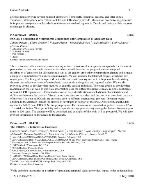
List of <strong>Abstracts</strong> 23affect regions covering several hundred kilometers. Temporally (synoptic, seasonal and inter-annualvariations), atmospheric observations of CO2 and CH4 clearly provide information on controlling processesin important ecosystems such as the boreal forest and wetland regions in Canada and their possible responseto changes in climate.P-Sources.28 ID:4507 15:35ECCAD : Emissions of Atmospheric Compounds and Compilation of Ancillary DataSabine Darras 1 , Claire Granier 2 , Vincent Pignot 1 , Renaud Bodichon 3 , Aude Mieville 2 , Cathy Liousse 1 ,Mireille Paulin 41 Laboratoire d'Aérologie / CNRS2 LATMOS / CNRS3 IPSL / INSU4 CNESContact: sabine.darras@aero.obs-mip.frThere is considerable uncertainty in estimating surface emissions of atmospheric compounds for the recentpast and up to now, no single data set exists which would describe the geographical and temporaldistribution of emissions for all species relevant to air quality, atmospheric composition change and climatechange in a comprehensive and consistent manner. We will describe the ECCAD project, which has twomajor goals. The first goal is to provide scientific users with an easy access to a large number of existingdatasets on surface emissions of atmospheric compounds at the global and regional scales. We are alsoproviding access to ancillary data required to quantify surface emissions. The other goal is to provide datamanipulation tools as well as statistical information over the different regions (climatic regions, continents,oceans, OECD regions, etc.). These tools allow an easy identification of each dataset characteristics anddifferences between the datasets. Visualization tools are also provided, and the users can download the dataof interest. The data in ECCAD are currently used in different international projects. The most recentaddition to the database include the emissions developed in support of the IPCC AR5 report, and the dataused in the MACC and CITYZEN European projects. The emissions are provided as gridded data at a 0.5 or1° spatial resolution. Time periodicity and temporal coverage periods vary among the datasets from one yearto up to 150 years. The database will be described, and examples of the tools will be presented. We will alsoprovide information on the access to the datasets.P-Sources.29 ID:4190 15:35The CIERA US Initiative on EmissionsGregory Frost 1 , Claire Granier 2 , Stefan Falke 3 , Terry Keating 4 , Jean-François Lamarque 5 , MeganMelamed 6 , Paulette Middleton 7 , Aude Mieville 8 , Gabrielle Pétron 9 , Steven Smith 101 Univ. Colorado/CIRES and NOAA/ESRL/CSD, Boulder, Colorado, USA2 Univ. Colorado/CIRES; NOAA/ESRL/CSD; LATMOS, CNRS and Univ. Pierre and Marie Curie, Paris, France3 Washington Univ. St Louis and Northrop Grumman, St Louis, Missouri, USA4 US EPA/OAR, Washington, DC, USA5 NCAR, Boulder, Colorado, USA6 AAAS Fellow, US EPA/NCER, Washington, DC, USA7 Panorama Pathways, Boulder, CO, USA8 LATMOS, CNRS and Univ. Pierre and Marie Curie, Paris, France9 Univ. Colorado/CIRES and NOAA/ESRL/GMD, Boulder, Colorado, USA10 PNNL, Univ. Maryland/JGCRI, College Park, Maryland, USAContact: gregory.j.frost@noaa.govWhile emission inventories at a variety of spatial and temporal scales are critical inputs to the understandingiCACGP-<strong>IGAC</strong> 2010 12 July, 2010


