western quebec and southern ontario - Department of Geology
western quebec and southern ontario - Department of Geology
western quebec and southern ontario - Department of Geology

Create successful ePaper yourself
Turn your PDF publications into a flip-book with our unique Google optimized e-Paper software.
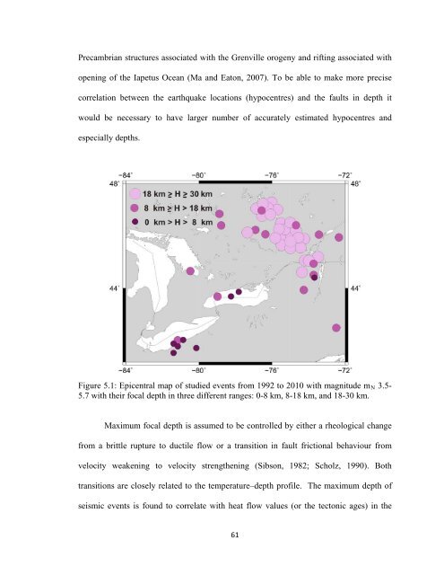
Precambrian structures associated with the Grenville orogeny <strong>and</strong> rifting associated withopening <strong>of</strong> the Iapetus Ocean (Ma <strong>and</strong> Eaton, 2007). To be able to make more precisecorrelation between the earthquake locations (hypocentres) <strong>and</strong> the faults in depth itwould be necessary to have larger number <strong>of</strong> accurately estimated hypocentres <strong>and</strong>especially depths.Figure 5.1: Epicentral map <strong>of</strong> studied events from 1992 to 2010 with magnitude m N 3.5-5.7 with their focal depth in three different ranges: 0-8 km, 8-18 km, <strong>and</strong> 18-30 km.Maximum focal depth is assumed to be controlled by either a rheological changefrom a brittle rupture to ductile flow or a transition in fault frictional behaviour fromvelocity weakening to velocity strengthening (Sibson, 1982; Scholz, 1990). Bothtransitions are closely related to the temperature–depth pr<strong>of</strong>ile. The maximum depth <strong>of</strong>seismic events is found to correlate with heat flow values (or the tectonic ages) in the61