- Page 1:
the Expedition ARKTIS-XIX/4 of the
- Page 5 and 6:
1 Cruise summary W. Jokat The exped
- Page 8 and 9:
6 1.1 Wetterverlauf ARK XIX/4a Bei
- Page 10 and 11:
8 noch vor der Küste, fern davon a
- Page 12 and 13:
10 northerly wind increased steadil
- Page 14 and 15:
12 In the latest stages of the proj
- Page 16 and 17:
Profile Date/Time Start Date/Time T
- Page 18 and 19:
Station Typ Extra Lat Long Höhe [m
- Page 20 and 21:
Station Typ Extra Lat Long Höhe [m
- Page 22 and 23:
Date Flight Start Time End Time No
- Page 24 and 25:
Date Flight Start Time End Time No
- Page 26 and 27:
Date Flight Start Time End Time No
- Page 28 and 29:
Date Flight Start Time End Time No
- Page 30 and 31:
Date Flight Start Time End Time No
- Page 32 and 33:
30 Preliminary results Along profil
- Page 34 and 35:
32 In addition to the deep seismic
- Page 36 and 37:
34 Fig. 2-5: Flight statistics for
- Page 38 and 39:
36 Fig. 3-1: Seafloor topography of
- Page 40 and 41:
38 In total, the PARASOUND system o
- Page 42 and 43:
40 Figure 4.1-3: Example of PARASOU
- Page 44 and 45:
42 Station Latitude Longitude Date
- Page 46 and 47:
44 After PCR was finished, samples
- Page 48 and 49:
46 Potsdam Lake (Shannon Island) Sc
- Page 50 and 51:
48 In den Schmelzwassertümpeln kon
- Page 52 and 53:
Temp. Sal. Tiefe max. Tiefe Trübe
- Page 54 and 55:
52 Store Koldewey Store Koldewey is
- Page 56 and 57:
54 In the shallow ponds the hydrolo
- Page 58 and 59:
56 The low amounts of solubles in t
- Page 60 and 61:
58 lake core no. latitude longitude
- Page 62 and 63:
60 6.3 Diatom phytoplankton and phy
- Page 64 and 65:
62 Generally, all sampled benthic s
- Page 66 and 67:
64 shaped profile at the top were i
- Page 68 and 69:
66 depth horizon description sample
- Page 70 and 71:
68 measured in the field, and the c
- Page 72 and 73:
70 Summary of results The summit pl
- Page 74 and 75:
72 Pre-Holocene shell material Pre-
- Page 76 and 77:
74 Christensen, T.R. (1993): Methan
- Page 78 and 79:
76 No EVK2-2001-00215 (ASOF-N). The
- Page 80 and 81:
78 Altimeters Model 2110-2, SN 189
- Page 82 and 83:
80 Mooring Latitude Longitude Water
- Page 84 and 85:
82 Mooring Latitude Longitude Water
- Page 86 and 87:
84 30° W 20° W 30° W Greenland 2
- Page 88 and 89:
Fig. 7-4: Vertical transects of pot
- Page 90 and 91:
88 8 Bericht zur akustischen Vermes
- Page 92 and 93: 90 Quality control sheet - Profile
- Page 94 and 95: 92 Quality control sheet - Profile
- Page 96 and 97: Station List Station Date Time Posi
- Page 98 and 99: Station Date Time PositionLat Posit
- Page 100 and 101: Station Date Time PositionLat Posit
- Page 102 and 103: Station Date Time PositionLat Posit
- Page 104 and 105: Station Date Time PositionLat Posit
- Page 106 and 107: Station Date Time PositionLat Posit
- Page 108 and 109: Station Date Time PositionLat Posit
- Page 110 and 111: Station Date Time PositionLat Posit
- Page 112 and 113: Station Date Time PositionLat Posit
- Page 114 and 115: Station Date Time PositionLat Posit
- Page 116 and 117: Station Date Time PositionLat Posit
- Page 118 and 119: Station Date Time PositionLat Posit
- Page 120 and 121: Station Date Time PositionLat Posit
- Page 122 and 123: Station Date Time PositionLat Posit
- Page 124 and 125: Station Date Time PositionLat Posit
- Page 126 and 127: Station Date Time PositionLat Posit
- Page 128 and 129: Station Date Time PositionLat Posit
- Page 130 and 131: Station Date Time PositionLat Posit
- Page 132 and 133: Station Date Time PositionLat Posit
- Page 134 and 135: Station Date Time PositionLat Posit
- Page 136 and 137: Station Date Time PositionLat Posit
- Page 138 and 139: Station Date Time PositionLat Posit
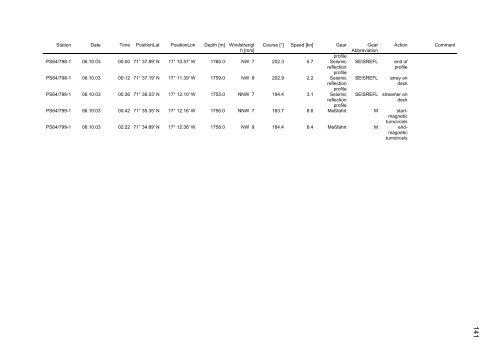
- Page 140 and 141: Station Date Time PositionLat Posit
- Page 144 and 145: 142 Beteiligte Institutionen / Part
- Page 146 and 147: 144 Fahrtteilnehmer / Participants