

the Expedition ARKTIS-XIX/4 of the research vessel POLARSTERN ...
the Expedition ARKTIS-XIX/4 of the research vessel POLARSTERN ...
the Expedition ARKTIS-XIX/4 of the research vessel POLARSTERN ...

Create successful ePaper yourself
Turn your PDF publications into a flip-book with our unique Google optimized e-Paper software.
84<br />
30° W<br />
20° W<br />
30° W<br />
Greenland<br />
20° W<br />
10° W<br />
10° W<br />
F10-5<br />
F9-5<br />
0°<br />
82° N<br />
80° N<br />
F15-2<br />
F8-6F6-7<br />
F4-6<br />
F16-2<br />
78° N<br />
Greenland<br />
Sea<br />
76° N<br />
0°<br />
10° E 20° E 30° E<br />
F7-5<br />
F3-6<br />
F5-6 F1-6<br />
F2-7<br />
4° 2° 0° 2° 4° 6° 726 8°<br />
79° 726<br />
740<br />
727<br />
738 736734<br />
74° N<br />
726<br />
739 737 735733<br />
728<br />
4° 2° 0° 2° 4° 6° 8°<br />
741 742<br />
W W E E E E 748 751<br />
762 760 758 744 753<br />
797 794 793 786 784 789 777<br />
775 767<br />
770<br />
752<br />
796<br />
745 749 750<br />
787 785 783 778 776<br />
771769<br />
768 763 761759<br />
743<br />
795<br />
746747<br />
W W<br />
E E E E<br />
10° E<br />
Svalbard<br />
30° E<br />
20° E<br />
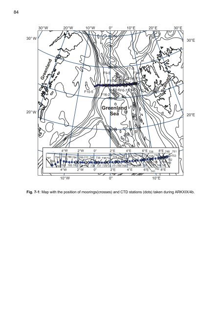
Fig. 7-1: Map with <strong>the</strong> position <strong>of</strong> moorings(crosses) and CTD stations (dots) taken during ARK<strong>XIX</strong>/4b.


