

the Expedition ARKTIS-XIX/4 of the research vessel POLARSTERN ...
the Expedition ARKTIS-XIX/4 of the research vessel POLARSTERN ...
the Expedition ARKTIS-XIX/4 of the research vessel POLARSTERN ...

Create successful ePaper yourself
Turn your PDF publications into a flip-book with our unique Google optimized e-Paper software.
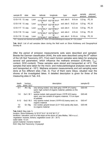
sample ID date lake latitude longitude type depth<br />
G 03-115 13. sep. Loon<br />
G 03-116 13. sep. Loon<br />
G 03-117 13. sep. Loon<br />
G 03-118 13. sep. Loon<br />
G 03-119 13. sep. Loon<br />
N<br />
W<br />
72°52'49.8'' 022°08´54.9''<br />
N<br />
W<br />
72°52'49.8'' 022°08´54.9''<br />
N<br />
W<br />
72°52'48.2'' 022°08'58.0''<br />
N<br />
W<br />
72°52'48.2'' 022°08'58.0''<br />
N<br />
W<br />
72°52'48.2'' 022°08'58.0''<br />
sample<br />
amount<br />
planned<br />
analyses*<br />
soil, site 5 6-9 cm 0,5 kg PC, B<br />
soil, site 5 9-22 cm 0,5 kg PC, B<br />
soil, site 4 0-2 cm 0,5 kg PC, B<br />
soil, site 4 2-9 cm 0,5 kg PC, B<br />
soil, site 4 9-16 cm 0,5 kg PC, B<br />
* PC = physical and chemical soil analyses; B = micro- an molecularbiological analyses; M = CH4-content<br />
Tab. 6.4-1: List <strong>of</strong> soil samples taken during <strong>the</strong> field work on Store Koldewey and Geographical<br />
Society Ø.<br />
After <strong>the</strong> period <strong>of</strong> emission measurements soils were described and sampled.<br />
Beside <strong>the</strong> German classification (KA4), <strong>the</strong> soils were described using <strong>the</strong> 8 th edition<br />
<strong>of</strong> <strong>the</strong> US Soil Taxonomy (ST). From each horizon samples were taken for analysing<br />
several soil parameters, which influence <strong>the</strong> methane emission (C/N-ratio, Corgcontent,<br />
DOC-content). These samples were stored and transported at +4°C. The<br />
samples that were taken for <strong>the</strong> micro- and molecularbiological analyses were stored<br />
and transported at –18°C. Methane emission measurements and soil sampling were<br />
done at five different sites (Tab. 3). Four <strong>of</strong> <strong>the</strong>m were Gleys, situated near <strong>the</strong><br />
shores <strong>of</strong> <strong>the</strong> investigated lakes. A detailed description is given for three <strong>of</strong> <strong>the</strong><br />
measuring sites in Tab. 4-6.<br />
depth horizon<br />
description sample-ID<br />
(cm) (KA4 / ST)*<br />
0-1 Ah / Ajj very strong rooted, very dark grey (10YR 3/1) loamy<br />
sand, high content <strong>of</strong> organic material, pebbles on <strong>the</strong><br />
surface<br />
G03-45<br />
1-6 Go1 / B 1 sparse rooted, dark greyish brown (10YR 4/2) loamy<br />
sand, very low content <strong>of</strong> organic material, 1-3 cm layer<br />
<strong>of</strong> pebbles<br />
G03-46<br />
6-12 Go2 / B 2 very sparse rooted, brown (10YR 4/3) loamy sand, no<br />
organic material<br />
G03-47<br />
12- Gr / Bg non rooted, greyish brown (2,5 Y 5/2) sandy silty loam, G03-48<br />
40+<br />
no organic material<br />
Tab. 6.4-2: Gley (site 1)<br />
location: Store Koldewey; N 76°07’33.5’’ W 018°36’17.2’’<br />
landform / elevation: end <strong>of</strong> a flat slope at <strong>the</strong> shore <strong>of</strong> Lake Melles, 166 m a.s.l.<br />
vegetation: mosses, lichens; vegetation cover: 20 – 30 %<br />
water table: 13 cm<br />
parent material: moraine material<br />
KA4: Gley Soil Taxonomy: Cryaquept<br />
65


