Toyota Toyota Touch & Go - PZ490-00331-*0 - Toyota Touch & Go - Toyota Touch & Go Plus - English - mode d'emploi
Toyota Toyota Touch & Go - PZ490-00331-*0 - Toyota Touch & Go - Toyota Touch & Go Plus - English - mode d'emploi
Toyota Toyota Touch & Go - PZ490-00331-*0 - Toyota Touch & Go - Toyota Touch & Go Plus - English - mode d'emploi
You also want an ePaper? Increase the reach of your titles
YUMPU automatically turns print PDFs into web optimized ePapers that Google loves.
<strong>Touch</strong>_<strong>Go</strong>_<strong>Plus</strong>_OM20B71E.book Page 76 Thursday, September 20, 2012 12:03 PM<br />
6. NAVIGATION SYSTEM INFORMATION<br />
3. MAP INFORMATION<br />
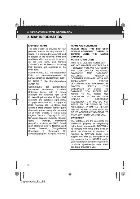
END-USER TERMS<br />
The data (“Data”) is provided for your<br />
personal, internal use only and not for<br />
resale. It is protected by copyright, and<br />
is subject to the following terms and<br />
conditions which are agreed to by you,<br />
on the one hand, and Harman<br />
(“Harman”) and its licensors (including<br />
their licensors and suppliers) on the<br />
other hand.<br />
© 2011 NAVTEQ B.V., © Bundesamt für<br />
Eich- und Vermessungswesen, ©<br />
EuroGeographics, source: © IGN 2009 -<br />
®<br />
BD TOPO , Die Grundlagendaten<br />
wurden mit<br />
Genehmigung der zustaendigen<br />
Behoerden entnommen, Contains<br />
Ordnance Survey data © Crown<br />
copyright and database right 2010<br />
Contains Royal Mail data © Royal Mail<br />
copyright and database right 2010,<br />
Copyright Geomatics Ltd., Copyright ©<br />
2003; Top-Map Ltd., La Banca Dati<br />
Italiana è stata prodotta usando quale<br />
riferimento anche cartografia numerica<br />
ed al tratto prodotta e fornita dalla<br />
Regione Toscana., Copyright © 2000;<br />
Norwegian Mapping Authority, Source:<br />
IgeoE – Portugal, Información<br />
geográfica propiedad del CNIG, Based<br />
upon electronic data Ó National Land<br />
Survey Sweden., Topografische<br />
Grundlage: Ó Bundesamt für<br />
Landestopographie.. All rights reserved.<br />
TERMS AND CONDITIONS<br />
PLEASE READ THIS END USER<br />
LICENSE AGREEMENT CAREFULLY<br />
BEFORE USING THE NAVTEQ<br />
DATABASE<br />
NOTICE TO THE USER<br />
THIS IS A LICENSE AGREEMENT -<br />
AND NOT AN AGREEMENT FOR SALE<br />
– BETWEEN YOU AND NAVTEQ B.V.<br />
FOR YOUR COPY OF THE NAVTEQ<br />
NAVIGABLE MAP DATA-BASE,<br />
INCLUDING<br />
ASSOCIATED<br />
COMPUTER SOFTWARE, MEDIA AND<br />
EXPLANATORY<br />
PRINTED<br />
DOCUMENTATION PUBLISHED BY<br />
NAVTEQ (JOINTLY “THE<br />
DATABASE”). BY USING THE<br />
DATABASE, YOU ACCEPT AND<br />
AGREE TO ALL TERMS AND<br />
CONDITIONS OF THIS END USER<br />
LICENSE<br />
AGREEMENT<br />
(“AGREEMENT”). IF YOU DO NOT<br />
AGREE TO THE TERMS OF THIS<br />
AGREEMENT, PROMPTLY RETURN<br />
THE DATABASE, ALONG WITH ALL<br />
OTHER ACCOMPANYING ITEMS, TO<br />
YOUR SUP-PLIER FOR A REFUND.<br />
OWNERSHIP<br />
The Database and the copyrights and<br />
intellectual property or neighboring<br />
rights therein are owned by NAVTEQ or<br />
its licensors. Ownership of the media on<br />
which the Database is contained is<br />
retained by NAVTEQ and/or your<br />
supplier until after you have paid in full<br />
any amounts due to NAVTEQ and/or<br />
your supplier pursuant to this Agreement<br />
or similar agreement(s) under which<br />
goods are provided to you.<br />
76<br />
Display audio_Ext_EE


