vii berichte von fachinstituten an universitäten und technischen
vii berichte von fachinstituten an universitäten und technischen
vii berichte von fachinstituten an universitäten und technischen

Erfolgreiche ePaper selbst erstellen
Machen Sie aus Ihren PDF Publikationen ein blätterbares Flipbook mit unserer einzigartigen Google optimierten e-Paper Software.
368 Fachinstitute <strong>an</strong> Universitäten <strong>und</strong> Hochschulen<br />
In comparison <strong>an</strong>d in extension to satellite based <strong>an</strong>d<br />
terrestrial methods the principle of airborne (vector-) gravimetry<br />
seems to be <strong>an</strong> optimal solution to determine the<br />
signific<strong>an</strong>t regional gravity ch<strong>an</strong>ges. The f<strong>und</strong>amental equation<br />
of airborne gravimetry is Newton’s second law of<br />
motion. In <strong>an</strong> inertial coordinate frame the kinematical<br />
acceleration a (= second time derivative of the position) c<strong>an</strong><br />
be computed by the sum of specific force f <strong>an</strong>d gravity g.<br />
Therefore <strong>an</strong> integrated system for airborne gravimetry c<strong>an</strong><br />
be implemented using GNSS observations in order to<br />
calculate the kinematic acceleration <strong>an</strong>d inertial measurements<br />
for derivation of specific forces. Together with two<br />
other research institutes <strong>an</strong>d two private comp<strong>an</strong>ies we are<br />
member of the Geotechnology Program f<strong>und</strong>ed (jointly) by<br />
the Federal Ministry of Education <strong>an</strong>d Research (BMBF)<br />
<strong>an</strong>d the Deutsche Forschungsgemeinschaft (DFG). The<br />
project "Development of Airborne Gravimetry using GNSS<br />
satellite observations" belongs to the research theme 2 of<br />
this program "Observation of the system earth from space".<br />
The project objectives are: Determination of the regional<br />
gravity field in the r<strong>an</strong>ge of 1 to 50 km, development of a<br />
GNSS based airborne vector gravimeter with <strong>an</strong> accuracy<br />
of 1 mGal with a spatial resolution of 1 km, comparison of<br />
different sensor systems <strong>an</strong>d processing methods, opening<br />
of new application area in earth sciences <strong>und</strong> exploration<br />
based on increased perform<strong>an</strong>ce <strong>an</strong>d efficiency of airborne<br />
gravimetry<br />
GNSS/INS Coupling<br />
Today basically three different methods are operational or<br />
a current investigation topic: loose, tight <strong>an</strong>d deep coupling.<br />
Tightly – Coupled System (in-part)<br />
In case of high dynamic applications or in jamming environments<br />
the principle of tight-coupling becomes very<br />
interesting. Information about the receiver dynamics<br />
measured by the inertial sensor is used to support the<br />
tracking loops of the integrated navigation system. An<br />
extension of this concept is the deeply coupling method. In<br />
this case the integrating navigation filter is implemented as<br />
one element of the receiver tracking loop. Using inertial<br />
information in combination with the in-phase <strong>an</strong>d quadraphase<br />
signals of the receiver signal processing <strong>an</strong> optimum<br />
control input for the numerical oscillator c<strong>an</strong> be computed.<br />
Optimisation of signal tracking perform<strong>an</strong>ce <strong>an</strong>d signal<br />
availability enh<strong>an</strong>cement are the goals of this method.<br />
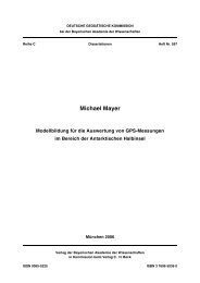
A tightly coupled GNSS/INS system was bread-boarded at<br />
the institute: In several theoretical <strong>an</strong>d numerical simulations<br />
the tracking loop perform<strong>an</strong>ce is investigated using different<br />
loop b<strong>an</strong>dwidths <strong>an</strong>d inertial data of different quality<br />
generated by various inertial measurement units. A breadboard<br />
system is implemented using the LITTON LN 200<br />
IMU <strong>an</strong>d the MITEL GNSS receiver development tool.<br />
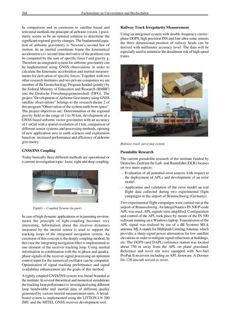
Railway Track Irregularity Measurement<br />
Using <strong>an</strong> integrated system with double frequency carrierphase<br />
DGPS, high precision INS <strong>an</strong>d four ultra-sonic sensors<br />
the three dimensional position of railway heads c<strong>an</strong> be<br />
derived with millimeter accuracy level. The data will be<br />
especially used to minimize the derailment risk of high speed<br />
trains.<br />
Railway track surveying system<br />
Pseudolite Research<br />
The current pseudolite research of the institute f<strong>und</strong>ed by<br />
Deutsches Zentrum für Luft- <strong>und</strong> Raumfahrt (DLR) focuses<br />
on two main aspects:<br />
– Evaluation of all potential error sources with respect to<br />
the deployment of APLs <strong>an</strong>d development of <strong>an</strong> error<br />
model.<br />
– Application <strong>an</strong>d validation of the error model on real<br />
flight data collected during two experimental flight<br />
campaigns at the airport of Braunschweig (Germ<strong>an</strong>y).<br />
Two experimental flight campaigns were carried out at the<br />
airport of Braunschweig. An IntegriNautics IN 500 P-code<br />
APL was used. APL signals were amplified. Configuration<br />
<strong>an</strong>d control of the APL took place by me<strong>an</strong>s of the IN 500<br />
software running on a Windows laptop. Tr<strong>an</strong>smission of the<br />
APL signal was realized by use of a dB Systems MLA<br />
<strong>an</strong>tenna. MLA st<strong>an</strong>ds for Multipath Limiting Antenna, which<br />
provides a sharp signal power attenuation for low satellite<br />
elevations in order to mitigate signal reflections at buildings,<br />
etc. The DGPS (<strong>an</strong>d DAPL) reference station was located<br />
about 750 m away from the APL on pl<strong>an</strong>e grassl<strong>an</strong>d.<br />
Reference <strong>an</strong>d rover site were equipped with NovAtel<br />
ProPak II receivers including <strong>an</strong> APL firmware. A Dornier<br />
Do 128 aircraft served as rover.