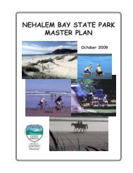
Report - Oregon State Library: State Employee Information Center ...
Report - Oregon State Library: State Employee Information Center ...
Report - Oregon State Library: State Employee Information Center ...

You also want an ePaper? Increase the reach of your titles
YUMPU automatically turns print PDFs into web optimized ePapers that Google loves.
8.0 HAZARD EVALUATION AND DEVELOPMENT OF<br />
MITIGATION STRATEGIES – EXAMPLE PROBLEM<br />
8.1 INTRODUCTION<br />
In order to assist engineers with the application of the individual procedures for evaluating<br />
liquefaction hazards, a comprehensive design example has been prepared. This hazard evaluation<br />
proceeds in a step-by-step manner, as would be followed in practice. A general flow chart<br />
illustrating the overall procedure is provided in Figure 8.1. This chart provides a framework to<br />
initiate a liquefaction hazard evaluation and assess the effectiveness of mitigation alternatives.<br />
The background material for each stage of the evaluation is referenced in the chart with a chapter<br />
and/or section annotation. It should be noted that project-specific conditions may require<br />
modifications to the process outlined in the flow chart.<br />
All seismic hazard information, in situ geotechnical data, and laboratory geotechnical soil<br />
parameters have been collected for a study site that includes a large levee located along the<br />
Columbia River near the Portland International Airport (PDX). This levee is a flood protection<br />
structure, as well as an embankment for major roadways and bridge approaches. This site was<br />
selected for the following reasons.<br />
1. The prevalence of loose to medium dense sandy and silty soils.<br />
2. The existence of extensive geotechnical data.<br />
3. Fluctuating ground water levels are controlled by the river stage.<br />
4. The seismic hazard includes contributions by large Cascadia subduction zone<br />
earthquakes, deep intra-plate earthquakes, and local shallow crustal sources.<br />
5. The site is located along a major thoroughfare (Marine Drive), and between two major<br />
Columbia River bridges (Interstate 5 and Interstate 205). Also, new bridges are being<br />
planned near Hayden Island as part of the Port of Portland’s terminal development.<br />
This example problem is presented in a series of interrelated steps, as it would be performed in<br />
practice. The method, as it is outlined here, is also intended to be consistent with the<br />
requirements of ODOT’s Liquefaction Mitigation Policy. The following discussion provides<br />
background for the regional seismic hazard, representative river stages and flood hazards, and<br />
geologic description before addressing specific aspects of the liquefaction evaluation.<br />
The seismic hazard in the Portland region reflects the contributions of three seismic sources: (1)<br />
interplate earthquakes along the Cascadia Subduction Zone located near the Pacific coast; (2)<br />
relatively deep intraplate subduction zone earthquakes that may be located as far inland as the<br />
Portland metropolitan region; and (3) relatively shallow crustal earthquakes located in the<br />
Portland metropolitan region. The maximum credible events associated with these source zones<br />
are postulated to be in the range of 8.5-9.0, 7.0-7.5, and 6.5-7.0, respectively. The results of<br />
recent probabilistic, uniform seismic hazard studies (Geomatrix 1995; USGS 1999; Wong et al.<br />
2000) indicate significant levels of bedrock shaking at recurrence intervals of engineering<br />
139