

A Natural Resource Management Guide for the County of Morris A ...
A Natural Resource Management Guide for the County of Morris A ...
A Natural Resource Management Guide for the County of Morris A ...

Create successful ePaper yourself
Turn your PDF publications into a flip-book with our unique Google optimized e-Paper software.
western Connecticut. Schooleys Mountain, Mase Mountain, Bowling Green Mountain, and Mount Paul are part<br />
<strong>of</strong> <strong>the</strong> second ridge <strong>of</strong> <strong>the</strong> Highlands. The peaks and plains east <strong>of</strong> <strong>the</strong> mountain ranges including Fox Hill and<br />
Copperas Mountain, over to <strong>the</strong> border escarpment, comprise <strong>the</strong> third ridge. The rolling hills <strong>of</strong> <strong>the</strong> Piedmont<br />
consist <strong>of</strong> sandstones and shales punctuated by <strong>the</strong> erosion-resistant volcanic igneous rocks <strong>of</strong> <strong>the</strong> Watchungs.<br />
These basalt ridges are known locally as Hook Mountain (Montville) and Long Hill (Long Hill and Harding<br />
Townships). Refer to <strong>the</strong> Land<strong>for</strong>ms map (Plate 4) <strong>for</strong> location <strong>of</strong> <strong>the</strong>se features.<br />
Rivers and streams within <strong>the</strong> county flow generally southwestward, following <strong>the</strong> trends <strong>of</strong> <strong>the</strong> Highlands.<br />
Notable exceptions are <strong>the</strong> east-flowing Pequannock River, <strong>the</strong> Rockaway River, which flows south out <strong>of</strong><br />
Berkshire Valley and <strong>the</strong>n east through a gap in <strong>the</strong> eastern Highlands, and <strong>the</strong> Passaic River, which rises in<br />
sou<strong>the</strong>rn Mendham Township, flows north through <strong>the</strong> Watchung valley, and turns eastward at Montville towards<br />
<strong>the</strong> Great Notch, Little Falls, and Paterson.<br />
Erosion, glaciation, and human activities have sculpted our geologic foundation into <strong>the</strong> familiar shapes <strong>of</strong> today's<br />
landscape. Erosion's effect on <strong>the</strong> landscape, is related to a number <strong>of</strong> factors: erodibility <strong>of</strong> materials, e.g., shale,<br />
sandstone, and limestone wear away much more readily than granite and gneiss. Caves and solution cavities in<br />
limestone <strong>for</strong>mations represent consequences <strong>of</strong> erosion. Steepness <strong>of</strong> slope and <strong>the</strong> presence or absence <strong>of</strong><br />
vegetative cover also affect <strong>the</strong> rate and nature <strong>of</strong> <strong>the</strong> erosion process. The broad, rounded hills and flat-topped<br />
ridges <strong>of</strong> <strong>the</strong> Highlands reflect hundreds <strong>of</strong> thousands <strong>of</strong> years <strong>of</strong> erosion by wind and rain. The wide, gently rolling,<br />
eroded plateau known as <strong>the</strong> Schooleys Mountain peneplain (Washington Township) is ano<strong>the</strong>r example <strong>of</strong><br />
erosional manifestations.<br />
These sloped reliefs provide a visual amenity to those traveling in <strong>the</strong> region but also contribute to <strong>the</strong> diverse<br />
ecosystems within <strong>the</strong> county. Uplands and outcrop areas, characterized by extremely dry conditions, provide<br />
excellent examples <strong>of</strong> succession where rock becomes inhabited, sequentially, by moss, lichens, herbs, shrubs, and<br />
trees. Habitat in <strong>the</strong> higher elevations host specific communities <strong>of</strong> flora and fauna, including rare species, and give<br />
rise to <strong>the</strong> headwaters <strong>of</strong> our rivers. A non-renewable resource, once blasted, ridges cannot be restored, although<br />
restoration <strong>of</strong> wetlands and disturbed areas in <strong>for</strong>mer quarried land is occurring.<br />
Icy Visitors<br />
A pr<strong>of</strong>ound impact on <strong>the</strong> landscape was <strong>the</strong> arrival,<br />
stay, and departure <strong>of</strong> <strong>the</strong> glaciers. As <strong>the</strong> lobes <strong>of</strong> ice<br />
moved across <strong>the</strong> landscape <strong>the</strong>y scraped up s<strong>of</strong>t shales<br />
and loose rubble and sheered <strong>of</strong>f ridges exposing sharp<br />
cliffs <strong>of</strong> polished Precambrian bedrock. The sou<strong>the</strong>ast<br />
travels <strong>of</strong> <strong>the</strong> glacier resulted in gentler slopes and<br />
fewer rock outcrops on <strong>the</strong> northwest side <strong>of</strong> ridges,<br />
and steep escarpments and many rock outcrops on<br />
sou<strong>the</strong>ast slopes. Green Pond and Copperas Mountains<br />
reflect this general pattern.<br />
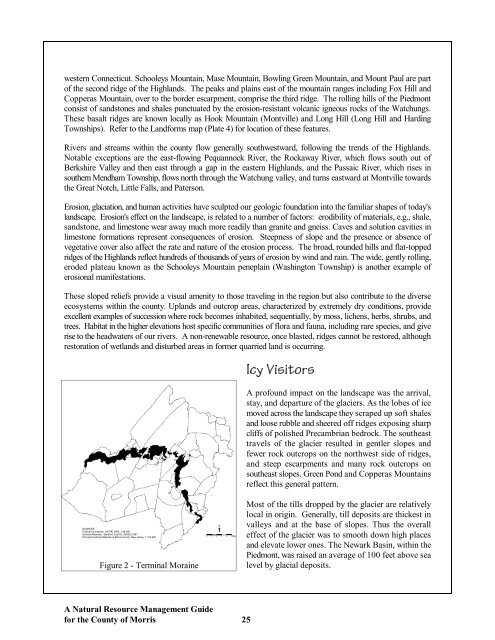
Figure 2 - Terminal Moraine<br />
Most <strong>of</strong> <strong>the</strong> tills dropped by <strong>the</strong> glacier are relatively<br />
local in origin. Generally, till deposits are thickest in<br />
valleys and at <strong>the</strong> base <strong>of</strong> slopes. Thus <strong>the</strong> overall<br />
effect <strong>of</strong> <strong>the</strong> glacier was to smooth down high places<br />
and elevate lower ones. The Newark Basin, within <strong>the</strong><br />
Piedmont, was raised an average <strong>of</strong> 100 feet above sea<br />
level by glacial deposits.<br />
A <strong>Natural</strong> <strong>Resource</strong> <strong>Management</strong> <strong>Guide</strong><br />
<strong>for</strong> <strong>the</strong> <strong>County</strong> <strong>of</strong> <strong>Morris</strong> 25