65th IHC Booklet/Program (pdf - 4.9MB) - Office of the Federal ...
65th IHC Booklet/Program (pdf - 4.9MB) - Office of the Federal ...
65th IHC Booklet/Program (pdf - 4.9MB) - Office of the Federal ...
Create successful ePaper yourself
Turn your PDF publications into a flip-book with our unique Google optimized e-Paper software.
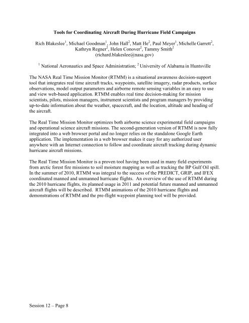
Tools for Coordinating Aircraft During Hurricane Field Campaigns<br />
Rich Blakeslee 1 , Michael Goodman 1 , John Hall 2 , Matt He 2 , Paul Meyer 1 , Michelle Garrett 2 ,<br />
Kathryn Regner 2 , Helen Conover 2 , Tammy Smith 2<br />
(richard.blakeslee@nasa.gov)<br />
1 National Aeronautics and Space Administration; 2 University <strong>of</strong> Alabama in Huntsville<br />
The NASA Real Time Mission Monitor (RTMM) is a situational awareness decision-support<br />
tool that integrates real time aircraft tracks, waypoints, satellite imagery, radar products, surface<br />
observations, model output parameters and airborne remote sensing variables in an easy to use<br />
and view web-based application. RTMM enables real time decision-making for mission<br />
scientists, pilots, mission managers, instrument scientists and program managers by providing<br />
up-to-date information about <strong>the</strong> wea<strong>the</strong>r, spacecraft, and <strong>the</strong> location, altitude and heading <strong>of</strong><br />
<strong>the</strong> aircraft.<br />
The Real Time Mission Monitor optimizes both airborne science experimental field campaigns<br />
and operational science aircraft missions. The second-generation version <strong>of</strong> RTMM is now fully<br />
integrated into a web browser portal and no longer relies on <strong>the</strong> standalone Google Earth<br />
application. The implementation in a web browser makes it easy for any authorized user<br />
anywhere with an Internet connection to follow and coordinate aircraft tracking during dynamic<br />
hurricane aircraft missions.<br />
The Real Time Mission Monitor is a proven tool having been used in many field experiments<br />
from arctic forest fire missions to soil moisture mapping as well as tracking <strong>the</strong> BP Gulf Oil spill.<br />
In <strong>the</strong> summer <strong>of</strong> 2010, RTMM was integral to <strong>the</strong> success <strong>of</strong> <strong>the</strong> PREDICT, GRIP, and IFEX<br />
coordinated manned and unmanned hurricane flights. An overview <strong>of</strong> <strong>the</strong> use <strong>of</strong> RTMM during<br />
<strong>the</strong> 2010 hurricane flights, its planned usage in 2011 and potential future manned and unmanned<br />
aircraft flights will be described. RTMM animations <strong>of</strong> <strong>the</strong> 2010 hurricane flights and<br />
demonstrations <strong>of</strong> RTMM and <strong>the</strong> pre-flight waypoint planning tool will be provided.<br />
Session 12 – Page 8


