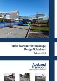
Regional Land Transport Programme 2009 - 2010 (2MB) - Auckland ...
Regional Land Transport Programme 2009 - 2010 (2MB) - Auckland ...
Regional Land Transport Programme 2009 - 2010 (2MB) - Auckland ...

Create successful ePaper yourself
Turn your PDF publications into a flip-book with our unique Google optimized e-Paper software.
Other short to medium-term impacts<br />
2. Linking to the global economy<br />
><br />
><br />
><br />
><br />
Reductions in deaths and serious injuries as a result of<br />
road crashes.<br />
More transportation choices, particularly for those with limited<br />
access to a car where appropriate.<br />
Reductions in adverse environmental effects from land transport.<br />
Contributions to positive health outcomes.<br />
<strong>Auckland</strong>’s transport network is an integral part of the door-to-door<br />
global chain – large volumes of exports and imports are carried<br />
through our air and sea ports, and on the region’s roads and rail<br />
network. In this global logistics chain, <strong>Auckland</strong>’s transport system<br />
needs to be a competitive, modern and integrated freight network<br />
hub and distribution centre, servicing both international and<br />
domestic customers.<br />
The GPS lists seven roads of national significance, which the<br />
Government considers New Zealand’s most essential routes, requiring<br />
significant development to reduce congestion, improve safety and<br />
support economic growth. The GPS requires that these roads are<br />
given priority when the NZTA develops the National <strong>Land</strong> <strong>Transport</strong><br />
<strong>Programme</strong>. The seven roads of national significance are:<br />
><br />
><br />
Puhoi to Wellsford – State Highway 1.<br />
The completed <strong>Auckland</strong> Western Ring Route – State Highways<br />
20/16/18.<br />
><br />
><br />
><br />
<strong>Auckland</strong>’s Victoria Park bottleneck – State Highway 1.<br />
Waikato Expressway – State Highway 1.<br />
Tauranga Eastern corridor – State Highway 2.<br />
> Wellington Northern Corridor (Levin to Wellington) –<br />
State Highway 1.<br />
> Christchurch motorway projects.<br />
The GPS also provides guidance on transport planning and evaluation.<br />
Key aspects of this guidance that ARTA’s planning and evaluation<br />
processes must take account of are:<br />
> The Government’s priority for land transport investment to<br />
support national economic growth and productivity growth –<br />
including the roads of national significance.<br />
3. Changing employment and settlement patterns<br />
The effective day-to-day <strong>Auckland</strong> economy is expanding beyond the<br />
formal <strong>Auckland</strong> regional boundaries to include upper North Island<br />
provincial centres. Locations with lifestyle options and lower overhead<br />
costs, with good transport and freight links will be a catalyst for<br />
investment attraction, creating hubs for exporters and places for<br />
foreign interests to set up businesses. This is particularly true of the<br />
economic ‘golden triangle’, between <strong>Auckland</strong>, Tauranga and<br />
Hamilton. This area already contains around half of New Zealand’s<br />
population and economy. Increasing employment and population in<br />
these centres will place major demands on transport and other<br />
infrastructure. The challenge is how the transport network will address<br />
the growing case for better access and mobility within this extended<br />
catchment that the regional economy now operates within.<br />
4. Promoting sustainability<br />
There is a strong policy expectation and community demand to<br />
achieve a more sustainable lifestyle through increased travel choice,<br />
reduced reliance on private cars, and less use of fossil fuel,<br />
acknowledging that fossil fuels are finite resources. Meeting this<br />
challenge requires transport solutions that better integrate transport<br />
and land use planning, improve public transport services and<br />
networks, and make greater use of non-motorised modes.<br />
><br />
><br />
><br />
The impact of volatile fuel prices, by providing transport choices<br />
such as public transport.<br />
Achieving value for money by prioritising projects which not only<br />
make the greatest contribution to the Government’s priorities,<br />
but which also give projects with higher benefit/cost ratios higher<br />
priority. Projects with a benefit/cost ratio of less than 2 will<br />
require more scrutiny. The GPS also requires the NZTA to consider<br />
broader benefits and costs of proposed investments not captured<br />
in traditional benefit/cost analysis methods.<br />
The need for integrated planning to ensure that transport and<br />
land use is connected. This includes identifying and protecting<br />
future transport corridors.<br />
5. Role of new technology<br />
There is an increasing range of emerging transport developments<br />
now available, with technologies previously considered uneconomic<br />
becoming more viable – e.g. tunnelling improvements, network<br />
efficiency tools, electronic tolling, new fuel options, ‘Intelligent<br />
<strong>Transport</strong> Systems’ and many other innovative solutions that have<br />
the potential to create more efficient transport options.<br />
The GPS also indicates that while the Government supports the<br />
overall intent of the New Zealand <strong>Transport</strong> Strategy 2008 (NZTS),<br />
developed by the previous Government, it considers that moving too<br />
quickly on the aspirational targets for modal shift will have a negative<br />
impact on environmental and economic efficiency. The Government<br />
will develop a forward plan for transport that is likely to replace the<br />
targets set in the 2008 NZTS.<br />
11