Workbench Release History
Workbench Release History
Workbench Release History
Create successful ePaper yourself
Turn your PDF publications into a flip-book with our unique Google optimized e-Paper software.
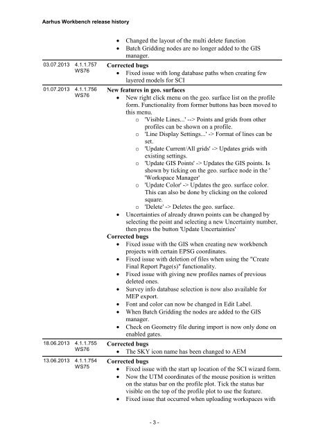
Aarhus <strong>Workbench</strong> release history<br />
03.07.2013 4.1.1.757<br />
WS76<br />
01.07.2013 4.1.1.756<br />
WS76<br />
18.06.2013 4.1.1.755<br />
WS76<br />
13.06.2013 4.1.1.754<br />
WS75<br />
<br />
<br />
Changed the layout of the multi delete function<br />
Batch Gridding nodes are no longer added to the GIS<br />
manager.<br />
Corrected bugs<br />
Fixed issue with long database paths when creating few<br />
layered models for SCI<br />
New features in geo. surfaces<br />
New right click menu on the geo. surface list on the profile<br />
form. Functionality from former buttons has been moved to<br />
this menu.<br />
o 'Visible Lines...' --> Points and grids from other<br />
profiles can be shown on a profile.<br />
o 'Line Display Settings...' -> Format of lines can be<br />
set.<br />
o 'Update Current/All grids' -> Updates grids with<br />
existing settings.<br />
o 'Update GIS Points' -> Updates the GIS points. Is<br />
shown by ticking on the geo. surface node in the '<br />
'Workspace Manager'<br />
o 'Update Color' -> Updates the geo. surface color.<br />
This can also be done by clicking on the colored<br />
square.<br />
o 'Delete' -> Deletes the geo. surface.<br />
Uncertainties of already drawn points can be changed by<br />
selecting the point and selecting a new Uncertainty number,<br />
then press the button 'Update Uncertainties'<br />
Corrected bugs<br />
Fixed issue with the GIS when creating new workbench<br />
projects with certain EPSG coordinates.<br />
Fixed issue with deletion of files when using the "Create<br />
Final Report Page(s)" functionality.<br />
Fixed issue with giving new profiles names of previous<br />
deleted ones.<br />
Survey info database selection is now also available for<br />
MEP export.<br />
Font and color can now be changed in Edit Label.<br />
When Batch Gridding the nodes are added to the GIS<br />
manager.<br />
Check on Geometry file during import is now only done on<br />
enabled gates.<br />
Corrected bugs<br />
The SKY icon name has been changed to AEM<br />
Corrected bugs<br />
Fixed issue with the start up location of the SCI wizard form.<br />
Now the UTM coordinates of the mouse position is written<br />
on the status bar on the profile plot. Tick the status bar<br />
visible on the top of the profile plot to use the feature.<br />
Fixed issue that occurred when uploading workspaces with<br />
- 3 -


