Victoria_Park_Re port Final.pdf - City of Charlottetown
Victoria_Park_Re port Final.pdf - City of Charlottetown
Victoria_Park_Re port Final.pdf - City of Charlottetown

Create successful ePaper yourself
Turn your PDF publications into a flip-book with our unique Google optimized e-Paper software.
<strong>Final</strong> <strong>Re</strong><strong>port</strong> • June 2013<br />
VICTORIA PARK COMPREHENSIVE MASTER PLAN<br />
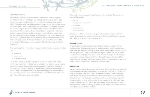
Shoreline Condition<br />
<strong>Victoria</strong> <strong>Park</strong> is located at the southern tip <strong>of</strong> <strong>Charlottetown</strong>, surrounded by the<br />
<strong>Charlottetown</strong> Harbour. For reference, <strong>Charlottetown</strong> Harbour is considered to be<br />
oriented in an east-west direction, with the mouth <strong>of</strong> the harbour at the western<br />
edge. The location <strong>of</strong> the park suggests that it is subject to the most exposed fetch in<br />
the entire harbour. Presently, the shoreline is protected with an armour stone matrix<br />
that was not designed to current standards, and is deficient in that it lacks core and<br />
filter material. The west and southeast sides <strong>of</strong> the park are protected with native<br />
sandstone armour, while the southern exposure is protected with a conglomerate<br />
that is arguably more resistent than the native sandstone. The existing elevation <strong>of</strong><br />
the armour is higher than the adjacent boardwalk, likely to prevent shoreline erosion<br />
from overtopping waves. There is still evidence <strong>of</strong> erosion on the backside <strong>of</strong> the<br />
armour stone, and photographs and descriptions <strong>of</strong> boardwalk damage have been<br />
documented.<br />
There are three primary threats that are imposed on the shoreline protection at <strong>Victoria</strong><br />
<strong>Park</strong>:<br />
»»<br />
Sea level rise<br />
»»<br />
Extreme events<br />
»»<br />
A combination <strong>of</strong> both<br />
Sea level rise creates an issue for seawalls worldwide as it raises both the mean<br />
normal water level and the height <strong>of</strong> waves during extreme weather events. Extreme<br />
events also pose a problem as it is not easy to predict or imagine the strength <strong>of</strong><br />
hurricane or storm-induced waves compared to normal, expected wave patterns. An<br />
extreme event can dissipate hundreds <strong>of</strong> times more energy than everyday waves,<br />
and calculating structures which will stand the force <strong>of</strong> coastal storms is difficult and,<br />
<strong>of</strong>ten the outcome can become unaffordable.<br />
There are five basic strategies for coastal defense in the context <strong>of</strong> the shoreline as<br />
found at <strong>Victoria</strong> <strong>Park</strong>:<br />
»»<br />
Inaction<br />
»»<br />
Managed retreat or realignment<br />
»»<br />
Hold the line<br />
»»<br />
Move seawards<br />
»»<br />
Limited intervention<br />
The decision to choose a strategy is site-specific, depending on relative sea-level<br />
change, geomorphological setting, concerns over sediment availability and erosion, as<br />
well a series <strong>of</strong> social, economic and political factors.<br />
Managed <strong>Re</strong>treat<br />
Managed retreat is an alternative to constructing or maintaining coastal structures.<br />
Managed retreat allows an area to become flooded, usually in low-lying estuarine or<br />
deltaic areas and floods land that has at some point in the past been reclaimed from the<br />
sea. Managed retreat is <strong>of</strong>ten a response to a change in sea level rise. The technique<br />
is used when the land adjacent to the sea is low in value. Managed retreat, involving<br />
no protection, is cheap and expedient. This is the usual response when land <strong>of</strong> little<br />
value will be lost. Managed retreat can comprise ‘setbacks’, rolling easements and other<br />
planning tools including building within a particular design life.<br />
Hold the Line<br />
Seawalls and solid coastal structures are built because they protect expensive properties<br />
or infrastructures, but they <strong>of</strong>ten relocate the problem to another part <strong>of</strong> the coast. In<br />
many cases there is a trail <strong>of</strong> decisions that were made in the past which have given<br />
rise to the present threats to coastal infrastructure and which necessitate immediate<br />
shore protection. For instance, the seawall and boardwalk <strong>of</strong> <strong>Charlottetown</strong> represent<br />
an engineered use <strong>of</strong> prime seafront space, which is designated as public open space,<br />
parkland and amenities. Such open space allows greater flexibility in terms <strong>of</strong> future<br />
land-use change, for instance through managed retreat, in the face <strong>of</strong> threats <strong>of</strong> erosion<br />
or inundation as a result <strong>of</strong> sea level rise.<br />
19