Victoria_Park_Re port Final.pdf - City of Charlottetown
Victoria_Park_Re port Final.pdf - City of Charlottetown
Victoria_Park_Re port Final.pdf - City of Charlottetown

You also want an ePaper? Increase the reach of your titles
YUMPU automatically turns print PDFs into web optimized ePapers that Google loves.
VICTORIA PARK COMPREHENSIVE MASTER PLAN<br />
<strong>Final</strong> <strong>Re</strong><strong>port</strong> • June 2013<br />
Sea Level Rise <strong>Re</strong><strong>port</strong> (2012)<br />
In 2012, faced with the ongoing need to plan for and address the implications <strong>of</strong><br />
climate, a team <strong>of</strong> climate scientists prepared a re<strong>port</strong> on the impacts <strong>of</strong> sea level rise in<br />
<strong>Charlottetown</strong>. The Projecting and Visualizing Future Extreme Levels for Climate Change<br />
Adaptation in <strong>Charlottetown</strong> Harbour, Prince Edward Island, Canada, written by Forbes,<br />
Webster, and MacDonald, summarizes the current understanding <strong>of</strong> sea level rise and<br />
extreme water levels in <strong>Charlottetown</strong> Harbour and presents information on the extent<br />
and depth <strong>of</strong> flooding that may be expected during severe storms over the next 100<br />
years.<br />
The study presents three plausible scenarios for future high water levels in<br />
<strong>Charlottetown</strong> and the surrounding communities. The predictions combine these sealevel<br />
scenarios with statistics for storm effects (combined tide and storm surge water<br />
levels) to project 100-year storm water levels in 2100. The high water levels obtained for<br />
the three scenarios are as follows:<br />
»»<br />
5.00 m Chart Datum, (3.31 m CGVD28)<br />
»»<br />
5.28 m Chart Datum, (3.59 m CGVD28)<br />
»»<br />
5.73 m Chart Datum, (4.04 m CGVD28)<br />
These numbers are respectively 0.77 m, 1.05 m and 1.50 m higher than the historic record<br />
water level.<br />
For planning purposes, the <strong>City</strong> <strong>of</strong> <strong>Charlottetown</strong> currently adopts a flooding prediction<br />
for the harbour derived from a 2002 study (McCulloch et al.). This prediction assumes<br />
a local sea-level rise (including land subsidence) <strong>of</strong> 0.7 m over 100 years and suggests<br />
that a 100-year storm event occurring in 2100 could reach an elevation <strong>of</strong> 4.93 m Chart<br />
Datum, (3.24 m CGVD28).<br />
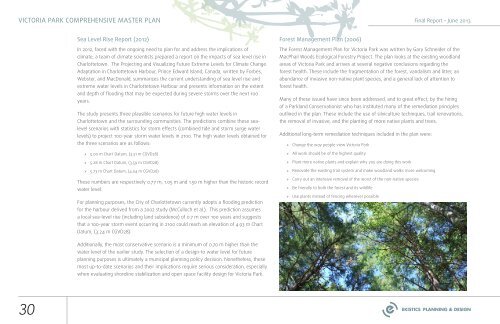
Forest Management Plan (2006)<br />
The Forest Management Plan for <strong>Victoria</strong> <strong>Park</strong> was written by Gary Schneider <strong>of</strong> the<br />
MacPhail Woods Ecological Forestry Project. The plan looks at the existing woodland<br />
areas <strong>of</strong> <strong>Victoria</strong> <strong>Park</strong> and arrives at several negative conclusions regarding the<br />
forest health. These include the fragmentation <strong>of</strong> the forest, vandalism and litter, an<br />
abundance <strong>of</strong> invasive non-native plant species, and a general lack <strong>of</strong> attention to<br />
forest health.<br />
Many <strong>of</strong> these issued have since been addressed, and to great effect, by the hiring<br />
<strong>of</strong> a <strong>Park</strong>land Conservationist who has instituted many <strong>of</strong> the remediation principles<br />
outlined in the plan. These include the use <strong>of</strong> silviculture techniques, trail renovations,<br />
the removal <strong>of</strong> invasive, and the planting <strong>of</strong> more native plants and trees.<br />
Additional long-term remediation techniques included in the plan were:<br />
»»<br />
Change the way people view <strong>Victoria</strong> <strong>Park</strong><br />
»»<br />
All work should be <strong>of</strong> the highest quality<br />
»»<br />
Plant more native plants and explain why you are doing this work<br />
»»<br />
<strong>Re</strong>novate the existing trail system and make woodland walks more welcoming<br />
»»<br />
Carry out an intensive removal <strong>of</strong> the worst <strong>of</strong> the non-native species<br />
»»<br />
Be friendly to both the forest and its wildlife<br />
»»<br />
Use plants instead <strong>of</strong> fencing wherever possible<br />
Additionally, the most conservative scenario is a minimum <strong>of</strong> 0.70 m higher than the<br />
water level <strong>of</strong> the earlier study. The selection <strong>of</strong> a design-to water level for future<br />
planning purposes is ultimately a municipal planning policy decision. Nonetheless, these<br />
most up-to-date scenarios and their implications require serious consideration, especially<br />
when evaluating shoreline stabilization and open space facility design for <strong>Victoria</strong> <strong>Park</strong>.<br />
30