2005 State of Mobility Report - City of Bellevue
2005 State of Mobility Report - City of Bellevue
2005 State of Mobility Report - City of Bellevue

Create successful ePaper yourself
Turn your PDF publications into a flip-book with our unique Google optimized e-Paper software.
CHAPTER 4: Transportation Planning and Programming<br />
and policies, as necessary, to meet the opportunities<br />
and challenges <strong>of</strong> the next 20 years. Through this<br />
process, which was last completed in 2004, the<br />
Transportation Element and its associated Subarea<br />
Transportation Facility Plans are kept current and<br />
relevant.<br />
Long-Range Facility Plans<br />
Long-range transportation plans study subareas<br />
<strong>of</strong> the <strong>City</strong> (such as Crossroads or Downtown),<br />
significant travel corridors (such as 148th<br />
Avenue or Eastgate Way), or sub-systems <strong>of</strong> the<br />
transportation system (such as transit service or<br />
pedestrian facilities). The goal <strong>of</strong> these plans is<br />
to evaluate future conditions — up to a 25-year<br />
horizon — including projected land use and traffic<br />
volumes, and then assess what improvements to<br />
the transportation system are needed to fulfill<br />
the vision, goals, and policies set forth in the<br />
Comprehensive Plan. Completed long-range plans<br />
include a wide range <strong>of</strong> projects designed to meet<br />
the mobility goals <strong>of</strong> the plan area. The project lists<br />
are <strong>of</strong>ten adopted into the Subarea Transportation<br />
Facility Plans in the Comprehensive Plan. Two<br />
major long-range planning efforts were underway in<br />
<strong>2005</strong>: Factoria Area Transportation Update and the<br />
Bel-Red Corridor Project.<br />
transit service. A small number <strong>of</strong> roadway projects<br />
were also included. Policy amendments support a<br />
transition away from a traditional suburban, autooriented<br />
business district, to an area that is more<br />
urban in character. The plan reflects an emphasis<br />
on high quality urban design and pedestrian<br />
infrastructure that will transform the neighborhood<br />
as it redevelops.<br />
The FATS Update prioritized many projects for<br />
implementation. In particular eight transit, seven<br />
roadway, and thirteen pedestrian/bicycle projects<br />
were recommended for completion within the next<br />
ten years. The Capital Investment Program (CIP)<br />
included funding for FATS early implementation<br />
and in <strong>2005</strong> a number <strong>of</strong> smaller projects, including<br />
construction <strong>of</strong> planted medians along Factoria<br />
Boulevard, were completed.<br />
(For background on the initiation <strong>of</strong> the FATS<br />
Update, see the 2003-2004 <strong>State</strong> <strong>of</strong> <strong>Mobility</strong> <strong>Report</strong>)<br />
Bel-Red Corridor Study<br />
Factoria Area Transportation Study Update<br />
The final report and recommendations for the<br />
Factoria Area Transportation Study (FATS) Update<br />
were issued in July, <strong>2005</strong>. In January 2006 the<br />
FATS update policies were adopted by Council and<br />
the recommended projects were simultaneously<br />
amended into the East <strong>Bellevue</strong> Transportation Plan,<br />
a necessary step for implementation.<br />
Through the FATS Update planning process the<br />
community supported a multi-modal approach to<br />
address Factoria’s transportation system challenges.<br />
The plan recommended projects that would enhance<br />
the pedestrian and bicycle system and improve<br />
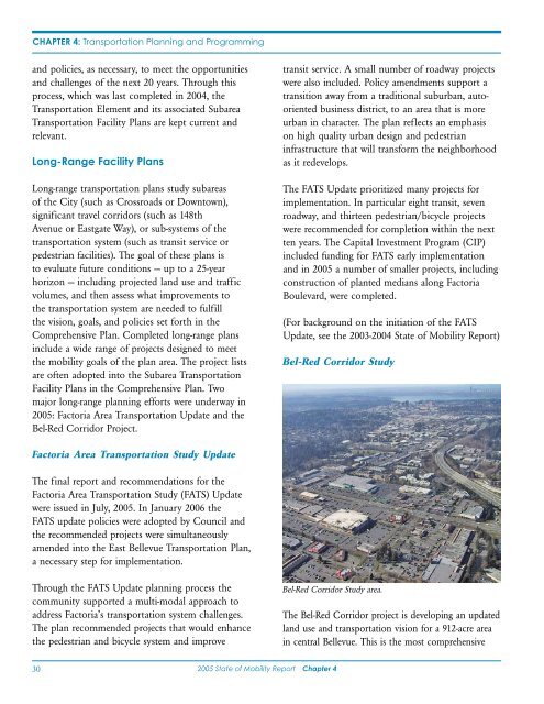
Bel-Red Corridor Study area.<br />
The Bel-Red Corridor project is developing an updated<br />
land use and transportation vision for a 912-acre area<br />
in central <strong>Bellevue</strong>. This is the most comprehensive<br />
30<br />
<strong>2005</strong> <strong>State</strong> <strong>of</strong> <strong>Mobility</strong> <strong>Report</strong> Chapter 4