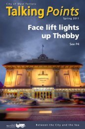
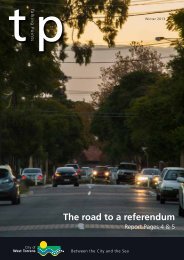
Recommendations - City of West Torrens - SA.Gov.au
Recommendations - City of West Torrens - SA.Gov.au
Recommendations - City of West Torrens - SA.Gov.au

You also want an ePaper? Increase the reach of your titles
YUMPU automatically turns print PDFs into web optimized ePapers that Google loves.
12.1 Road Hierarchy<br />
There are a number <strong>of</strong> ways that a<br />
road can be classified. The classical<br />
model uses descriptions such as<br />
freeways, arterials, distributors,<br />
collectors and local streets.<br />
The <strong>City</strong> <strong>of</strong> <strong>West</strong> <strong>Torrens</strong> has<br />
previously adopted the following<br />
classification <strong>of</strong> roads.<br />
Urban Local Road - Local streets -<br />
provide essentially local access or<br />
access to properties. Generally<br />
resident access tend to dominate the<br />
characteristics <strong>of</strong> these streets with<br />
lower speed and traffic volume being<br />
the desirable aim.<br />
Urban Local Road - Local<br />
collector roads - these are higher<br />
order streets which “collect” traffic<br />
from local streets and distribute the<br />
traffic to other higher order streets<br />
such as arterial roads. By their nature<br />
and function, they are expected to<br />
carry higher volumes <strong>of</strong> traffic and<br />
speeds tend to be higher. They also<br />
frequently form part <strong>of</strong> a public<br />
transport route. The desirable aim is to<br />
limit traffic volume and speed, while<br />
still being able to provide relatively<br />
unhindered access. Some through<br />
traffic usage can be expected.<br />
The following local roads are proposed<br />
as local collector roads:<br />
• Coral Sea Road (Fulham)<br />
• Fulham Park Drive (Lockleys)<br />
56<br />
Part 1 - Overview | Local Road Network<br />
• Rutland Avenue (Lockleys)<br />
• White Avenue (Lockleys)<br />
• Lipsett Terrace (Brooklyn Park)<br />
• Pine Avenue (Novar Gardens)<br />
• Bonython Avenue (Novar Gardens)<br />
• Whelan Avenue (Camden Park)<br />
• Streeters Road (North Plympton)<br />
• Harvey Avenue (North Plympton)<br />
• Tennyson Street (Kurralta Park)<br />
• Barwell Avenue (Marleston)<br />
• Davenport Terrace (Hilton)<br />
• Ashley Street (South Road to East<br />
Terrace) (Thebarton)<br />
• Parker Street (Thebarton)<br />
• Albert Street (Thebarton)<br />
• Holland Street (Thebarton)<br />
• Croydon Road (Keswick)<br />
• Victoria Street (Mile End)<br />
• Claremont Street (Mile End)<br />
Figure 9 identifies the above Local<br />
Collector Roads.<br />
‘ The <strong>City</strong> <strong>of</strong> <strong>West</strong> <strong>Torrens</strong><br />
has been very proactive in<br />
previous years addressing<br />
crash issues. Many Black<br />
Spot locations have already<br />
been investigated and/or<br />
addressed.’<br />
Urban Local Road - Major collector<br />
roads - these are higher order streets<br />
which generally serves a sub-arterial<br />
function, carrying higher volumes<br />
than a local collector road but lesser<br />
traffic volumes than an arterial road.<br />
They generally provide convenient<br />
and more direct connection between<br />
arterial roads, area generally without<br />
traffic control devices and carry more<br />
significant volumes <strong>of</strong> commercial<br />
traffic and through traffic.<br />
The following local roads are proposed<br />
as major collector roads:<br />
• <strong>West</strong> Beach Road (<strong>West</strong> Beach)<br />
• Military Road (<strong>West</strong> Beach)<br />
• Africaine Road (Glenelg North)<br />
• Warren Avenue (Tapleys Hill Road to<br />
James Melrose Road) (Novar Gardens)<br />
• James Melrose Road (Novar Gardens)<br />
• Morphett Road (Camden Park)<br />
• Mooringe Avenue (Camden Park)<br />
• Stonehouse Avenue (Camden Park)<br />
• Beckman Street (Plympton)<br />
• Gray Street (Kurralta Park)<br />
• Daly Street (Kurralta Park)<br />
• Galway Avenue (Marleston)<br />
• Grove Avenue (Marleston)<br />
• Brooker Terrace (Richmond)<br />
• Bagot Avenue (Cowandilla)<br />
• Hounslow Avenue (Cowandilla)<br />
• May Terrace (Lockleys)<br />
• Pierson Street (Lockleys)<br />
• Garden Terrace (Underdale)<br />
• Ashley Street (Holbrooks Road to<br />
Hardys Road) (Underdale)<br />
• Hardys Road (<strong>Torrens</strong>ville)<br />
• Ashwin Parade (<strong>Torrens</strong>ville)<br />
• <strong>West</strong> Thebarton Road (Thebarton)<br />
• Phillips Street (Thebarton)<br />
• George Street (Thebarton)<br />
• Deacon Avenue (Mile End South)<br />
• Everard Avenue (Keswick)<br />
• Richmond Road (<strong>West</strong> Richmond)<br />
NOTE: Parts <strong>of</strong> <strong>West</strong> Beach Road<br />
and Military Road are in the <strong>City</strong> <strong>of</strong><br />
Charles Sturt. Further discussions<br />
between councils will be undertaken<br />
to determine the acceptability <strong>of</strong> the<br />
road hierarchy and functional hierarchy<br />
definitions in this strategy.<br />
FIGURE 9 identifies the above major<br />
collector roads.<br />
Urban Local Road - Arterial roads -<br />
these are roads performing a regional<br />
type function, carry significant volumes<br />
<strong>of</strong> traffic and commercial vehicles.