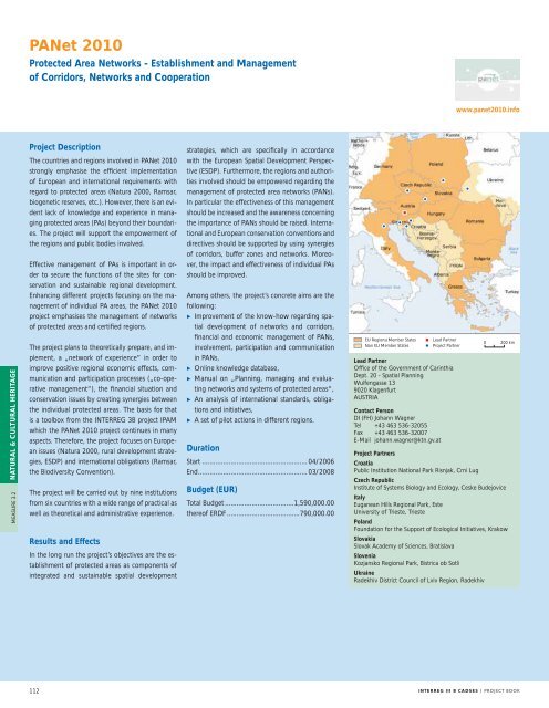
PANet 2010Protected Area Networks - Establishment and Managementof Corridors, Networks and Cooperationwww.panet2010.infoNATURAL & CULTURAL HERITAGEMEASURE 3.2Project DescriptionThe countries and regions involved in PANet 2010strongly emphasise the efficient implementationof European and international requirements withregard to protected areas (Natura 2000, Ramsar,biogenetic reserves, etc.). However, there is an evidentlack of knowledge and experience in managingprotected areas (PAs) beyond their boundaries.The project will support the empowerment ofthe regions and public bodies involved.Effective management of PAs is important in orderto secure the functions of the sites for conservationand sustainable regional development.Enhancing different projects focusing on the managementof individual PA areas, the PANet 2010project emphasises the management of networksof protected areas and certified regions.The project plans to theoretically prepare, and implement,a „network of experience“ in order toimprove positive regional economic effects, communicationand participation processes („co-operativemanagement“), the financial situation andconservation issues by creating synergies betweenthe individual protected areas. The basis for thatis a toolbox from the <strong>INTERREG</strong> 3B project IPAMwhich the PANet 2010 project continues in manyaspects. Therefore, the project focuses on Europeanissues (Natura 2000, rural development strategies,ESDP) and international obligations (Ramsar,the Biodiversity Convention).The project will be carried out by nine institutionsfrom six countries with a wide range of practical aswell as theoretical and administrative experience.strategies, which are specifically in accordancewith the European Spatial Development Perspective(ESDP). Furthermore, the regions and authoritiesinvolved should be empowered regarding themanagement of protected area networks (PANs).In particular the effectiveness of this managementshould be increased and the awareness concerningthe importance of PANs should be raised. Internationaland European conservation conventions anddirectives should be supported by using synergiesof corridors, buffer zones and networks. Moreover,the impact and effectiveness of individual PAsshould be improved.Among others, the project’s concrete aims are thefollowing:i Improvement of the know-how regarding spatialdevelopment of networks and corridors,financial and economic management of PANs,involvement, participation and communicationin PANs,i Online knowledge database,i Manual on „Planning, managing and evaluatingnetworks and systems of protected areas“,i An analysis of international standards, obligationsand initiatives,i A set of pilot actions in different regions.DurationStart ....................................................... 04/2006End ......................................................... 03/2008Budget (EUR)Total Budget ....................................1,590,000.00thereof ERDF ......................................790,000.00EU Regions/Member StatesNon EU Member StatesLead PartnerProject PartnerLead PartnerOffice of the Government of CarinthiaDept. 20 - Spatial PlanningWulfengasse 139020 KlagenfurtAUSTRIAContact PersonDI (FH) Johann WagnerTel +43 463 536-32055Fax +43 463 536-32007E-Mail johann.wagner@ktn.gv.at0 200 kmProject PartnersCroatiaPublic Institution National Park Risnjak, Crni LugCzech RepublicInstitute of Systems Biology and Ecology, Ceske BudejoviceItalyEuganean Hills Regional Park, EsteUniversity of Trieste, TriestePolandFoundation for the Support of Ecological Initiatives, KrakowResults and EffectsIn the long run the project’s objectives are the establishmentof protected areas as components ofintegrated and sustainable spatial developmentSlovakiaSlovak Academy of Sciences, BratislavaSloveniaKozjansko Regional Park, Bistrica ob SotliUkraineRadekhiv District Council of Lviv Region, Radekhiv112<strong>INTERREG</strong> <strong>III</strong> B <strong>CADSES</strong> / <strong>PROJECT</strong> <strong>BOOK</strong>
SISTEMaPARCSpatial Information Systems for Transnational EnvironmentalManagement of Protected Areas and Regions in <strong>CADSES</strong>www.sistemaparc.euProject DescriptionResults and EffectsProtected cross-border regions in the <strong>CADSES</strong> areaface similar problems. Often frontiers divide oneregion of cultural and natural heritage into morethan one national park, biosphere reserve, naturereserve or protected landscape area and they aresituated in two or more countries. As a consequence,two or more administrations, managementstructures and - if existing - spatial informationsystems (SIS) are working for these regions.Main effects and foreseen results of SISTEMaP-ARC are:i Foster the co-ordinated transnational developmentof cross-border protected regions byimproving or establishing spatial database networksand spatial information systems, and initiatethe transnational exchange of experiencesand know-how,i Support transnational strategies of monitoring,planning and management of cross-border protectedareas and respective regions through integrationand application of spatial informationsystems with special regard to European initiativeson protecting natural heritage and transnationalplanning strategies,i Increase the awareness of the values of conservationand development of natural heritage byproviding clear information,i Prepare and facilitate the implementation ofEU Regions/Member StatesNon EU Member StatesLead PartnerProject Partner0 200 kmSISTEMaPARC project teamThere is urgent need for co-ordination in establishingelaborate monitoring and managementschemes in those protected regions, as humanactivities from one area usually affect the wholeregion. The increasing demand for transnationalplanning and management approaches is backedby various European and global initiatives suchas FFH of EC, WCM of UNEP-WCMC or theUNESCO World Heritage. These initiatives fosterefforts to homogenise documentation of naturalheritages as well as the co-operation between administrationsof neighbouring countries.The project aims at fostering regional to transnationalnetworks of spatial information systems. Thecross-border protected regions of Sächsisch-BöhmischeSchweiz (DE/CZ), Neusiedler See-Seewinkel/Fertö-Hanság(AT/HU) and Krkonose/Karkonosze(CZ/PL) are the core regions of the project.The transnational approach is open-ended in orderto assure the successive integration of additionalregions throughout the duration of the project.Partners in the cross-border regions of Triglav/PrealpiGiulie (SI/IT) have already declared their cooperationat that level for example.transnational strategies for the adequate developmentof a tourism infrastructure, of co-ordinatedmeasures for cross-border nature conservationand of information systems for thepublic,i Develop indicators for changes in land use andland cover by monitoring and correlating thedynamics of changes with the impact of politicaland socio-economic changes in the <strong>CADSES</strong>area since the late 18th century.DurationStart ....................................................... 01/2004End ......................................................... 06/2007Budget (EUR)Total Budget ....................................1,402,931.00thereof ERDF ......................................880,671.00Lead PartnerUniversity of DresdenInstitute of Photogrammetry and Remote SensingMommsenstrasse 1301062 DresdenGERMANYContact PersonProf. Dr. E. CsaplovicsTel +49 351 46333680Fax +49 351 46337266E-Mail stefan.wagenknecht@tu-dresden.deProject PartnersAustria: University of Technology Vienna, Vienna / Governmentof Burgenland - Biological Research Centre NeusiedlerSee, Illmitz / National Park Administration Neusiedler See,ApetlonCzech Republic: University of Usti nad Labem, Usti nad Labem/ National Park Administration Ceské Švýcarsko, KrásnáLípa / Administration of Protected Landscape Area LabskéPískovce, Decín / National Park Administration Krkonose,VrchlabíGermany: Leibniz Institute of Ecological and Regional Development(IOER), Dresden / National Park AdministrationSächsische Schweiz, Bad Schandau / Saxon State Ministry ofInterior, Div. 45, Dresden / National Park Information CentreSächsische Schweiz, Bad Schandau / Office for RegionalPlanning Oberes Elbtal/Osterzgebirge, RadebeulHungary: University of Sopron, Sopron / Ferto-Hanság NationalPark Administration Sarród, SarródItaly: Polytecnico delle Marche, DARDUS, Ancona / PolytechnicUniversity of Marche Region, AnconaPoland: National Park Administration Karkonosze, JeleniaGóraSlovenia: Geodetic Institute of Slovenia, Ljubljana / SlovenianAcademy of Sciences and of Arts, LjubljanaNATURAL & CULTURAL HERITAGEMEASURE 3.2Map displaying the changed land use in Saxon-BohemianSwitzerland<strong>INTERREG</strong> <strong>III</strong> B <strong>CADSES</strong> / <strong>PROJECT</strong> <strong>BOOK</strong>113