DRAVA RIVER BASIN <strong>PROJECT</strong> (DRBP)Environmental Infrastructure Measures in the River Drava Basinwww.drava-river-basin.netProject DescriptionIn the environmental sector, problems are oftentransnational, with the cause lying in one countryor region, and the effects in the bordering one. Inmany cases, the border regions are economicallyand infrastructurally disadvantaged. The lack offinancial means makes it very difficult to improvethe infrastructure in these regions and to achieveEU standards. These improvements are necessaryand requested, especially in the field of waste andwastewater management. Projects dealing withthese issues require considerable amounts of money,technical know-how and complex organisationaland legal structures to be effective.DRBP worked on the improvement of the environmentalinfrastructure in the river Drava BasinThe Drava River Basin Project has elaborated thei Integration of the DRBP waste managementENVIRONMENTMEASURE 4.1comprehensive strategy concept and concretewaste and wastewater management pilot projects,which serve as examples and basis for the developedSystematic Guideline - a methodology whichenables the authorities in less developed regions toplan and implement environmental infrastructureprojects. It provides assistance to achieve a longtermsustainable, economically and socially viablesolution, thereby taking into account the EU environmentaland technological standards and usinginnovative organisational and financial models.Results and EffectsThe Drava River Basin Project has achieved thefollowing results:i Systematic Guideline for the Implementationof Environmental Infrastructure Measures inWater and Waste Management Sector for theEuropean Union as well as other Eastern andSouth-Eastern European Countries,i Integrated Regional Environmental StrategyConcept (master plan for the Drava River Basinproject area, consisting of the waste managementand water management components),i Successful development of pilot projects andpreparation of concrete large-scale investments:one waste management pilot project (regionalwaste management solution for north-westernCroatia) and two wastewater managementpilot projects (wastewater management solutionfor the selected pilot project municipalitiesof Lepoglava and Varaždinske Toplice, both innorth-western Croatia),pilot project in north-western Croatia into theCroatian National ISPA Strategy,i Wastewater management concepts (technical,economic, ecological, legal, organisational andfinancial) for the pilot project municipalities ofLepoglava and Varaždinske Toplice,i Establishment of a co-operation network ofpublic and private sector experts from Austria,Croatia, Hungary and other countries and institutions,i Enhancement of the environmental situation inthe Drava River Basin and in the Danube regionsdownriver,i Increase in the living standard of the local populations(positive effect on the local economies,employment and tourism),i Improvements to the environmental infrastructurein the regions,i Optimisation of administrative structures,i Raising public awareness of environmental issues.DurationStart ....................................................... 01/2003End ......................................................... 06/2006Budget (EUR)Total Budget ....................................2,283,834.00thereof ERDF ......................................750,000.00EU Regions/Member StatesNon EU Member StatesLead PartnerProject Partner0 200 kmLead PartnerARGE DRBP (Arbeitsgemeinschaft Drava River Basin Project)Walther-von-der-Vogelweide-Platz 49020 KlagenfurtAUSTRIAContact PersonDr. Adolf RauschTel +43 463 3261242Fax +43 463 3261245E-Mail office@quantum-gmbh.atProject PartnersAustriaQuantum GmbH, KlagenfurtJoanneum Research, GraziC Consulenten, ViennaCroatiaMinistry of Public Works, Reconstruction and Construction,ZagrebHungarySouth Transdanubian Regional Development Agency, PécsMinistry of Environment and Water Management – South-Transdanubian Environment Protection Authority, PécsGeneral Assembly of Baranya County, Pécs128<strong>INTERREG</strong> <strong>III</strong> B <strong>CADSES</strong> / <strong>PROJECT</strong> <strong>BOOK</strong>
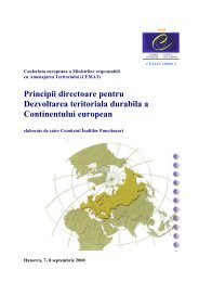
ISOTEIAIntegrated System for the promotion Of Territorial / EnvironmentalImpact Assessment in the framework of spatial planningwww.isoteia.orgMeeting of the ISOTEIA projectProject DescriptionThe aim of the ISOTEIA project is the establishmentof an integrated system designed to promotethe best means and instruments to assess Territorialand Environmental Impacts (TEIA) within theframework of resource management and regionalplanning in the <strong>CADSES</strong> region for environmentalprotection.During the project run-time, eight TEIA case studieswhich are based on alternative scenarios generatedby the Spatial Decision Support Systems(SDSS) in national and transnational study areasin different environmental fields such as surfacewater management, ecosystem protection, forestmanagement, integrated irrigation management,water supply optimisation and precision farmingare planned. They will serve as examples and asfeedback to further improve the methodology andtools. The main expected result of the project isthe promotion of an effective and sustainable managementof natural resources in <strong>CADSES</strong>.Results and EffectsISOTEIA will and has already achieved the followingresults:i Establishment of a network comprising researchand technological institutions as well as localand regional authorities and organisations,i Integration of methodologies and tools for TEIAusing the Spatial Decision Support Systems(SDSS) in national and transnational study areas,i Eight case studies (two transnational) based onthe application of SDSS in different environmentalfields,i Ten researchers among the project partnerstrained in Geographical Information Systemsand Remote Sensing (GIS-RS) tools and applications,i Training of researchers and professionals onbest practices in TEIA using SDSS,i One multi-task digital service offering all thenecessary documentation and sources of updatedinformation to planners, stakeholders andprofessionals for TEIA and SDSS applications aswell as a forum for consultancy,i Course curricula related to GIS-RS, SDSS andTEIA.DurationStart ....................................................... 01/2004End ......................................................... 12/2006Budget (EUR)Total Budget ....................................1,194,136.00thereof ERDF ......................................799,891.55EU Regions/Member StatesNon EU Member StatesLead PartnerProject Partner0 200 kmLead PartnerCIHEAM - Mediterranean Agronomic Institute of ChaniaPO Box 85, Makedonias Str. 173100 ChaniaGREECEContact PersonMr. Alkinoos NikolaidisTel +30 282 1035000Fax +30 282 1035001E-Mail alkinoos@maich.grProject PartnersAlbaniaInstitute of Informatics and Applied Mathematics, TiranaBosnia and HerzegovinaHydro-Engineering Institute of Civil-Engineering Faculty ofSarajevo, SarajevoBulgariaTechnical University of Sofia, Faculty of Computer Science,SofiaGreeceAristotle University of Thessaloniki, Department of Forestryand Natural Environment, Laboratory of Forest Managementand GIS, ThessalonikiAristotle University of Thessaloniki, ThessalonikiOrganisation for the Development of Western Crete, ChaniaMunicipality of Kolymbari, Crete, ChaniaMunicipality of Archanes, Crete, IrakleioItalyUniversity of Trieste, TriesteCIHEAM- Mediterranean Agronomic Institute of Bari, ValenzanoRegional Government of Friuli Venezia Giulia, TriesteRomaniaTechnical University of Bucarest, BucharestENVIRONMENTMEASURE 4.1<strong>INTERREG</strong> <strong>III</strong> B <strong>CADSES</strong> / <strong>PROJECT</strong> <strong>BOOK</strong>129