Comprehensive Plan - Carbondale, IL
Comprehensive Plan - Carbondale, IL
Comprehensive Plan - Carbondale, IL
- No tags were found...

You also want an ePaper? Increase the reach of your titles
YUMPU automatically turns print PDFs into web optimized ePapers that Google loves.
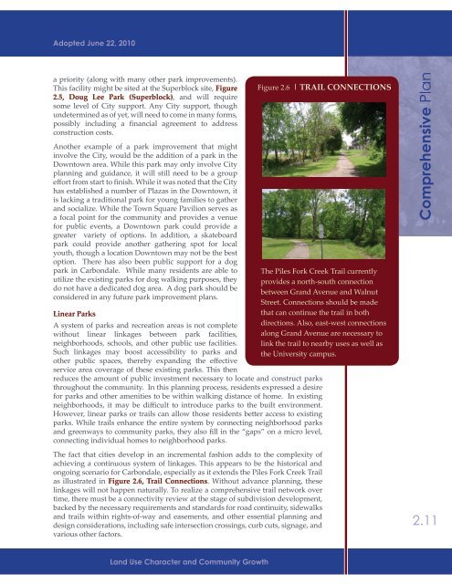
Adopted June 22, 2010a priority (along with many other park improvements).This facility might be sited at the Superblock site, Figure2.5, Doug Lee Park (Superblock), and will requiresome level of City support. Any City support, thoughundetermined as of yet, will need to come in many forms,possibly including a financial agreement to addressconstruction costs.Another example of a park improvement that mightinvolve the City, would be the addition of a park in theDowntown area. While this park may only involve Cityplanning and guidance, it will still need to be a groupeffort from start to finish. While it was noted that the Cityhas established a number of Plazas in the Downtown, itis lacking a traditional park for young families to gatherand socialize. While the Town Square Pavilion serves asa focal point for the community and provides a venuefor public events, a Downtown park could provide agreater variety of options. In addition, a skateboardpark could provide another gathering spot for localyouth, though a location Downtown may not be the bestoption. There has also been public support for a dogpark in <strong>Carbondale</strong>. While many residents are able toutilize the existing parks for dog walking purposes, theydo not have a dedicated dog area. A dog park should beconsidered in any future park improvement plans.Linear ParksA system of parks and recreation areas is not completewithout linear linkages between park facilities,neighborhoods, schools, and other public use facilities.Such linkages may boost accessibility to parks andother public spaces, thereby expanding the effectiveservice area coverage of these existing parks. This thenreduces the amount of public investment necessary to locate and construct parksthroughout the community. In this planning process, residents expressed a desirefor parks and other amenities to be within walking distance of home. In existingneighborhoods, it may be difficult to introduce parks to the built environment.However, linear parks or trails can allow those residents better access to existingparks. While trails enhance the entire system by connecting neighborhood parksand greenways to community parks, they also fill in the “gaps” on a micro level,connecting individual homes to neighborhood parks.The fact that cities develop in an incremental fashion adds to the complexity ofachieving a continuous system of linkages. This appears to be the historical andongoing scenario for <strong>Carbondale</strong>, especially as it extends the Piles Fork Creek Trailas illustrated in Figure 2.6, Trail Connections. Without advance planning, theselinkages will not happen naturally. To realize a comprehensive trail network overtime, there must be a connectivity review at the stage of subdivision development,backed by the necessary requirements and standards for road continuity, sidewalksand trails within rights-of-way and easements, and other essential planning anddesign considerations, including safe intersection crossings, curb cuts, signage, andvarious other factors.Figure 2.6 | TRA<strong>IL</strong> CONNECTIONSThe Piles Fork Creek Trail currentlyprovides a north-south connectionbetween Grand Avenue and WalnutStreet. Connections should be madethat can continue the trail in bothdirections. Also, east-west connectionsalong Grand Avenue are necessary tolink the trail to nearby uses as well asthe University campus.<strong>Comprehensive</strong> <strong>Plan</strong>2.11Land Use Character and Community Growth