October 2011 Bassetlaw District Local Development Framework
October 2011 Bassetlaw District Local Development Framework
October 2011 Bassetlaw District Local Development Framework
- No tags were found...

Create successful ePaper yourself
Turn your PDF publications into a flip-book with our unique Google optimized e-Paper software.
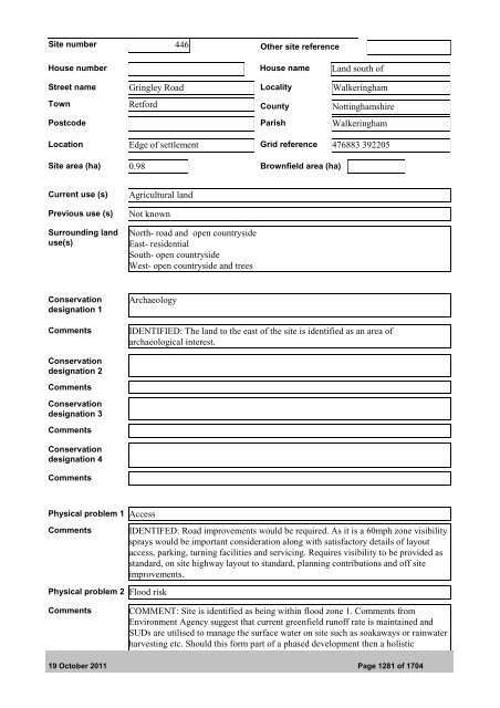
Site number 446 Other site referenceHouse number House name Land south ofStreet name Gringley Road <strong>Local</strong>ity WalkeringhamTown Retford County NottinghamshirePostcode Parish WalkeringhamLocation Edge of settlement Grid reference 476883 392205Site area (ha) 0.98 Brownfield area (ha)Current use (s)Previous use (s)Surrounding landuse(s)Agricultural landNot knownNorth- road and open countrysideEast- residentialSouth- open countrysideWest- open countryside and treesConservationdesignation 1CommentsArchaeologyIDENTIFIED: The land to the east of the site is identified as an area ofarchaeological interest.Conservationdesignation 2CommentsConservationdesignation 3CommentsConservationdesignation 4CommentsPhysical problem 1 AccessCommentsIDENTIFED: Road improvements would be required. As it is a 60mph zone visibilitysprays would be important consideration along with satisfactory details of layoutaccess, parking, turning facilities and servicing. Requires visibility to be provided asstandard, on site highway layout to standard, planning contributions and off siteimprovements.Physical problem 2 Flood riskCommentsCOMMENT: Site is identified as being within flood zone 1. Comments fromEnvironment Agency suggest that current greenfield runoff rate is maintained andSUDs are utilised to manage the surface water on site such as soakaways or rainwaterharvesting etc. Should this form part of a phased development then a holistic19 <strong>October</strong> <strong>2011</strong> Page 1281 of 1704