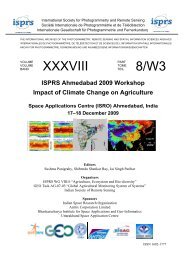
(SAR) to Support Agricultural Monitoring 2 - Group on Earth ...
(SAR) to Support Agricultural Monitoring 2 - Group on Earth ...
(SAR) to Support Agricultural Monitoring 2 - Group on Earth ...

Create successful ePaper yourself
Turn your PDF publications into a flip-book with our unique Google optimized e-Paper software.
Internati<strong>on</strong>al GEO Workshop <strong>on</strong> <str<strong>on</strong>g>SAR</str<strong>on</strong>g> <str<strong>on</strong>g>to</str<strong>on</strong>g> <str<strong>on</strong>g>Support</str<strong>on</strong>g> <str<strong>on</strong>g>Agricultural</str<strong>on</strong>g> M<strong>on</strong>i<str<strong>on</strong>g>to</str<strong>on</strong>g>ring<br />
future users of <str<strong>on</strong>g>SAR</str<strong>on</strong>g> images. Very low or no cost images for research in<br />
developing countries should be provided, this should be d<strong>on</strong>e with more seminars<br />
or teaching courses in use of <str<strong>on</strong>g>SAR</str<strong>on</strong>g> images in developing countries. I think that the<br />
GEO <str<strong>on</strong>g>Agricultural</str<strong>on</strong>g> M<strong>on</strong>i<str<strong>on</strong>g>to</str<strong>on</strong>g>ring Community of Practice is an important step in this<br />
way.”<br />
• “Educati<strong>on</strong> and tailor made training courses.”<br />
• “I think the upcoming workshop is a good step but there needs <str<strong>on</strong>g>to</str<strong>on</strong>g> be follow-<strong>on</strong>.”<br />
• “Develop a <str<strong>on</strong>g>SAR</str<strong>on</strong>g> c<strong>on</strong>stellati<strong>on</strong> that produces c<strong>on</strong>tinuous systematic observati<strong>on</strong>s<br />
throughout the growing seas<strong>on</strong>.”<br />
• “Str<strong>on</strong>gly c<strong>on</strong>sider l<strong>on</strong>g term calibrati<strong>on</strong> and validati<strong>on</strong> sites for all agricultural<br />
mapping sensor data in developing countries. Help build functi<strong>on</strong>al networks <strong>on</strong><br />
ground data or in-situ m<strong>on</strong>i<str<strong>on</strong>g>to</str<strong>on</strong>g>ring processes. C<strong>on</strong>sider modeling socio-ec<strong>on</strong>omic<br />
issues <strong>on</strong> operati<strong>on</strong>al product development using <str<strong>on</strong>g>SAR</str<strong>on</strong>g> data.”<br />
• “Increased capacity building through training and availability of <str<strong>on</strong>g>SAR</str<strong>on</strong>g> products<br />
and <str<strong>on</strong>g>to</str<strong>on</strong>g>ols for analysis and interpretati<strong>on</strong>, particularly <str<strong>on</strong>g>to</str<strong>on</strong>g> new users from<br />
developing regi<strong>on</strong>s, will go a l<strong>on</strong>g way <str<strong>on</strong>g>to</str<strong>on</strong>g> encouraging greater use of <str<strong>on</strong>g>SAR</str<strong>on</strong>g> for<br />
<str<strong>on</strong>g>Agricultural</str<strong>on</strong>g> M<strong>on</strong>i<str<strong>on</strong>g>to</str<strong>on</strong>g>ring.”<br />
• “Online training is a key comp<strong>on</strong>ent, particularly for advanced <str<strong>on</strong>g>SAR</str<strong>on</strong>g><br />
(polarimetry/inferometry) - academia should be included!”<br />
• “Focus <strong>on</strong> workshop sessi<strong>on</strong>s <str<strong>on</strong>g>to</str<strong>on</strong>g> run examples. Explore different applicati<strong>on</strong>s; get<br />
people/potential users engaged and involved in thinking about work they do that<br />
could use <str<strong>on</strong>g>SAR</str<strong>on</strong>g> informati<strong>on</strong>.”<br />
5.6 Other Views<br />
In answer <str<strong>on</strong>g>to</str<strong>on</strong>g> Questi<strong>on</strong> 11, other views that are relevant <str<strong>on</strong>g>to</str<strong>on</strong>g> the Internati<strong>on</strong>al GEO<br />
Workshop <strong>on</strong> <str<strong>on</strong>g>SAR</str<strong>on</strong>g> <str<strong>on</strong>g>to</str<strong>on</strong>g> <str<strong>on</strong>g>Support</str<strong>on</strong>g> <str<strong>on</strong>g>Agricultural</str<strong>on</strong>g> M<strong>on</strong>i<str<strong>on</strong>g>to</str<strong>on</strong>g>ring include:<br />
• “Develop databank of standardized/representative values for surface roughness<br />
for different crop or soil c<strong>on</strong>diti<strong>on</strong>s.”<br />
• “Explorati<strong>on</strong> <strong>on</strong> the possibility of a <str<strong>on</strong>g>SAR</str<strong>on</strong>g> payload in a micro-satellite should be<br />
discussed, <str<strong>on</strong>g>to</str<strong>on</strong>g> compete with the existing optic payloads operated in most of the<br />
existing micro-satellites.”<br />
• “<str<strong>on</strong>g>SAR</str<strong>on</strong>g> systems (sensor + ground segment) should be designed <str<strong>on</strong>g>to</str<strong>on</strong>g> allow c<strong>on</strong>tinuous<br />
m<strong>on</strong>i<str<strong>on</strong>g>to</str<strong>on</strong>g>ring, i.e. data flows should be completely au<str<strong>on</strong>g>to</str<strong>on</strong>g>matic. Image ordering,<br />
manual processing, etc. should become a thing of the past.”<br />
• “There is a str<strong>on</strong>g need for c<strong>on</strong>stellati<strong>on</strong> of <str<strong>on</strong>g>SAR</str<strong>on</strong>g> satellites at different frequencies<br />
and different polarizati<strong>on</strong>, incidence angle, high repeat cycle of 5 <str<strong>on</strong>g>to</str<strong>on</strong>g> 10 days).”<br />
• “I would like <str<strong>on</strong>g>to</str<strong>on</strong>g> see an overview of prices of <str<strong>on</strong>g>SAR</str<strong>on</strong>g> data. Should prices be keyed <strong>on</strong><br />
$ per sq km? Or should they be keyed <strong>on</strong> number of polarizati<strong>on</strong>s? Or should they<br />
be keyed <strong>on</strong> what the data is used for?”<br />
• “It is unclear if the desirable extent of <str<strong>on</strong>g>SAR</str<strong>on</strong>g> local / regi<strong>on</strong>al coverage could be<br />
promptly obtained c<strong>on</strong>currently with an event of interest (i.e. hurricane or flood).<br />
Apparently, we need <str<strong>on</strong>g>to</str<strong>on</strong>g> learn more about <str<strong>on</strong>g>SAR</str<strong>on</strong>g> capabilities and methods <str<strong>on</strong>g>to</str<strong>on</strong>g> access<br />
Report <strong>on</strong> Results: Survey <strong>on</strong> <str<strong>on</strong>g>SAR</str<strong>on</strong>g> <str<strong>on</strong>g>to</str<strong>on</strong>g> <str<strong>on</strong>g>Support</str<strong>on</strong>g> <str<strong>on</strong>g>Agricultural</str<strong>on</strong>g> M<strong>on</strong>i<str<strong>on</strong>g>to</str<strong>on</strong>g>ring – Annex 1 31