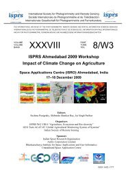
(SAR) to Support Agricultural Monitoring 2 - Group on Earth ...
(SAR) to Support Agricultural Monitoring 2 - Group on Earth ...
(SAR) to Support Agricultural Monitoring 2 - Group on Earth ...

You also want an ePaper? Increase the reach of your titles
YUMPU automatically turns print PDFs into web optimized ePapers that Google loves.
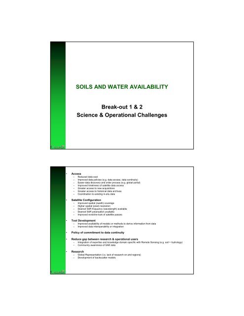
SOILS AND WATER AVAILABILITY<br />
Break-out 1 & 2<br />
Science & Operati<strong>on</strong>al Challenges<br />
• Access<br />
– Reduced data cost<br />
– Improved data policies (e.g. data access, data c<strong>on</strong>tinuity)<br />
– Easier data discovery and order process (e.g. global portal)<br />
– Improved timeliness of satellite data access<br />
– Greater access <str<strong>on</strong>g>to</str<strong>on</strong>g> new acquisiti<strong>on</strong>s<br />
– Greater access <str<strong>on</strong>g>to</str<strong>on</strong>g> his<str<strong>on</strong>g>to</str<strong>on</strong>g>rical data archives<br />
– Coordinati<strong>on</strong> <str<strong>on</strong>g>to</str<strong>on</strong>g> existing in-situ data<br />
• Satellite C<strong>on</strong>figurati<strong>on</strong><br />
– Improved spatial (swath) coverage<br />
– Higher spatial (pixel) resoluti<strong>on</strong><br />
– Desired <str<strong>on</strong>g>SAR</str<strong>on</strong>g> frequency (wavelength) available<br />
– Desired <str<strong>on</strong>g>SAR</str<strong>on</strong>g> polarizati<strong>on</strong> available<br />
– Improved revisit/re-look of satellite passes<br />
• Tool Development<br />
– Improved availability of models or methods <str<strong>on</strong>g>to</str<strong>on</strong>g> derive informati<strong>on</strong> from data<br />
– Improved data interoperability or integrati<strong>on</strong><br />
• Policy of commitment <str<strong>on</strong>g>to</str<strong>on</strong>g> data c<strong>on</strong>tinuity<br />
• Reduce gap between research & operati<strong>on</strong>al users<br />
– Integrati<strong>on</strong> of expertise and knowledge domain specific with Remote Sensing (e.g. soil + hydrology)<br />
– Community awareness of <str<strong>on</strong>g>SAR</str<strong>on</strong>g> data<br />
• Research<br />
– Global Representati<strong>on</strong> (i.e. lack of research <strong>on</strong> arid regi<strong>on</strong>s)<br />
– Development of backscatter models