General Plan - Moreno Valley
General Plan - Moreno Valley
General Plan - Moreno Valley

Create successful ePaper yourself
Turn your PDF publications into a flip-book with our unique Google optimized e-Paper software.
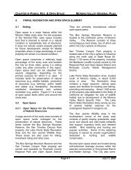
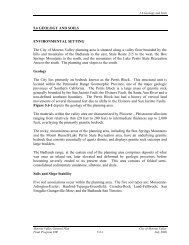
CHAPTER 4–P ARKS , R EC . & OPEN SPACE MORENO VALLEY GENERAL PLAN4. PARKS, RECREATION AND OPEN SPACE ELEMENT4.1 SettingOpen space is a major feature within the<strong>Moreno</strong> <strong>Valley</strong> study area. For the purposesof this <strong>General</strong> <strong>Plan</strong>, open space includesland that is planned to remain in a naturalcondition or substantially free of structures.It does not include vacant property plannedfor future development, except for hillsideproperties where a large percentage of suchproperty will remain in a natural condition.Open space comprises a relatively largepercentage of the study area and bordersthe City on three sides, giving it a settingunlike any other community in the region.Open space land can be classified intoseveral categories, depending on theprimary purpose for which it is used. Itincludes lands for preservation of naturalresources (e.g. wildlife habitat), productionof resources (e.g. farming), public healthand safety (e.g. floodplains), low-densityresidential development and outdoorrecreation (e.g. parks). Figure 4-1 is a mapof open space lands within and around thestudy area.4.2 Open Space4.2.1 Open Space for the Preservationof Natural ResourcesA large amount of the study area consists ofopen space lands managed for thepreservation of natural resources. Theseareas include the Box Springs MountainReserve, the San Timoteo Canyon Parkproperty, the Lake Perris State RecreationArea and the San Jacinto Wildlife Area.These areas are also used for hiking,horseback riding and other uses.The Box Springs Mountain Reserve and theSan Timoteo Canyon Park property areowned and operated by Riverside CountyRegional Park and Open Space District.They are primarily mountainous naturalopen space parks.The Box Springs Mountain Reserve islocated at the northwest corner of <strong>Moreno</strong><strong>Valley</strong>. The Reserve consists of threenoncontiguous land areas, two of which arewithin the City’s sphere of influence.San Timoteo Canyon Park property islocated east of the City’s sphere of influencealong the north side of State Route 60.About 1,100 acres of the property, includingthe Badlands Landfill is jointly owned by theRegional Park and Open Space District andRiverside County Waste ManagementDistrict.Lake Perris State Recreation Area, locatedsouth of <strong>Moreno</strong> <strong>Valley</strong>, is about 8,000acres in area. The Recreation Areacontains a major reservoir, natural openspace and facilities for boating and fishing,picnicking and camping. About 1,600 acresof the property was dedicated to the State ofCalifornia as mitigation for loss of wildlifehabitat due to development of the <strong>Moreno</strong><strong>Valley</strong> Ranch Specific <strong>Plan</strong>. The LakePerris State Recreation Area serves as oneof several habitat reserves for theendangered Stephen’s kangaroo rat.The San Jacinto Wildlife Area in thesoutheastern corner of the study areaconsists of gently sloping grasslands, sagescrub and natural and man-made wetlandsthat support migratory birds and residentwildlife. Bird watching and hunting arepopular activities. Some of the adjoiningproperty is owned by private organizationsdedicated to hunting and wildlifeconservation.Several open space areas are located alongsoft-bottomed drainage courses within theplanned communities of Sunnymead Ranchand Hidden Springs. The City also ownsPage 4-1 July 11, 2006