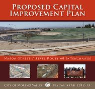
General Plan - Moreno Valley
General Plan - Moreno Valley
General Plan - Moreno Valley

You also want an ePaper? Increase the reach of your titles
YUMPU automatically turns print PDFs into web optimized ePapers that Google loves.
CHAPTER 5 – CIRCULATIONMORENO VALLEY GENERAL PLANeach arterial segment in the City, it does notspecify additional lane improvements atintersections or various other trafficoperational improvements that wouldtypically be needed to remediate excessdemand and achieve acceptable level ofservice conditions. These segments willrequire further study to determine ifadditional improvements will be needed tomaintain an acceptable LOS at <strong>General</strong><strong>Plan</strong> build-out. <strong>General</strong>ly, these segmentswill be identified and studied as newdevelopments are proposed in their vicinity.Measures will be identified that areconsistent with the Circulation Elementdesignation of these roadway segments,such as additional turn lanes atintersections, signal optimization bycoordination and enhanced phasing, andtravel demand management measures.5.3.2.2 Industrial DevelopmentIndustrial and business park development isconcentrated in the southern part of theCity, generally located south of Iris Avenueand north of San Michele Road to the Perriscity limits. This development is an importantcomponent of the City land use pattern,providing significant local employmentopportunities for <strong>Moreno</strong> <strong>Valley</strong> residentsand municipal revenue to support highlevels of public services and facilities. Tosupport this development, a sound networkof arterial and collector streets is needed.5.3.2.3 School CirculationSchools generate significant traffic,particularly during the weekday morningpeak hours. This condition is expected tocontinue through City build-out because ofthe large existing and expected populationof families with children and the lack ofschool district funding to support bussing.Coordination with school districts andadjacent jurisdictions is and will continue tobe an important method for ensuring thatadequate vehicular and pedestriancirculation to schools is provided.5.3.2.4 Geographical Constraints<strong>Moreno</strong> <strong>Valley</strong> is bordered by the BoxSprings Mountains on the north and theBadlands on the northeast and east. Southof the City is the San Jacinto fault line andLake Perris, and to the west in the MarchAir Reserve Base/March Inland Port.Because of these constraints, effectiveregional circulation is critical to <strong>Moreno</strong><strong>Valley</strong>’s continued growth and maintenanceof the quality of life. This will requirecoordination with adjacent localgovernments and County and regionalagencies to monitor future regional growth.5.3.3 Regional IssuesAn effective regional transportation networkwill require that regional growth anddevelopment trends are understood andaccommodated.5.3.3.1 Regional GrowthPopulation and Employment:Demographic data compiled by SCAG insupport of the 2001 RTP demonstrates thatthe Western Riverside region, inclusive of<strong>Moreno</strong> <strong>Valley</strong>, is currently a jobs poorregion with only 0.31 jobs for every WesternRiverside County resident. Most of thepopulation commutes outside the WesternRiverside region, and many outside theCounty to work. This demographic profileputs a greater demand on both local andregional roadways.By 2025, the proportion of jobs to populationin Western Riverside County is expected toincrease to 0.35. Between 2000 and 2025,the population of Western Riverside Countyis expected to increase from 1,199,004persons 2,232,983 persons, an increase of86.2% over the 25-year period or 2.5% peryear. During this same period, employmentis projected to increase from 371,318 jobsto 801,806 jobs, an increase of 115.9% overthe 25-year period or 3.1% per year, aPage 5-7 July 11, 2006