General Plan - Moreno Valley
General Plan - Moreno Valley
General Plan - Moreno Valley

You also want an ePaper? Increase the reach of your titles
YUMPU automatically turns print PDFs into web optimized ePapers that Google loves.
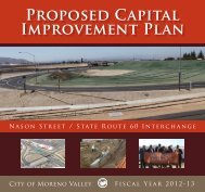
CHAPTER 5 – CIRCULATIONMORENO VALLEY GENERAL PLANDrive and Pigeon Pass Road/FrederickStreet.5.2.1.1 Interstate and State HighwaysI-215, located on the western edge of theCity, is the major north-south regionaltransportation route within the City,connecting <strong>Moreno</strong> <strong>Valley</strong> to Riverside, SanBernardino and San Diego Counties.SR-60, or the <strong>Moreno</strong> <strong>Valley</strong> Freeway, is themajor east-west transportation route withinthe City. The <strong>Moreno</strong> <strong>Valley</strong> Freewayconnects <strong>Moreno</strong> <strong>Valley</strong> with the coastalcities and the greater Los Angeles area tothe west. It also merges with Interstate 10 (I-10) to the east, and connects to thecommunities of Beaumont, Banning, and thecities of the Coachella <strong>Valley</strong>. I-10 is themajor route connecting Southern Californiato the states of Arizona, New Mexico, Texas,and the Gulf States. As such, this routecarries a significant amount of traffic through<strong>Moreno</strong> <strong>Valley</strong>.5.2.1.2 Existing Roadway DeficienciesFor the purpose of identifying deficiencies onthe <strong>General</strong> <strong>Plan</strong> circulation system, dailytraffic volumes are compared to roadwaycapacity standards in the form of a volume tocapacity ratio. The volume to capacity ratiosare correlated to Levels of Service (LOS) 1 .Roadway segments that exceed the City’sLOS standard are defined as deficient.Existing deficiencies are identified andcorrected through the City CapitalImprovement Program.Other deficiencies are caused by regionaltraffic, which is affected both by regionalgrowth and state and regional transportationpolicies. These deficiencies are addressedthrough close coordination with State andregional agencies.1 Reference Section 5.2.6.1 for a definition of Level ofService, and Table 5-15.2.2 Regional <strong>Plan</strong>sRegional access is an important function ofthe transportation network, allowing safe andefficient travel between cities, counties andstates. Efficient regional access supports theeconomic development and general welfareof the community and helps maintainacceptable levels of service on local streets.<strong>Plan</strong>ning for regional access requires strongcoordination between the City and regionaland state agencies, including: WesternRiverside Council of Governments(WRCOG), Riverside County TransportationCommission (RCTC), the Southern CaliforniaAssociation of Governments (SCAG) andCaltrans. This coordination must involve boththe land use and infrastructure decisionmaking.The following regional plans have beenestablished to organize and implementregional transportation planning efforts:5.2.2.1 Regional Transportation <strong>Plan</strong>The Regional Transportation <strong>Plan</strong> (RTP) is acomponent of the Regional Comprehensive<strong>Plan</strong> and Guide prepared by the SouthernCalifornia Association of Governments(SCAG) to address regional issues, goals,objectives, and policies for the SouthernCalifornia region into the early part of the21st century. The RTP, which SCAGperiodically updates, sets broad goals for theregion and provides strategies to reduceproblems related to congestion and mobility.The RTP identifies transportation facilitiesthat are of regional significance. In order tobe eligible for federal funding assistance,transportation projects must be consistentwith the RTP.5.2.2.2 Riverside County IntegratedProjectTransportation corridors in the generalvicinity of the City of <strong>Moreno</strong> <strong>Valley</strong> are beingPage 5-2 July 11, 2006