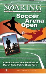
General Plan - Moreno Valley
General Plan - Moreno Valley
General Plan - Moreno Valley

Create successful ePaper yourself
Turn your PDF publications into a flip-book with our unique Google optimized e-Paper software.
CHAPTER 4–P ARKS , R EC . & OPEN SPACE MORENO VALLEY GENERAL PLANtwo natural open space areas. One openarea is adjacent to the <strong>Moreno</strong> <strong>Valley</strong>Equestrian Center, located at the northeastcorner of Redlands Boulevard and LocustAvenue. A second natural open space areais located north of Sunnymead RanchParkway, on the east side of PerrisBoulevard.Natural open space can also be foundwithin the steeply sloping areas designatedRural Residential and Hillside Residentialon the <strong>General</strong> <strong>Plan</strong> land use map. Theseareas contain wildlife habitat, watershedbenefits and scenic values that can beconserved even as these areas aredeveloped. Natural open space can beconserved because these areas areplanned for low-density residentialdevelopment. Low-density developmentrequires a minimal amount of landdisturbance.4.2.2 Open Space for Public Health andSafetyA substantial amount of land within the studyarea cannot be developed due to publichealth and safety concerns. These includeareas subject to air crash hazards, floodingand cemeteries.March Air Reserve Base, located southwestof the city limits, was once an active dutyaerial refueling and deployment base. Theairfield is a joint-use military reserve baseand civilian airport. The land at each end ofthe runway is subject to significant danger ofaircraft accidents during takeoff and landing.The land below the landing approach,designated as the clear zone, is within thestudy area. It is located at the northeastcorner of Heacock Street and OleanderAvenue. Only open space uses areappropriate within the clear zone.Part of the southeast corner of the planningarea is within the floodplain of the SanJacinto River. The resulting floodwater,known as Mystic Lake, has been known toinundate the area for months and sometimesyears at a time. The land use designation forthe area is Floodplain. Only uses consistentwith the protection of public health and safetyare allowed within this area.Man-made lakes and flood control basinsare also important open space features.Man-made lakes are found within thecommunities of Sunnymead Ranch and<strong>Moreno</strong> <strong>Valley</strong> Ranch. A network of flooddetention basins and flood channels exist orare planned throughout the study area.Although public access is restricted to mostflood control facilities, plans for publicrecreational uses have been made forseveral flood detention basins, includingPoorman’s Reservoir, the Nason Basin andthe Elder Basin.A cemetery is yet another form of openspace set aside for public health and safetypurposes. Cemeteries are open space usesalthough they typically include accessorybuildings such as mausoleums. Thesoutheast corner of State Route 60 andGilman Springs Road is designated for useas a cemetery.4.2.3. Open Space for the Production ofResourcesOpen space for the production of resourcesincludes open space used for agriculturalproduction and open space used for themineral production. The acreage within thestudy devoted to these uses is expected todecrease.Agricultural open space within the studyarea has diminished over time as farmingbecame less economically viable incomparison to commercial, industrial andresidential development. The viability offarming is further impacted by the high costof water, the cost of land and propertytaxes, conflicts with surrounding urban usesPage 4-3 July 11, 2006