- Page 1 and 2:
T.C. KÜLTÜR VE TURİZM BAKANLIĞI
- Page 3 and 4:
İ Ç İ N D E K İ L E R Mustafa H
- Page 5:
Gülriz KOZBE Şırnak İli, Cizre-
- Page 8 and 9:
ma yap› ve yaz›tlar›n› ince
- Page 10 and 11:
aflland›¤› san›lan bir asker
- Page 12 and 13:
zindeki evlerden birinde Kozan civa
- Page 14 and 15:
Resim 1: Limonlu Vadisi’nden bir
- Page 16 and 17:
Resim 7: Mut’un Karacao¤lan Köy
- Page 18 and 19:
Resim 13: Anazarbos, at heykeli par
- Page 20 and 21:
Daha önceki y›llarda fiarköy´
- Page 22 and 23:
Resim 3: ‹nanl› Tar›m ‹flle
- Page 24 and 25:
Resim 7: Tahrip edilen su yolunun p
- Page 26 and 27:
Koza¤ac›(wiederum etwa 15 km sü
- Page 28 and 29:
Sütunlar›n tamam› korunamam›
- Page 30 and 31:
Bugüne kadar Korykos’un bilinen
- Page 32 and 33:
a¤l› olarak ikonografik özellik
- Page 34 and 35:
2) Grotesk ve Karikatür Heykelcikl
- Page 36 and 37:
Resim: 1 Resim: 2 Resim: 3 30
- Page 38 and 39:
Resim: 7 Resim: 8 Resim: 9 Resim: 1
- Page 40 and 41:
immer noch kontroversiell beurteilt
- Page 42 and 43:
während jene der anderen Nekropole
- Page 44 and 45:
allerdings stark zerstört ist; so
- Page 46 and 47:
Abb. 1: P›nara -Südnekropole Abb
- Page 48 and 49:
Abb. 5: Grabmal des Uwemi in Limyra
- Page 50 and 51:
Abb. 10: Grabanlage des Uhetei in L
- Page 52 and 53:
Abb. 14: Grabanlage des H]urttija i
- Page 54 and 55:
Bafl k›sm› oval, gövdesi ise y
- Page 56 and 57:
KARfiILAfiTIRMA VE TAR‹HLEND‹RM
- Page 58 and 59:
KOfiAY, Hamit Z.-Mahmut AKOK 1957,
- Page 60 and 61:
Resim: 5 Resim: 6 Resim: 7 Resim: 8
- Page 62 and 63:
Resim: 13 Resim: 14 56
- Page 64 and 65:
Größe der Nekropole wie auch die
- Page 66 and 67:
he durchgeführten Grabungen konnte
- Page 68 and 69:
Abb. 4: Grabstele mit der Darstellu
- Page 70 and 71:
Gründung der römischen Provinz au
- Page 72 and 73:
te Außenfestung der klassischen Ze
- Page 74 and 75:
Abb. 2 Abb. 3 68
- Page 76 and 77:
tutan bir tepe üzerinde konumlanm
- Page 78 and 79:
15. Baltac› Tümülüsü: Devrek
- Page 80 and 81:
Harita: Devrek ve çevresi 74
- Page 82 and 83:
Çizim 2: Mezar plan› (Karakoçlu
- Page 84 and 85:
Çizim 4: Boncuklar Höyük 78
- Page 86 and 87:
Resim 3: P›narönü, kemerli meza
- Page 88 and 89:
Resim 7: Cumhuriyet Alan›’nda b
- Page 90 and 91:
Bu kesimde önce Bolvadin’in 13 k
- Page 92 and 93:
(Orta Kalkolitik Ça¤), GKÇ (Geç
- Page 94 and 95:
Yerleflmelerin Listesi 9 Bolvadin 3
- Page 96 and 97:
KAYNAKÇA BAHAR, H.- Ö. KOÇAK (20
- Page 98 and 99:
Çizim: 1 92
- Page 100 and 101:
Resim 1: Pani Höyük Resim 2: Bald
- Page 102 and 103:
Beyflehir’de inceledi¤imiz yerle
- Page 104 and 105:
Bölgede çal›flmalar›m›z›
- Page 106 and 107:
KAYNAKÇA ORTHMANN, W. (1963), Frü
- Page 108 and 109:
Çizim 2: Katranl› Seki mevkii; 2
- Page 110 and 111:
Resim 1: Çukurkent Höyük Resim 2
- Page 112 and 113:
Resim 5: Döfleme mevkii, antik yol
- Page 114 and 115:
sine bu önemin Yak›ndo¤u'da Neo
- Page 116 and 117:
Anadolu’da Neolitik Dönemde bitu
- Page 118 and 119:
KAYNAKÇA VE KISALTMALAR ALGAZE, G.
- Page 120 and 121:
Resim: 3 Resim: 4 114
- Page 122 and 123:
Resim: 7 116
- Page 124 and 125:
nistration des forêts a implanté
- Page 126 and 127:
— Sur la tranche de cette même p
- Page 128 and 129:
Photo 1: Vue générale du bâtimen
- Page 130 and 131:
ÇALIfiMA BÖLGES‹ Urartu baraj,
- Page 132 and 133:
Çevrede herhangi bir su kayna¤›
- Page 134 and 135:
KURBA⁄ALI GÖLET‹ Kurba¤al›
- Page 136 and 137:
silmesiyle aç›lan ve arazinin el
- Page 138 and 139:
1987-2004 YILLARI ARASINDA DO⁄U A
- Page 140 and 141:
Çizim 1: Aktafl Göleti ve yak›n
- Page 142 and 143:
Çizim 5: Mercimek Kalesi ve Gölet
- Page 144 and 145:
Çizim 9: Zor Osman Pafla Ark›’
- Page 146 and 147:
Resim 3: ‹çi toprak ile dolan Zo
- Page 148 and 149:
¤inde de baz› tafl ocaklar› ve
- Page 150 and 151:
de formu hakk›nda bir fley söyle
- Page 152 and 153:
Kemer-Çal›flda¤ Tepesi (Resim:
- Page 154 and 155:
l› bloklardan oluflturulmufltur.
- Page 156 and 157:
lanm›flt›r. Do¤usunda yer alan
- Page 158 and 159:
Resim 1: Trebenna çevresi GPS hari
- Page 160 and 161:
Resim 7: Neapolis, konutlar Resim 8
- Page 162 and 163:
yerel Eski Tunç, güney kökenli E
- Page 164 and 165:
8. ÇAKILHAN DÜZ YERLEfi‹M‹ Me
- Page 166 and 167:
ile iliflkili olmal›d›r. Gerek
- Page 168 and 169:
P›nar›" ve Merkez Yenikonak Kö
- Page 170 and 171:
Harita: Yukar› F›rat Bölgesi 2
- Page 172 and 173:
Çizim 4: Hoh Höyük, yerleflim pl
- Page 174 and 175:
Çizim 8: Namebafl› Karakolu, rö
- Page 176 and 177:
Çizim 12: Görgüflan Kalesi röl
- Page 178 and 179:
Tarihçe ‹.Ö. 2. biny›lda Mino
- Page 180 and 181:
Dönem kentinin çok genifl bir ala
- Page 182 and 183:
melerini karfl›lamak için hizmet
- Page 184 and 185:
Yukar›daki buluntu listesinden de
- Page 186 and 187:
Çizim 2: Gümüfllük-Myndos, kili
- Page 188 and 189:
Resim 1: Akropolden limanlara do¤r
- Page 190 and 191:
Resim 7: K›z›l Burun, kaya meza
- Page 192 and 193:
Prof. D. Parrish taraf›ndan organ
- Page 194 and 195:
tarihlerde birbirinden ba¤›ms›
- Page 196 and 197:
ARIT-‹stanbul Ofisi Kütüphanesi
- Page 198 and 199:
Eruh Kavaközü Köyü De¤irmeni E
- Page 200 and 201:
11. Kaya Ev Enine genifl aç›kl
- Page 202 and 203:
23. Kaya Ev Evin bat›ya bakan dik
- Page 204 and 205:
Pervari ‹lçesi, Kilis Köyü, Ka
- Page 206 and 207:
Resim 3: Eruh Kavaközü Köyü, ka
- Page 208 and 209:
Resim 7: Eruh Erenkaya Köyü Kaya
- Page 210 and 211:
Resim 13: Pervari ‹lçesi, Ekind
- Page 212 and 213:
Son 2 y›ld›r gerek ODTÜ-TAÇDA
- Page 214 and 215:
t›k sol kenar› düzeltiyle kena
- Page 216 and 217:
tuplu piramit biçimli çekirdek bu
- Page 218 and 219:
Harita: 1 Harita: 2 212
- Page 220 and 221:
Çizim 2: Kureflan Düzü buluntu y
- Page 222 and 223:
Çizim 6: Dirrejan S›rt›’ndan
- Page 224 and 225:
Çizim 11: fiikeftanyusuf S›rt›
- Page 226 and 227:
d›rd›¤› metinlerdir. Yaz›t
- Page 228 and 229:
Resim 4: Env.No.494 Resim 5: Env.No
- Page 230 and 231:
Resim 12: Env.No.489 Resim 13: Env.
- Page 232 and 233:
ROUGH CILICIA MARITIME SURVEY Chery
- Page 234 and 235:
and D allowed some evidence of alte
- Page 236 and 237:
(1444-2003 AD) based on 23 trees; f
- Page 238 and 239:
BOZKAYA MOUNTAIN (8-09-04) UTM 4622
- Page 240 and 241:
PROJECT PUBLICATIONS. The following
- Page 242 and 243:
Map 3: Trenches A & B and walking t
- Page 244 and 245:
Plan 1: Geomorphological profile of
- Page 246 and 247:
Fig. 5: RC 0405, Remains at Hisar F
- Page 248 and 249:
enormous amount of pottery visible
- Page 250 and 251:
In the 1950s, G. Kleiner and P. Hom
- Page 252 and 253:
into question since no architectura
- Page 254 and 255:
Herodotus for the Panionion, althou
- Page 256 and 257:
Fig. 4: MYK 138 Melia? Carian forti
- Page 258 and 259:
Fig. 9: MYK 139 Archaic Panionium?L
- Page 260 and 261:
monastic in form, function, and con
- Page 262 and 263:
designed, decorated, and laid out,
- Page 264 and 265:
threshold to the second half of the
- Page 266 and 267:
were able to make several correctio
- Page 268 and 269:
Fig. 3: Site diagram with legend Fi
- Page 270 and 271:
Fig. 8: Selime Kalesi, hall one, in
- Page 272 and 273:
Fig. 13: Selime Kalesi, pitloom, lo
- Page 274 and 275:
lir. Genel olarak oval biçimli say
- Page 276 and 277:
mimari özellikleri bak›m›ndan,
- Page 278 and 279:
‹çe aç›lan kap›s›yla dör
- Page 280 and 281:
fededir. Bu vadi, Elmada¤ (1865 m.
- Page 282 and 283:
Harita 1: Galatia kaleleri/yerleflm
- Page 284 and 285:
Harita: 5 278
- Page 286 and 287:
Çizim: 3 Çizim: 4 280
- Page 288 and 289:
Resim: 1 Resim: 2 Resim: 3 Resim: 4
- Page 290 and 291: arkeoloji ve sembolik arkeoloji aç
- Page 292 and 293: ana yükseltiler ve co¤rafî yap
- Page 294 and 295: pakl› Kaya mevkiinde bulunan dolm
- Page 296 and 297: ir platforma ulafl›lmaktad›r. B
- Page 298 and 299: Resim 1: Lalapafla, dolmen 292
- Page 300 and 301: 1990 y›llar› aras›nda bölged
- Page 302 and 303: 10. Kortik Höyük Silopi’nin 8 k
- Page 304 and 305: de büyük bir askerî gözetleme k
- Page 306 and 307: lerinin ele geçirilmesi, "Ulluba"
- Page 308 and 309: Çizim: 2 302
- Page 310 and 311: Çizim: 4 304
- Page 312 and 313: Resim: 1 Resim: 2 Resim: 3 306
- Page 314 and 315: Resim: 7 Resim: 8 308
- Page 316 and 317: avlu/mekân vard›r. Tonoz örtün
- Page 318 and 319: olmal›d›r. Yukar›da sözünü
- Page 320 and 321: Resim: 1 Resim: 2 Resim: 3 314
- Page 322 and 323: Resim: 7 Resim: 8 Resim: 9 316
- Page 324 and 325: Resim: 12 Resim: 13 Resim: 14 318
- Page 326 and 327: Pencerelerin alt›ndaki 52 korkulu
- Page 328 and 329: dan oluflan içiçe geçmifl bir ç
- Page 330 and 331: Resim 1: ‹stanbul, Aya Sofya Müz
- Page 332 and 333: Resim 5: ‹stanbul, Aya Sofya Müz
- Page 334 and 335: Resim 8: ‹stanbul, Aya Sofya Müz
- Page 336 and 337: Resim 13: ‹stanbul, Aya Sofya Mü
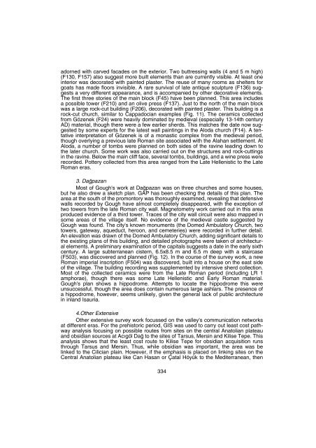
- Page 338 and 339: Roman (F105), one medieval (F106).
- Page 342 and 343: numerous flooding events show that
- Page 344 and 345: Fig. 3: 2004 spring fieldwalking ar
- Page 346 and 347: Fig. 7: Alahan frieze fragments (F3
- Page 348 and 349: Fig. 12: Da¤pazar› cistern plan
- Page 350 and 351: Ayn› kilisede bir de paye bafll
- Page 352 and 353: nin bir benzeri gene ayn› müzede
- Page 354 and 355: Resim 1: Silivri Had›m ‹brahim
- Page 356 and 357: Resim 5: ‹skender Çelebi Camii
- Page 358 and 359: Resim 9: Silivrikap›, Yediemirler
- Page 360 and 361: Resim 14: Silivrikap›, Fatih Site
- Page 362 and 363: Edirne’nin Osmanl› Döneminde i
- Page 364 and 365: KAYNAKÇA Abdurrahman H›bri, Enis
- Page 366 and 367: fiekil 1: Edirne Müzesi ‹dari Bi
- Page 368 and 369: fiekil 5: Edirne Türk ve ‹slam E
- Page 370 and 371: Resim 3: Edirne Müzesi ‹dari Bin
- Page 372 and 373: Resim 7: Edirne Türk ve ‹slâm E
- Page 374 and 375: Tünelin son bölümünde, y›k›
- Page 376 and 377: manda I No.lu ma¤aran›n, Birkley
- Page 378 and 379: ma¤aran›n hangi dönemlerde kull
- Page 380 and 381: ve duvar parçalar›na dayanarak y
- Page 382 and 383: güzergâh› korumak ve kontrol et
- Page 384 and 385: Harita Resim: 1 378
- Page 386 and 387: Resim: 5 Resim: 6 Resim : 7 380
- Page 388 and 389: Resim: 10 Resim: 11 Resim: 12 382
- Page 390 and 391:
Resim : 15 384
- Page 392 and 393:
mitten in einer dieser beiden antik
- Page 394 and 395:
5.2. Im Canyon östlich Pepouzas be
- Page 396 and 397:
consequence of this is that, lackin
- Page 398 and 399:
and wool 9 . All seven of these tab
- Page 400 and 401:
394
- Page 402 and 403:
396
- Page 404 and 405:
do¤ru giderken tesadüfen Tatik k
- Page 406 and 407:
lemlenmifltir. Apsisi d›flar› d
- Page 408 and 409:
Resim 7: Baka mozai¤i, iç Resim 8
- Page 410 and 411:
Resim 13: Koyuntafl, bazilika plan
- Page 412 and 413:
Mut masifini de içine alarak Orta
- Page 414 and 415:
kullan›m› yaln›zca betimlemel
- Page 416 and 417:
Resim 6: Çunur Biyomitrik globorot
- Page 418 and 419:
nokta üzerinde yer almaktad›r. T
- Page 420 and 421:
ine yönelik ticaretin varl›¤›
- Page 422 and 423:
Resim 2: Coflkuntepe yüzey buluntu
- Page 424:
Resim 8: Üretim hatas› ö¤ütme


