Creating a Map with ArcMap - Tufts University
Creating a Map with ArcMap - Tufts University
Creating a Map with ArcMap - Tufts University

You also want an ePaper? Increase the reach of your titles
YUMPU automatically turns print PDFs into web optimized ePapers that Google loves.
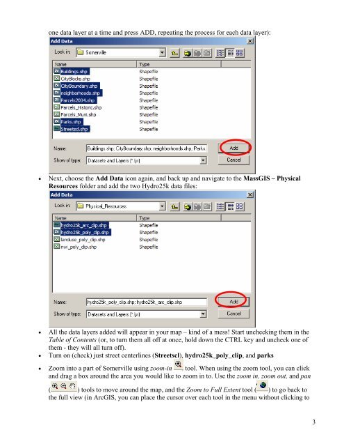
one data layer at a time and press ADD, repeating the process for each data layer):<br />
• Next, choose the Add Data icon again, and back up and navigate to the MassGIS – Physical<br />
Resources folder and add the two Hydro25k data files:<br />
• All the data layers added will appear in your map – kind of a mess! Start unchecking them in the<br />
Table of Contents (or, to turn them all off at once, hold down the CTRL key and uncheck one of<br />
them - they will all turn off).<br />
• Turn on (check) just street centerlines (Streetscl), hydro25k_poly_clip, and parks<br />
• Zoom into a part of Somerville using zoom-in tool. When using the zoom tool, you can click<br />
and drag a box around the area you would like to zoom in to. Use the zoom in, zoom out, and pan<br />
( ) tools to move around the map, and the Zoom to Full Extent tool ( ) to go back to<br />
the full view (in ArcGIS, you can place the cursor over each tool in the menu <strong>with</strong>out clicking to<br />
3