

FEMA P-499: Home Builder's Guide to Coastal Construction
FEMA P-499: Home Builder's Guide to Coastal Construction
FEMA P-499: Home Builder's Guide to Coastal Construction

Create successful ePaper yourself
Turn your PDF publications into a flip-book with our unique Google optimized e-Paper software.
Using a Digital Flood<br />
Insurance Rate Map (DFIRM)<br />
HOME BUILDER’S GUIDE TO COASTAL CONSTRUCTION Technical Fact Sheet No. 1.3<br />
Purpose: To explain the purpose of Flood Insurance Rate Maps (FIRMs), Digital Flood Insurance Rate<br />
Maps (DFIRMs), highlight features that are important <strong>to</strong> coastal builders, and explain how <strong>to</strong> obtain<br />
FIRMs, DFIRMs, and Flood Insurance Studies (FISs).<br />
What Is a FIRM?<br />
Flood-prone areas are studied by engineers and hydrologists<br />
that specialize in analysis of streams, rivers, tidal shorelines,<br />
and their adjacent floodplain or coastal area. These published<br />
studies, known as the community’s FIS, provide detailed information<br />
on the study area that facilitates the creation of flood<br />
maps. FISs are usually produced for the highest risk streams,<br />
most rivers, and almost all coastal reaches.<br />
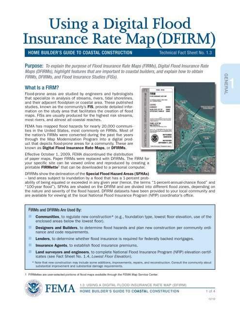
<strong>FEMA</strong> has mapped flood hazards for nearly 20,000 communities<br />
in the United States, most commonly on FIRMs. Most of<br />
the nation’s FIRMs were converted during the past five years<br />
through the Map Modernization Program in<strong>to</strong> a digital product<br />
that depicts flood-prone areas for a community. These are<br />
known as Digital Flood Insurance Rate Maps, or DFIRMs.<br />
Effective Oc<strong>to</strong>ber 1, 2009, <strong>FEMA</strong> discontinued the distribution<br />
of paper maps. Paper FIRMs were replaced with DFIRMs. The FIRM for<br />
your specific site can be viewed online and reproduced by creating a<br />
printable FIRMette1 that can be downloaded <strong>to</strong> a personal computer.<br />
DFIRMs show the delineation of the Special Flood Hazard Areas (SFHAs)<br />
– land areas subject <strong>to</strong> inundation by a flood that has a 1-percent probability<br />
of being equaled or exceeded in any given year (hence, the terms “1-percent-annual-chance flood” and<br />
“100-year flood”). SFHAs are shaded on the DFIRM and are divided in<strong>to</strong> different flood zones, depending on<br />
the nature and severity of the flood hazard. DFIRM datasets have been provided <strong>to</strong> your local community and<br />
are available for viewing at the local National Flood Insurance Program (NFIP) coordina<strong>to</strong>r’s office.<br />
FIRMs and DFIRMs Are Used By:<br />
n Communities, <strong>to</strong> regulate new construction* (e.g., foundation type, lowest floor elevation, use of the<br />
enclosed areas below the lowest floor).<br />
n Designers and Builders, <strong>to</strong> determine flood hazards and plan new construction per community ordinance<br />
and code requirements.<br />
n Lenders, <strong>to</strong> determine whether flood insurance is required for federally backed mortgages.<br />
n Insurance Agents, <strong>to</strong> establish flood insurance premiums.<br />
n Land surveyors and engineers, <strong>to</strong> complete National Flood Insurance Program (NFIP) elevation certificates<br />
(see Fact Sheet No. 1.4, Lowest Floor Elevation).<br />
* Note that new construction may include some additions, improvements, repairs, and reconstruction. Consult the community about<br />
substantial improvement and substantial damage requirements.<br />
1 FIRMettes are user-selected portions of flood maps available through the <strong>FEMA</strong> Map Service Center.<br />
1.3: USING A DIGITAL FLOOD INSURANCE RATE MAP (DFIRM)<br />
HOME BUILDER’S GUIDE TO COASTAL CONSTRUCTION<br />
1 of 4<br />
12/10<br />
GENERAL<br />
1