Disclaimer note - WWF - Pakistan
Disclaimer note - WWF - Pakistan
Disclaimer note - WWF - Pakistan

Create successful ePaper yourself
Turn your PDF publications into a flip-book with our unique Google optimized e-Paper software.
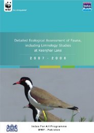
Detailed Ecological Assessment Report 2008 – Keti Bunder<br />
EXECUTIVE SUMMARY<br />
The ‘Detailed Ecological Assessment Study Report’ by the Indus for All<br />
Programme provides extensive and updated (April 2008) status of various<br />
ecological aspects of the Programme’s four priority sites. These include a<br />
summer survey (June to July) and winter survey (November to February) of<br />
vegetation, reptiles and amphibians, avi-fauna, mammals (which have been<br />
divided into large and small), fisheries (divided into freshwater and marine) waterquality<br />
and limnology which includes phytoplankton, zooplankton and<br />
physicochemical properties of the water at the programme sites. The floral<br />
aspects of the study is available in a separate report titles<br />
To ensure the authenticity of the reports, maintain the level of scientific approach<br />
and install a sense of ownership at government level, a large proportion of the<br />
consultancy’s were outsourced to <strong>Pakistan</strong> Natural History Museum, Zoological<br />
Survey of <strong>Pakistan</strong>, Mehran University of Engineering and Technology, University<br />
of Karachi and University of Sindh.<br />
This detailed ecological assessment is planned under of the completion of<br />
Programme Output A.1.2.3 – “Detailed ecological assessment of Keti Bunder”<br />
Keti Bunder: Keti Bunder is located at a distance of about 200 km SE of Karachi<br />
in Thatta district of Sindh province. It is a Taluka (Tehsil) of Thatta district and<br />
consists of a total of 42 dehs (cluster of villages) that spread over a total area of<br />
60,969 hectare. It is believed that the sea has engulfed 28 dehs and the total<br />
affected area in Keti Bunder is around 46,137 hectare (<strong>WWF</strong> 2004). Hoekstra et<br />
al. (1997) mentioned that Keti Bunder Tehsil includes a total of 19 Dehs and 29<br />
villages while total human population is around 12,000.<br />
Historically Keti Bunder was a port city before the construction of any dams and<br />
barrages on Indus river. At that time the river was navigable up to Thatta and<br />
even upwards.<br />
At present, it is one of the major towns along the <strong>Pakistan</strong> coastline that is facing<br />
environmental degradation and loss of livelihood opportunities for the locals.<br />
Local elders mention that the location of Keti Bunder town has changed thrice<br />
during the past 70 years due to progressive intrusion of the seawater. There are<br />
four major creeks in the area viz. Chann, Hajamro, Khobar and Kangri with<br />
innumerable small creeks. For sweet water (drinking and farming), Keti Bunder<br />
and other coastal region depend entirely on Indus River and its distributaries.<br />
It is located in Indus Delta experiencing warm monsoon climatic regime. Mild<br />
winters extend from November to February while summer season extends from<br />
March to October. Most of the annual precipitation falls during monsoon, which is<br />
erratic in distribution. Mean annual rainfall is 220 mm. January is the coolest<br />
month with minimum temperature of 9.5 o C while in June – July minimum and<br />
maximum temperatures range from 23 o C – 26 o C and from 30 o C - 36 o C,<br />
respectively. Humidity is generally higher in the morning than in the afternoon. It<br />
also varies from place to place depending upon the proximity to the sea. Wind is<br />
another important feature of coastal zone. It is variable and is faster during<br />
summer (7.4 to 20.5 km/h) than winter (Qureshi 1985).<br />
Before construction of upstream barrages, river water used to reach the tail end<br />
during low tides round the year. However, upstream dams and barrages have<br />
<strong>WWF</strong> <strong>Pakistan</strong> – Indus for All Programme xv