Knowsley Replacement Unitary Development Plan - Knowsley Council
Knowsley Replacement Unitary Development Plan - Knowsley Council
Knowsley Replacement Unitary Development Plan - Knowsley Council
You also want an ePaper? Increase the reach of your titles
YUMPU automatically turns print PDFs into web optimized ePapers that Google loves.
HOUSING<br />
HOUSING<br />
MAKING EFFICIENT USE OF LAND<br />
5.27<br />
<strong>Plan</strong>ning Policy Guidance Note 3 “Housing” requires<br />
that (to ensure an efficient use of existing land and<br />
buildings) new dwellings should normally be provided<br />
at a minimum density of 30 units to the hectare.<br />
In considering any planning applications for housing<br />
development, the <strong>Council</strong> will expect this overall<br />
average to be maintained. It should be stressed<br />
however that:<br />
• For some sites (e.g. within or near town centres)<br />
higher densities of up to 50 or 60 dwellings<br />
per hectare will be appropriate;<br />
• In some exceptional circumstances,<br />
developments at lower densities may be required.<br />
Examples of where this may be the case include<br />
where the surrounding highway network<br />
constrains the number of dwellings to be<br />
accommodated, or in some circumstances where<br />
higher density development would damage the<br />
character of a Conservation Area.<br />
REGULATING WINDFALL PROVISION<br />
5.28<br />
Although table 5.1 anticipates considerable provision<br />
from windfall sources over the <strong>Plan</strong> period, it will be<br />
important to ensure that excessive releases from<br />
these sources (as defined in table 5.1) do not occur<br />
which could threaten the overall strategy in this<br />
chapter. Windfall releases on greenfield sites will be<br />
particularly discouraged unless (as referred to above)<br />
they form an integral part of wider regeneration<br />
proposals bringing significant social, economic or<br />
environmental benefits.<br />
5.29<br />
Sources of brownfield windfall development can<br />
include the following:<br />
• The re-use or conversion of empty dwellings or<br />
other existing buildings;<br />
• The sub-division of existing dwellings to<br />
form flats;<br />
• The provision of dwellings to replace demolition<br />
losses on the same site;<br />
• The re-use or redevelopment of vacant industrial<br />
or commercial properties;<br />
• Housing or live / work development as part of<br />
wider regeneration schemes in town centres.<br />
5.30<br />
In some parts of Merseyside, there has been<br />
significant recent pressure for various forms of<br />
windfall development, such as the demolition of<br />
single or semi-detached pairs of dwellings or of<br />
existing uses such as public houses, often in<br />
suburban areas, and replacement by high-density<br />
development such as blocks of flats. Such<br />
development can be regarded as an efficient use of<br />
land and therefore in some respects compliant with<br />
<strong>Plan</strong>ning Policy Guidance note 3. However, if it takes<br />
place to an excessive and unforeseen degree it can<br />
have the effect of prejudicing the overall achievement<br />
of the <strong>Plan</strong> strategy.<br />
5.31<br />
Therefore, as part of its overall monitoring of the rate<br />
of new housing development as a whole, the <strong>Council</strong><br />
will monitor the rate of release of windfall sites from<br />
brownfield sources. If it appears that windfall<br />
development is occurring at a rate which is<br />
threatening an over-provision, or diverting<br />
development pressures away from other priorities<br />
such as the regeneration of the Action Areas,<br />
constraints will be placed on the nature and the rate<br />
of release of “windfall” sites.<br />
PROCEDURES<br />
5.32<br />
The <strong>Council</strong> will monitor and manage the release of<br />
sites for housing development through decisions on<br />
planning applications. The way in which this is done<br />
must be sensitive to changing circumstances, such as<br />
variations in the rate of demolitions or of the rate of<br />
release of different types of housing development.<br />
To help it make decisions on planning applications,<br />
and to inform its wider regeneration functions, the<br />
<strong>Council</strong> will keep an up to date assessment of<br />
housing land availability and development trends.<br />
This will identify factors such as:<br />
• The overall rate of new development and<br />
demolitions (compared to RSS requirements);<br />
• Current site availability differentiated by type,<br />
location, market sector, quality etc.<br />
• Likely future trends in building and<br />
demolition rates;<br />
• The degree of “fit” between current site<br />
availability and the regeneration needs of<br />
the Borough.<br />
5.33<br />
The <strong>Council</strong> will produce a Supplementary <strong>Plan</strong>ning<br />
Document which will describe in detail the<br />
mechanism for controlling the release of housing<br />
land in accordance with the principles set out above.<br />
POLICY LINKS<br />
Policy H2<br />
“Sites allocated for housing development”<br />
Policy H3<br />
“North Huyton and Tower Hill, Kirkby Action Areas”<br />
Policy H4<br />
“<strong>Development</strong> Opportunity Site - Valley Road, Kirkby”<br />
Policy EC5<br />
“South Prescot Action Area”<br />
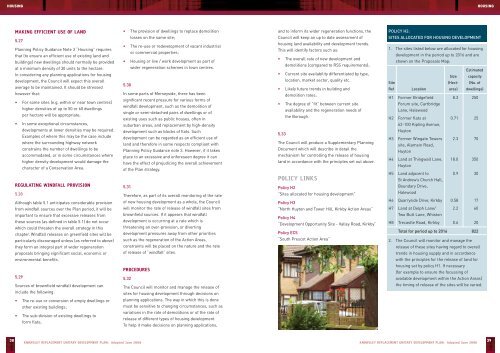
POLICY H2:<br />
SITES ALLOCATED FOR HOUSING DEVELOPMENT<br />
1. The sites listed below are allocated for housing<br />
development in the period up to 2016 and are<br />
shown on the Proposals Map:<br />
Estimated<br />
Size capacity<br />
Site (Hect- (No. of<br />
Ref Location ares) dwellings)<br />
H1 Former Bridgefield 8.3 250<br />
Forum site, Cartbridge<br />
Lane, Halewood<br />
H2 Former flats at 0.71 25<br />
62-100 Kipling Avenue,<br />
Huyton<br />
H3 Former Wingate Towers 2.3 70<br />
site, Alamein Road,<br />
Huyton<br />
H4 Land at Thingwall Lane, 18.0 350<br />
Huyton<br />
H5 Land adjacent to 0.9 30<br />
St Andrew’s Church Hall,<br />
Boundary Drive,<br />
Halewood<br />
H6 Quarryside Drive, Kirkby 0.58 17<br />
H7 Land at Delph Lane/ 2.2 60<br />
Two Butt Lane, Whiston<br />
H8 Trecastle Road, Kirkby 0.6 20<br />
Total for period up to 2016 822<br />
2. The <strong>Council</strong> will monitor and manage the<br />
release of these sites having regard to overall<br />
trends in housing supply and in accordance<br />
with the principles for the release of land for<br />
housing set by policy H1. If necessary<br />
(for example to ensure the focussing of<br />
available development within the Action Areas)<br />
the timing of release of the sites will be varied.<br />
38<br />
KNOWSLEY REPLACEMENT UNITARY DEVELOPMENT PLAN: Adopted June 2006<br />
KNOWSLEY REPLACEMENT UNITARY DEVELOPMENT PLAN: Adopted June 2006<br />
39


