Knowsley Replacement Unitary Development Plan - Knowsley Council
Knowsley Replacement Unitary Development Plan - Knowsley Council
Knowsley Replacement Unitary Development Plan - Knowsley Council

You also want an ePaper? Increase the reach of your titles
YUMPU automatically turns print PDFs into web optimized ePapers that Google loves.
ENVIRONMENTAL PROTECTION AND NATURE CONSERVATION<br />
ENVIRONMENTAL PROTECTION AND NATURE CONSERVATION<br />
PROCEDURES<br />
13.29<br />
Article 10 of the Town and Country <strong>Plan</strong>ning (General<br />
<strong>Development</strong> Procedure) Order 1995 requires the<br />
<strong>Council</strong> to consult with the Waste Regulation<br />
Authority (now the Environment Agency) before<br />
granting planning permission for development within<br />
250 metres of land which:<br />
a. is or has, at any time in the 30 years prior to the<br />
submission of the application, been used for the<br />
deposit of refuse or waste; or<br />
b. is or has been notified to the <strong>Council</strong> by the<br />
Waste Regulation Authority for the purposes of<br />
this provision.<br />
13.30<br />
The Environment Agency maintains a publicly<br />
available register of former landfill sites, and notifies<br />
<strong>Knowsley</strong> <strong>Council</strong> of sites within the Borough.<br />
The statutory distance where consultation is required<br />
(250 metres) is a minimum, and the <strong>Council</strong> may<br />
consult the Environment Agency about suspect sites<br />
outside the consultation zone. The <strong>Council</strong> will<br />
consult closely with the Environment Agency at all<br />
stages of an application, as advised in Department of<br />
the Environment Circular 17/89.<br />
13.31<br />
It is the developer’s responsibility to supply the<br />
following information if required:<br />
i) A site investigation report containing<br />
information on the nature and extent of landfill<br />
gas and any other harmful mobile substances;<br />
ii) A site specific risk assessment for gas;<br />
iii) A schedule of any remedial measures that are<br />
necessary to prevent migrating gas or other<br />
harmful substances causing a hazard either<br />
during the course of development or during the<br />
subsequent use of the site;<br />
iv) Where remedial measures are put in place a<br />
verification report; and<br />
v) Where appropriate, evidence that adequate<br />
provision has been made for the continued<br />
monitoring of gas on site.<br />
13.32<br />
<strong>Plan</strong>ning conditions or legal agreements will be used<br />
to ensure that appropriate measures are<br />
incorporated into proposals to control the migration<br />
of gas or other mobile substances and to monitor and<br />
if necessary remediate any potential problems<br />
following development.<br />
POLICY LINKS<br />
Policy ENV9<br />
“Protection of Habitats and Designated Sites”<br />
Policy ENV5<br />
“Contaminated land”<br />
POLICY ENV7:<br />
FLOOD RISK AND DRAINAGE<br />
1. <strong>Development</strong> at an unacceptable risk of<br />
flooding will not be permitted. Where a<br />
development would be within an area of flood<br />
risk, the applicant will be required to:<br />
a) submit evidence to establish that the<br />
development could not be practicably<br />
located within an area of lower or no<br />
flood risk.<br />
b) submit a flood risk assessment, which will<br />
fully assess the risks of flooding associated<br />
with the development in accordance with<br />
the requirements of <strong>Plan</strong>ning Policy<br />
Guidance note 25 "<strong>Development</strong> and<br />
Flood Risk".<br />
2. <strong>Development</strong> will not be permitted if it<br />
may cause an unacceptable risk of<br />
flooding elsewhere.<br />
3. Mitigation measures will be required, where<br />
necessary, to manage flood risk associated<br />
with or caused by new development.<br />
These should:<br />
a) Be derived from a flood risk assessment;<br />
b) Be fully described in the planning<br />
application;<br />
c) Be fully funded - including for the provision<br />
of long-term maintenance - as part of the<br />
development; and<br />
d) Contribute to the biodiversity resource of<br />
the Borough.<br />
4. New development will not be permitted unless<br />
a Sustainable Drainage System is incorporated<br />
into the overall design. Exceptions may be<br />
made where it can be demonstrated that:<br />
a) The Sustainable Drainage System would be<br />
likely to cause either significant land or<br />
water pollution; or<br />
b) The site’s ground conditions would<br />
preclude the use of a Sustainable Drainage<br />
System; or<br />
c) The size of the site precludes the use of a<br />
Sustainable Drainage System; or<br />
d) The proposed Sustainable Drainage System<br />
could cause damage to adjacent buildings<br />
or sites.<br />
EXPLANATION ENV7<br />
13.33<br />
It is recognised by the <strong>Council</strong> that flood risk is<br />
likely to increase as a result of climate change.<br />
<strong>Plan</strong>ning Policy Guidance Note 25 “<strong>Development</strong> and<br />
Flood Risk” requires new development to be<br />
consistent with the sustainable management of river<br />
systems. Within <strong>Knowsley</strong> this means having regard<br />
to Merseyside-wide initiatives including the<br />
Mersey Basin Campaign and the Alt/Crossens<br />
Action <strong>Plan</strong> 2000+.<br />
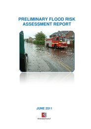
13.34<br />
The areas currently identified as being at risk from<br />
flooding within <strong>Knowsley</strong> are within the catchment of<br />
the River Alt in the northern part of the Borough and<br />
Ditton Brook to the south. These areas are based<br />
upon the most up to date data from the Environment<br />
Agency. Policy ENV7 requires proposals for new<br />
development (other than for very minor development<br />
such as small extensions and alterations) that are to<br />
be located in an area of flood risk to be accompanied<br />
by evidence to establish that there are no areas of<br />
lower or no flood risk available for that development.<br />
13.35<br />
The policy also imposes controls over new<br />
development which may itself increase flooding<br />
elsewhere by increasing surface run-off, thereby over<br />
stretching the capacity of watercourses and sewers.<br />
To control run off as close to the source as possible,<br />
the use of Sustainable Drainage systems (SuDs) is<br />
often appropriate. These represent a move away from<br />
traditional piped drainage systems to those that<br />
mimic natural drainage processes e.g. balancing<br />
ponds and infiltration devices.<br />
13.36<br />
Part 4) of this policy aims to complement Part H of<br />
the Building Regulations 2000 by ensuring that SuDS<br />
are incorporated into the overall design of the<br />
development. The policy will apply to developments<br />
comprising one dwelling or more and also to<br />
applications for new retail, industrial and<br />
warehousing, as well as commercial uses such<br />
as hotels.<br />
13.37<br />
SuDS may be inappropriate in areas which comprise<br />
soils with low infiltration rates or where there may be<br />
an increased risk of polluting land or water.<br />
For example, SuDS may not be suitable for use on<br />
contaminated sites or where industrial development<br />
is proposed that uses or stores hazardous materials.<br />
It will be the responsibility of the applicant to<br />
demonstrate why it may be inappropriate to<br />
incorporate SuDS into the overall design of their<br />
scheme. Whilst secondary benefits such as the<br />
creation of new biodiversity habitats are to be<br />
welcomed, the primary functions of SuDS must<br />
take priority.<br />
158<br />
KNOWSLEY REPLACEMENT UNITARY DEVELOPMENT PLAN: Adopted June 2006<br />
KNOWSLEY REPLACEMENT UNITARY DEVELOPMENT PLAN: Adopted June 2006<br />
159