Biodiversity (1 - SRK Consulting
Biodiversity (1 - SRK Consulting
Biodiversity (1 - SRK Consulting

You also want an ePaper? Increase the reach of your titles
YUMPU automatically turns print PDFs into web optimized ePapers that Google loves.
Topography and drainage<br />
The topography is generally flat and open, except for the few quartzite mountains<br />
and, given the low rainfall, recent drainage lines that are relatively lightly incised and<br />
shallow. The area does form part of the palaeo-drainage system of the Gariep River<br />
basin, evident on and around the site as the rather ill-defined Koa River wash(es)<br />
and some of their pans (Figs 2-5). The mountains on site generally have their<br />
steepest and coolest sides facing southwest, into the prevailing wind, and their<br />
warmest and less steep sides facing northeast, with associated effects on the<br />
biodiversity on either side.<br />
Soil<br />
Much of the area is covered in deep (up to 30 cm) red sands, forming scattered<br />
and/or fields of red dunes in places most subject to the prevailing southwest wind<br />
and with structures that impede their movement (Fig. 5). The quartzite gravels occur<br />
in three main forms, small fine-grained patches on the tops and foothills of the<br />
mountains, more variable and widespread sizes around the erosion zones below the<br />
mountains, and small feldspar patches (with pink Hoogoor Suite gneiss evident), with<br />
calcrete gravels also emerging in a few patches where exposed by erosion on the<br />
flats. The effects of the mountains, plus the prevailing winds, result in sand and<br />
dunes accumulating mainly on their southern foothills, or in channels between them,<br />
with more exposed and gravelly plains forming in their northeast lee.<br />
Land Use<br />
The only agricultural land use is livestock grazing at low densities (?about 4 large<br />
stock units (LSU)/100 ha), with sheep, cattle and goats currently present on site. A<br />
few game animals (springbok, ostrich) also occur.<br />
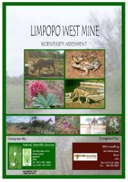
5.3 Vegetation Types<br />
The main vegetation type on site is classified as the Bushmanland Sandy Grassland<br />
vegetation unit (NKb 4), with the isolated mountains creating conditions for the<br />
Aggeneys Gravel Vygieveld (SKr 19, Mucina & Rutherford 2006).<br />
The Khai Ma local municipality (KMLM) lies to the east of the Richtersveld and<br />
contains virtually the entire extent of the Bushmanland Inselberg priority area - one of<br />
the nine zones identified through the SKEP process as important conservation areas<br />
SATO Aggeneys July 2011 27