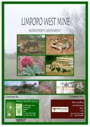
Biodiversity (1 - SRK Consulting
Biodiversity (1 - SRK Consulting
Biodiversity (1 - SRK Consulting

Create successful ePaper yourself
Turn your PDF publications into a flip-book with our unique Google optimized e-Paper software.
Figure 25. The vegetation sensitivity map compiled for the site during this survey. . 70<br />
Figure 26. A map indicating the Black Mountain Land Use Plan (SKEP 2008) with the<br />
Zuurwater area immediately west of the mining area (Image provided by <strong>SRK</strong><br />
<strong>Consulting</strong>) .............................................................................................................. 73<br />
Figure 27. A south-westerly view over the gravelly plain earmarked for the proposed<br />
development. Note the sparse basal cover. ............................................................ 80<br />
Figure 28. The dammed water in the Koa River wash and pan. This water body<br />
appears to be a permanent feature and as such probably support insects which can<br />
be expected to rise during summer sunsets and serve as feeding patches for<br />
hawking bats commuting from roosting sites in the various mountains on the<br />
property. .................................................................................................................. 80<br />
Figure 29. An aardvark burrow in the Kalahari duneveld. ........................................ 81<br />
Figure 30. The Bobbejaansgat Mountain. The many boulder overhangs and deep<br />
crevices are likely to offer suitable daytime roosting sites for bats. .......................... 81<br />
Figure 31. View north down the Koa River drainage where the deepest part passes<br />
under the N14, about where the eastern boundary of Zuurwater meets the road. Note<br />
the good but patchy stands of grasses, few woody plants, and the mountains,<br />
Hoedkop (left) around Aggeneys in the background (right). ..................................... 91<br />
Figure 32. View west from the east boundary of Zuurwater, with Hoedkop on the<br />
centre and Skelemberg on the left horizon, showing the open flats of the Koa wash<br />
with the Springbok powerline on the right side of the proposed northeast end of the<br />
PV arrays. ............................................................................................................... 91<br />
Figure 33. View east from the Zuurwater farmhouse, showing a Karoo Korhaan in the<br />
overgrazed plains on a calcrete substrate with shallow soils and some Rhigozum<br />
trichotomum shrubs, the sort of habitat at the south end of the PV array. ................ 92<br />
Figure 34. View east from a dune crest in the northern dune fields, looking across a<br />
dune street with a lone Acacia karroo to the Springbok power lines coming from the<br />
Eskom substation behind the Aggeneys hills on the left. ......................................... 93<br />
Figure 35. View south west from rocky outcrop at crest of the northern dune field on<br />
Zuurwater, showing the tussocky grass, few trees/bushes and the Koa wash behind,<br />
with the Skelemberg on the left and Hoedkop on the right. ...................................... 93<br />
Figure 36. View north from the southern sandy area with mainly Centropodia grass,<br />
looking north of the eastern half of the Windhoekberg (with the N14 passing at the<br />
extreme left of the picture. ....................................................................................... 94<br />
Figure 37. View west from northeast corner of Zuurwater, showing the pan just inside<br />
the fenceline that forms the downstream end and overflow of water from the mine<br />
dam/vlei just outside the farm. Hoedkop ison the horizon. ....................................... 95<br />
Figure 38. View west down the main Koa River wash where it would flow into the<br />
wide expanese of Pan 1, looking along the fence line that marks the approximate<br />
northern edge of the PV array and also the ecotone between the open plains (left)<br />
and the start (right) of the northern dune fields. Hoedkop is in the background, with<br />
Pan 2 near its base. ................................................................................................ 95<br />
SATO Aggeneys July 2011 9