- Page 1 and 2:
Doc 7754 EUROPEAN REGION AIR NAVIGA
- Page 3 and 4:
0-iii TABLE OF CONTENTS Page Introd
- Page 5 and 6:
Table of Contents 0-v Page Appendix
- Page 7 and 8:
Table of Contents 0-vii Attachemnt
- Page 9 and 10:
0-1 INTRODUCTION — FASID GENERAL
- Page 11 and 12:
Introduction 0-3 that amendments re
- Page 13 and 14:
Introduction 0-5 22. After completi
- Page 15 and 16:
Introduction 0-7 34. If an internat
- Page 17 and 18:
Introduction 0-9 45. actually opera
- Page 19 and 20:
Introduction 0-11 64. The managemen
- Page 21 and 22:
II-1 Part II GENERAL PLANNING ASPEC
- Page 23 and 24:
III-1 Part III AERODROME OPERATIONA
- Page 25 and 26:
AOP III-3
- Page 27 and 28:
III-A2 EUR FASID RUNWAY STATE INFOR
- Page 29 and 30:
III-A4 EUR FASID DRDR//////. Exampl
- Page 31 and 32:
III-B2 EUR FASID 10. In order to be
- Page 33 and 34:
III-C1 Attachment C GUIDANCE RELATE
- Page 35 and 36:
III-E1 Attachment D GUIDANCE ON THE
- Page 37 and 38:
III-F1 Attachment E IMPACT OF OPERA
- Page 39 and 40:
III-G1 Attachment F GUIDANCE ON THE
- Page 41 and 42:
III-H1 Attachment G B747-400 OPERAT
- Page 43 and 44:
III-I2 EUR FASID Note.— This assu
- Page 45 and 46:
III-J1 Attachment I GUIDANCE MATERI
- Page 47 and 48:
III-K1 Attachment J GUIDANCE MATERI
- Page 49 and 50:
III-AOP -1 Table AOP — REQUIREMEN
- Page 51 and 52:
AOP III-AOP 1-3 NONP: non-precision
- Page 53 and 54:
III-AOP 1-6 EUR FASID IDENTIFICATIO
- Page 55 and 56:
III-AOP 1-8 EUR FASID IDENTIFICATIO
- Page 57 and 58:
III-AOP 1-10 EUR FASID IDENTIFICATI
- Page 59 and 60:
III-AOP 1-12 EUR FASID IDENTIFICATI
- Page 61 and 62:
III-AOP 1-14 EUR FASID IDENTIFICATI
- Page 63 and 64:
III-AOP 1-16 EUR FASID IDENTIFICATI
- Page 65 and 66:
III-AOP 1-18 EUR FASID IDENTIFICATI
- Page 67 and 68:
III-AOP 1-20 EUR FASID IDENTIFICATI
- Page 69 and 70:
III-AOP 1-22 EUR FASID IDENTIFICATI
- Page 71 and 72:
III-AOP 1-24 EUR FASID IDENTIFICATI
- Page 73 and 74:
III-AOP 1-26 EUR FASID IDENTIFICATI
- Page 75 and 76:
III-AOP 1-28 EUR FASID IDENTIFICATI
- Page 77 and 78:
III-AOP 1-30 EUR FASID IDENTIFICATI
- Page 79 and 80:
III-AOP 1-32 EUR FASID IDENTIFICATI
- Page 81 and 82:
III-AOP 1-34 EUR FASID IDENTIFICATI
- Page 83 and 84:
III-AOP 1-36 EUR FASID IDENTIFICATI
- Page 85 and 86:
III-AOP 1-38 EUR FASID IDENTIFICATI
- Page 87 and 88:
III-AOP 1-40 EUR FASID IDENTIFICATI
- Page 89 and 90:
III-AOP 1-42 EUR FASID IDENTIFICATI
- Page 91 and 92:
III-AOP 1-44 EUR FASID IDENTIFICATI
- Page 93 and 94:
III-AOP 1-46 EUR FASID IDENTIFICATI
- Page 95 and 96:
III-AOP 1-48 EUR FASID IDENTIFICATI
- Page 97 and 98:
III-AOP 1-50 EUR FASID IDENTIFICATI
- Page 99 and 100:
III-AOP 1-52 EUR FASID IDENTIFICATI
- Page 101 and 102:
III-AOP 1-54 EUR FASID IDENTIFICATI
- Page 103 and 104:
III-AOP 1-56 EUR FASID IDENTIFICATI
- Page 105 and 106:
EUR FASID УКАЗАТЕЛЬ АЭР
- Page 107 and 108:
EUR FASID СРЕДСТВА КОНЕ
- Page 109 and 110:
EUR FASID СРЕДСТВА КОНЕ
- Page 111 and 112:
information and area control servic
- Page 113 and 114:
IV-A1 Attachment A METEOROLOGICAL O
- Page 115 and 116:
CNS IV-A3 Note 6.— See Note 2. No
- Page 117 and 118:
CNS IV-A5 Note 13.— Letter shift
- Page 119 and 120:
CNS IV-A7 36. If, for any reason, t
- Page 121 and 122:
IV-C1 Attachment C CONSIDERATIONS R
- Page 123 and 124:
CNS IV-C3 planning. REQUIRED HORIZO
- Page 125 and 126:
IV-D1 Attachment D PRINCIPLES AND P
- Page 127 and 128:
CNS IV-D3 protection required, in o
- Page 129 and 130:
CNS IV-D5 MONITORING OF THE PLAN 35
- Page 131:
IV-H9 Appendix 2 to Attachment D OR
- Page 134 and 135:
IV-E2 EUR FASID ESSENTIAL CAPABILIT
- Page 136 and 137:
IV-E4 EUR FASID 16. Allocated by th
- Page 138 and 139:
IV-E6 EUR FASID Figure IV-I-1. Dire
- Page 140 and 141:
IV-E8 EUR FASID Figure IV-I-5
- Page 142 and 143:
IV-E10 EUR FASID NOTES RELATING TO
- Page 144 and 145:
IV-E12 EUR FASID
- Page 146 and 147:
IV-F2 EUR FASID a) Annex 11, Attach
- Page 148 and 149:
IV-F4 EUR FASID Note.— DME facili
- Page 150 and 151:
IV-F6 Appendix to Attachment F ILLU
- Page 152 and 153:
Attachment G PRINCIPLES AND PROCEDU
- Page 154 and 155:
Codes thus established will be subm
- Page 156 and 157:
C Sensor Sensor Identifier Sensor T
- Page 158 and 159:
CNS IV-CNS 1-3 Location HF VHF GP R
- Page 160 and 161:
CNS IV-CNS 1-5 Location HF VHF GP R
- Page 162 and 163:
IV-CNS 2-2 EUR FASID CVFR DEP HEL I
- Page 164 and 165:
IV-CNS 2-4 EUR FASID Location TWR A
- Page 166 and 167:
IV-CNS 2-6 EUR FASID APP Location T
- Page 168 and 169:
IV-CNS 2-8 EUR FASID Location TWR A
- Page 170 and 171:
IV-CNS 2-10 EUR FASID Location TWR
- Page 172 and 173:
IV-CNS 2-12 EUR FASID APP Location
- Page 174 and 175:
IV-CNS 2-14 EUR FASID Location TWR
- Page 176 and 177:
IV-CNS 2-16 EUR FASID Location TWR
- Page 178 and 179:
IV-CNS 2-18 EUR FASID Location TWR
- Page 180 and 181:
IV-CNS 2-20 EUR FASID Location TWR
- Page 182 and 183:
SST For SST traffic Note.— All of
- Page 184 and 185:
IV-CNS 3-4 EUR FASID Lower airspace
- Page 186 and 187:
IV-CNS 3-6 EUR FASID Lower airspace
- Page 188 and 189:
IV-CNS 3-8 EUR FASID Lower airspace
- Page 190 and 191:
IV-CNS 3-10 EUR FASID Lower airspac
- Page 192 and 193:
IV-CNS 3-12 EUR FASID Lower airspac
- Page 194 and 195:
IV-CNS 4-1 Table CNS 4A — RADIO N
- Page 196 and 197:
CNS IV-CNS 4-3 Figure IV-CNS 4-1
- Page 198 and 199:
IV-CNS 4-6 EUR FASID Location Type
- Page 200 and 201:
IV-CNS 4-8 EUR FASID Location Type
- Page 202 and 203:
IV-CNS 4-10 EUR FASID Location Type
- Page 204 and 205:
IV-CNS 4-12 EUR FASID Location Type
- Page 206 and 207:
IV-CNS 4-14 EUR FASID Location Type
- Page 208 and 209:
IV-CNS 4-16 EUR FASID Location Type
- Page 210 and 211:
IV-CNS 4-18 EUR FASID Location Type
- Page 212 and 213:
IV-CNS 4-20 EUR FASID Location Type
- Page 214 and 215:
IV-CNS 4-22 EUR FASID Location Type
- Page 216 and 217:
IV-CNS 4-24 EUR FASID Location Type
- Page 218 and 219:
IV-CNS 4-26 EUR FASID Location Type
- Page 220 and 221:
IV-CNS 4-28 EUR FASID Porto Santo V
- Page 222 and 223:
IV-CNS 4-30 EUR FASID Bazhenovo NDB
- Page 224 and 225:
IV-CNS 4-32 EUR FASID Kirishi NDB 5
- Page 226 and 227: IV-CNS 4-34 EUR FASID Moskow (Vnuko
- Page 228 and 229: IV-CNS 4-36 EUR FASID Razdolye NDB
- Page 230 and 231: IV-CNS 4-38 EUR FASID Ust-Bolsheret
- Page 232 and 233: IV-CNS 4-40 EUR FASID Hajniky (Slia
- Page 234 and 235: IV-CNS 4-42 EUR FASID Lulea VOR/DME
- Page 236 and 237: IV-CNS 4-44 EUR FASID Elazig VOR/DM
- Page 238 and 239: IV-CNS 4-46 EUR FASID Tomakivka NDB
- Page 240 and 241: IV-CNS 4-48 EUR FASID Guzar Kakaydi
- Page 242 and 243: V.I-1 Part V.I AIRSPACE MANAGEMENT
- Page 244 and 245: V.II-2 EUR FASID where electronic d
- Page 246 and 247: V.II-A1 Attachment A BASIC ELEMENTS
- Page 248 and 249: ATS V.II-A3 a) the combination of m
- Page 250 and 251: V.II-C1 Attachment C PRINCIPLES FOR
- Page 252 and 253: V.II-D1 Attachment D AIR TRAFFIC IN
- Page 254 and 255: V.II-E1 Attachment E CONSIDERATIONS
- Page 256 and 257: ATS V.II-E3 Activation (ACT) ATS fi
- Page 258 and 259: ATS V.II-E5 processing shall provid
- Page 260 and 261: V.III-A1 Attachment A THE AIR TRAFF
- Page 262 and 263: V.III-B1 Attachment B STATES RECEIV
- Page 264 and 265: ATTACHMENT D TO THE EUR FASID (DOC
- Page 266 and 267: A-3 ATFM System of the European Reg
- Page 268 and 269: A-5 Flight Level (FL) - A surface o
- Page 270 and 271: A-7 Re-Routeing [ATFM] [for ATFM pu
- Page 272 and 273: - 2 - ASTER ATA ATC ATD ATFM ATM EN
- Page 274 and 275: - 4 - RAD Route Availability Docume
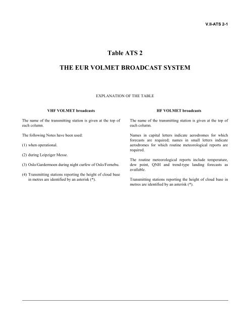
- Page 278 and 279: V.II-ATS 2-4 EUR FASID København A
- Page 280 and 281: V.II-ATS 2-6 EUR FASID Visby Kiruna
- Page 282 and 283: VI-1 Part VI METEOROLOGY (MET) —
- Page 284 and 285: VI-A1 Attachment PROVISIONS REGARDI
- Page 286 and 287: Albania Armenia Austria State Aerod
- Page 288 and 289: Bulgaria Croatia Cyprus Czech Repub
- Page 290 and 291: Finland France PARNU EEPU RG METEOR
- Page 292 and 293: PERPIGNAN- RIVESALTES LFMP RNS AIX-
- Page 294 and 295: HERINGSDORF EDAH RNS BERLIN MET REG
- Page 296 and 297: Hungary Ireland Italy HELLINIKON KA
- Page 298 and 299: Kazakhstan Kyrgyzstan Latvia Lithua
- Page 300 and 301: Poland Portugal Republic of Moldova
- Page 302 and 303: CHITA/KADALA UIAA RNS CHITA/KADALA
- Page 304 and 305: Slovakia Slovenia Spain BEOGRAD/ LY
- Page 306 and 307: Switzerland Tajikistan LULEA/KALLAX
- Page 308 and 309: Ukraine United Kingdom CHERKASY UKK
- Page 310 and 311: TASHKENT/YUZHNY UTTT RS TASHKENT/ U
- Page 312 and 313: State Meteorological Watch Office F
- Page 314 and 315: State Meteorological Watch Office F
- Page 316 and 317: State Meteorological Watch Office F
- Page 318 and 319: VI-MET 1C-1 FASID Table MET 1C METE
- Page 320 and 321: FASID Table MET 2A OPMET INFORMATIO
- Page 322 and 323: MOGILEV UMOO N VITEBSK UMII N Belgi
- Page 324 and 325: IVALO EFIV Y C P JOENSUU EFJO Y C P
- Page 326 and 327:
SAINT-ETIENNE-BOUTHEON LFMH Y C F S
- Page 328 and 329:
ALMIROS/NEA ANCHIALOS (MIL) LGBL Y
- Page 330 and 331:
RIMINI/MIRAMARE (MIL.) LIPR Y C F R
- Page 332 and 333:
BERLEVAG ENBV Y P BODO ENBO Y T F B
- Page 334 and 335:
CHELYABINSK/BALANDINO USCC Y C F CH
- Page 336 and 337:
Spain A CORUNA LECO Y T P ALICANTE
- Page 338 and 339:
SAMEDAN LSZS Y C P SION LSGS Y T F
- Page 340 and 341:
EDINBURGH EGPH Y T F EXETER EGTE Y
- Page 342 and 343:
FASID Table MET 2B EXCHANGE REQUIRE
- Page 344 and 345:
` FASID Table MET 3B VOLCANIC ASH A
- Page 346 and 347:
Name VAAC ICAO Loc Ind Area of resp
- Page 348 and 349:
FASID Table MET 3C SELECTED STATE V
- Page 350 and 351:
FASID Table MET 5 REQUIREMENTS FOR
- Page 352 and 353:
VII-2 EUR FASID [Annex 12, 3.1.8, D
- Page 354 and 355:
VII-SAR 1-2 EUR FASID - medium heli
- Page 356 and 357:
VII-SAR 1-4 EUR FASID Minimum requi
- Page 358 and 359:
VII-SAR 1-4 EUR FASID Iraklion N. K
- Page 360 and 361:
VII-SAR 1-6 EUR FASID ROMANIA BUCUR
- Page 362 and 363:
VII-SAR 1-8 EUR FASID Visby HEL-M S
- Page 364 and 365:
VII-SAR 1-10 EUR FASID Urgench
- Page 366 and 367:
elated to the European AIS Database
- Page 368 and 369:
VIII-A2 EUR FASID ties required of
- Page 370 and 371:
VIII-B1 Attachment B PUBLICATION OF
- Page 372 and 373:
Attachment C THE EUROPEAN AIS DATAB
- Page 374 and 375:
VIII-AIS 1-1 Table AIS 1 — INTERN
- Page 376 and 377:
CNS Russian Federation (EUR/NAT-F 0


